TopoQuest Logo
Do you find TopoQuest useful?
Help keep TopoQuest running and adding new maps/features by donating!
Bitcoin:  19c7KJd3qBynnjoSw5npx9KScwjBe4ifkT
Litecoin:  LXs6TkuXGGXo1vDsWCkWVdjQX94eUKd6ui
Home View Maps Find Maps Find Places Resources & Links


Neutral, Kansas Topographic Map

USGS Map Title: Neutral, KS
USGS Map MRC: 37094A7
DRG (GeoTIFF) Download: o37094a7.tif


Neighboring USGS Topographic Map Quads:


  Hallowell, KS  
37094B8
 

  Columbus, KS  
37094B7
 

  Crestline, KS  
37094B6
 

  Melrose, KS  
37094A8
 

  Neutral, KS  
37094A7
 

  Baxter Springs, KS  
37094A6
 

  Miami NW, OK  
36094H8
 

  Picher, OK  
36094H7
 

  Peoria, OK  
36094H6


Map MRC Location:

N38°
W95°
N38°
W94°
H8 H7 H6 H5 H4 H3 H2 H1
G8 G7 G6 G5 G4 G3 G2 G1
F8 F7 F6 F5 F4 F3 F2 F1
E8 E7 E6 E5 E4 E3 E2 E1
D8 D7 D6 D5 D4 D3 D2 D1
C8 C7 C6 C5 C4 C3 C2 C1
B8 B7 B6 B5 B4 B3 B2 B1
A8 A7 A6 A5 A4 A3 A2 A1
N37°
W95°
N37°
W94°

Neutral, KS USGS 1:24K Topographic Map Preview:
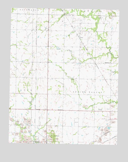
Neutral, KS USGS Topographic Map
Click on map above to begin viewing in our Map Viewer.

This topographic map contains these locations and features:
Feature Name Type Latitude Longitude GNIS ID View Map
Baxter Springs CemeteryCemeteryN37.0325°W94.7695°469365View Map
Baxter Springs City Cemetery Soldiers' LotCemeteryN37.0324°W94.7707°2770061View Map
Beasley CemeteryCemeteryN37.0757°W94.8313°469366View Map
Bethel Church (historical)ChurchN37.0898°W94.8597°483277View Map
Bitter CreekStreamN37.0848°W94.7597°469367View Map
Blue MoundSummitN37.0042°W94.8241°469363View Map
Blue Mound ChurchChurchN37.0315°W94.8133°469364View Map
Blue Mound School (historical)SchoolN37.0253°W94.8136°483317View Map
Brush Creek CemeteryCemeteryN37.1176°W94.7736°469370View Map
Brush Creek School (historical)SchoolN37.1040°W94.7586°483318View Map
Burger School (historical)SchoolN37.1051°W94.8136°483319View Map
CaptainLocaleN37.0167°W94.8536°481178View Map
City of TreeceCivilN37.0005°W94.8437°2397048View Map
CravensvillePopulated PlaceN37.0320°W94.8447°484439View Map
Dockery CemeteryCemeteryN37.0790°W94.7952°2057020View Map
Elm Tree School (historical)SchoolN37.0678°W94.7952°483325View Map
Ferris CemeteryCemeteryN37.0461°W94.7727°2056811View Map
Golden Rule School (historical)SchoolN37.0603°W94.8500°483279View Map
Mount Hope School (historical)SchoolN37.0167°W94.7633°483349View Map
NeutralPopulated PlaceN37.0978°W94.7950°484440View Map
Pleasant View CemeteryCemeteryN37.0672°W94.7580°469368View Map
Pleasant View School (historical)SchoolN37.0756°W94.7591°483360View Map
Pleasantview ChurchChurchN37.0756°W94.7588°469369View Map
Potter School (historical)SchoolN37.0903°W94.8591°483361View Map
Tar Valley School (historical)SchoolN37.0203°W94.8494°483369View Map
Township of Spring ValleyCivilN37.0615°W94.7795°469373View Map
Treece (historical)Populated PlaceN37.0009°W94.8433°469375View Map
Treece Wastewater Treatment Plant (historical)LocaleN37.0034°W94.8390°2692041View Map
Usrey CemeteryCemeteryN37.0784°W94.7580°2057017View Map
Walter A Swalley AirparkAirportN37.0170°W94.8002°481448View Map
Willow Creek School (historical)SchoolN37.0456°W94.7505°483372View Map

Note: Coordinates in the location and feature list above are referenced to NAD83 datum.


Copyright (C) 2008-2024 Ryan Niemi / Sunset Dynamics ... All Rights Reserved