TopoQuest Logo
Do you find TopoQuest useful?
Help keep TopoQuest running and adding new maps/features by donating!
Bitcoin:  19c7KJd3qBynnjoSw5npx9KScwjBe4ifkT
Litecoin:  LXs6TkuXGGXo1vDsWCkWVdjQX94eUKd6ui
Home View Maps Find Maps Find Places Resources & Links


Neosho Falls, Kansas Topographic Map

USGS Map Title: Neosho Falls, KS
USGS Map MRC: 38095A5
DRG (GeoTIFF) Download: o38095a5.tif


Neighboring USGS Topographic Map Quads:


  Burlington, KS  
38095B6
 

  Aliceville, KS  
38095B5
 

  Westphalia, KS  
38095B4
 

  Le Roy, KS  
38095A6
 

  Neosho Falls, KS  
38095A5
 

  Geneva, KS  
38095A4
 

  Yates Center, KS  
37095H6
 

  Piqua, KS  
37095H5
 

  Iola, KS  
37095H4


Map MRC Location:

N39°
W96°
N39°
W95°
H8 H7 H6 H5 H4 H3 H2 H1
G8 G7 G6 G5 G4 G3 G2 G1
F8 F7 F6 F5 F4 F3 F2 F1
E8 E7 E6 E5 E4 E3 E2 E1
D8 D7 D6 D5 D4 D3 D2 D1
C8 C7 C6 C5 C4 C3 C2 C1
B8 B7 B6 B5 B4 B3 B2 B1
A8 A7 A6 A5 A4 A3 A2 A1
N38°
W96°
N38°
W95°

Neosho Falls, KS USGS 1:24K Topographic Map Preview:
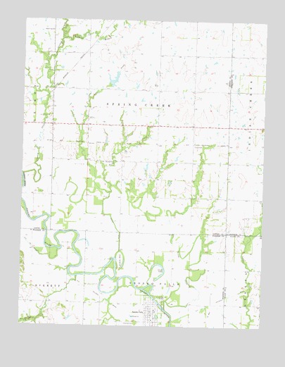
Neosho Falls, KS USGS Topographic Map
Click on map above to begin viewing in our Map Viewer.

This topographic map contains these locations and features:
Feature Name Type Latitude Longitude GNIS ID View Map
Bowmans BranchStreamN38.1172°W95.6055°478097View Map
Cedarvale CemeteryCemeteryN38.0012°W95.5651°478100View Map
Circle LakeLakeN38.0199°W95.5538°478101View Map
City of Neosho FallsCivilN38.0056°W95.5555°2395173View Map
Crooked CreekStreamN38.0617°W95.6247°478096View Map
Logue CemeteryCemeteryN38.0737°W95.5369°478105View Map
Loss CreekStreamN38.0548°W95.5794°478106View Map
Neosho FallsPopulated PlaceN38.0056°W95.5572°478098View Map
Neosho Falls Community BuildingBuildingN38.0034°W95.5562°2693234View Map
Neosho Falls Fire DepartmentBuildingN38.0036°W95.5556°2111664View Map
Neosho Falls United Methodist ChurchChurchN38.0026°W95.5568°2690231View Map
North Star School (historical)SchoolN38.0089°W95.5922°484254View Map
Philmore School (historical)SchoolN38.0270°W95.5647°484263View Map
Riverside ParkParkN38.0111°W95.5514°478099View Map
Rock CreekStreamN38.0314°W95.6055°478081View Map
Spogie DitchCanalN38.0409°W95.5764°478103View Map
Spring CreekStreamN38.0070°W95.5500°478108View Map
Stoeltzing CemeteryCemeteryN38.1206°W95.6097°478107View Map
The IslandBendN38.0273°W95.5742°478090View Map
Township of Spring CreekCivilN38.0893°W95.5643°478091View Map
Twiss CreekStreamN38.0278°W95.5758°478104View Map
Wooster CemeteryCemeteryN38.0671°W95.5828°478102View Map

Note: Coordinates in the location and feature list above are referenced to NAD83 datum.


Copyright (C) 2008-2024 Ryan Niemi / Sunset Dynamics ... All Rights Reserved