TopoQuest Logo
Do you find TopoQuest useful?
Help keep TopoQuest running and adding new maps/features by donating!
Bitcoin:  19c7KJd3qBynnjoSw5npx9KScwjBe4ifkT
Litecoin:  LXs6TkuXGGXo1vDsWCkWVdjQX94eUKd6ui
Home View Maps Find Maps Find Places Resources & Links


Bell Mountain, New Mexico Topographic Map

USGS Map Title: Bell Mountain, NM
USGS Map MRC: 33107A5
DRG (GeoTIFF) Download: o33107a5.tif


Neighboring USGS Topographic Map Quads:


  Sugarloaf Peak, NM  
33107B6
 

  Thumb Tank Peak, NM  
33107B5
 

  Williamsburg NW, NM  
33107B4
 

  Apache Peak, NM  
33107A6
 

  Bell Mountain, NM  
33107A5
 

  Saladone Tank, NM  
33107A4
 

  Kingston, NM  
32107H6
 

  Hillsboro, NM  
32107H5
 

  Skute Stone Arroyo, NM  
32107H4


Map MRC Location:

N34°
W108°
N34°
W107°
H8 H7 H6 H5 H4 H3 H2 H1
G8 G7 G6 G5 G4 G3 G2 G1
F8 F7 F6 F5 F4 F3 F2 F1
E8 E7 E6 E5 E4 E3 E2 E1
D8 D7 D6 D5 D4 D3 D2 D1
C8 C7 C6 C5 C4 C3 C2 C1
B8 B7 B6 B5 B4 B3 B2 B1
A8 A7 A6 A5 A4 A3 A2 A1
N33°
W108°
N33°
W107°

Bell Mountain, NM USGS 1:24K Topographic Map Preview:
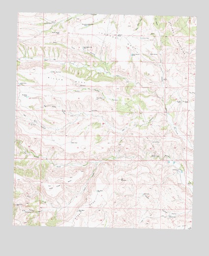
Bell Mountain, NM USGS Topographic Map
Click on map above to begin viewing in our Map Viewer.

This topographic map contains these locations and features:
Feature Name Type Latitude Longitude GNIS ID View Map
Antelope WindmillLocaleN33.1195°W107.5986°885808View Map
April TankReservoirN33.0202°W107.5354°885859View Map
Artesia TankReservoirN33.0508°W107.5295°885912View Map
Artesia WindmillLocaleN33.0606°W107.5400°885913View Map
Ash CanyonValleyN33.0662°W107.5195°903437View Map
Bell MountainSummitN33.0284°W107.5509°886184View Map
Big Rocky CanyonValleyN33.0653°W107.5745°903810View Map
Big Rocky TankReservoirN33.0755°W107.6175°886325View Map
Bodine SpringSpringN33.1026°W107.5323°886563View Map
Cave CreekStreamN33.0381°W107.5678°904850View Map
Cave Creek MesaSummitN33.0240°W107.6011°887305View Map
Crews WellWellN33.0592°W107.5136°888072View Map
Dollar TankReservoirN33.0494°W107.5862°888441View Map
East Myers TankReservoirN33.0215°W107.5674°888681View Map
East South Salado Peak TankReservoirN33.1179°W107.5771°888698View Map
Evans TankReservoirN33.0759°W107.5648°888936View Map
Fish WellWellN33.0951°W107.5920°889047View Map
Fox TankReservoirN33.0751°W107.5056°889204View Map
Francisco Rascon PlaceLocaleN33.0117°W107.6228°898779View Map
Garden TankReservoirN33.0271°W107.5022°889340View Map
George Mee TankReservoirN33.0746°W107.5103°898320View Map
George Mee WindmillLocaleN33.0878°W107.5225°898321View Map
Higgins WellWellN33.0270°W107.5078°889954View Map
Johnson MesaSummitN33.1062°W107.5545°890504View Map
Johnson TankReservoirN33.1127°W107.5553°890521View Map
Johnson WindmillLocaleN33.0906°W107.5656°890529View Map
Ladder RanchLocaleN33.0348°W107.5109°890859View Map
Little Rocky CanyonValleyN33.0623°W107.5323°891174View Map
Little Rocky TankReservoirN33.0831°W107.6230°891175View Map
Long CanyonValleyN33.0751°W107.5223°891291View Map
Mike TankReservoirN33.0826°W107.5811°892034View Map
Miller MesaSummitN33.0917°W107.6142°892057View Map
Miller Mesa TankReservoirN33.0905°W107.6008°892058View Map
Myers MesaSummitN33.0167°W107.5734°892362View Map
New Tank CanyonValleyN33.0909°W107.5600°909072View Map
Number 2 TankReservoirN33.0684°W107.5724°898063View Map
Number 2 WindmillLocaleN33.0653°W107.5842°898064View Map
Number 3 TankReservoirN33.0598°W107.6145°898066View Map
Number 3 WindmillLocaleN33.0612°W107.6120°898067View Map
Pine SpringSpringN33.0087°W107.6170°893282View Map
Pine Spring CanyonValleyN33.0112°W107.5967°909682View Map
Punkin TankReservoirN33.1115°W107.5391°893557View Map
Salado MountainsRangeN33.1212°W107.5203°920684View Map
Salado Mountains Fluorspar DepositMineN33.1042°W107.5048°917428View Map
South HillMineN33.1034°W107.5067°917442View Map
South Johnson TankReservoirN33.1018°W107.5452°895073View Map
South Salado PeakSummitN33.1128°W107.5950°898854View Map
South Salado Peak TankReservoirN33.1048°W107.5794°895117View Map
Tank CanyonValleyN33.0012°W107.5048°911538View Map
Truth or Consequences West DivisionCivilN33.0907°W107.5881°1937608View Map
Wanda TankReservoirN33.0073°W107.5167°896248View Map
Wanda WellWellN33.0092°W107.5150°896249View Map
Warm SpringSpringN33.0426°W107.5273°896258View Map
West Myers TankReservoirN33.0095°W107.5799°896395View Map

Note: Coordinates in the location and feature list above are referenced to NAD83 datum.


Copyright (C) 2008-2024 Ryan Niemi / Sunset Dynamics ... All Rights Reserved