TopoQuest Logo
Do you find TopoQuest useful?
Help keep TopoQuest running and adding new maps/features by donating!
Bitcoin:  19c7KJd3qBynnjoSw5npx9KScwjBe4ifkT
Litecoin:  LXs6TkuXGGXo1vDsWCkWVdjQX94eUKd6ui
Home View Maps Find Maps Find Places Resources & Links


Mumbo Basin, California Topographic Map

USGS Map Title: Mumbo Basin, CA
USGS Map MRC: 41122B5
DRG (GeoTIFF) Download: o41122b5.tif


Neighboring USGS Topographic Map Quads:


  Scott Mountain, CA  
41122C6
 

  South China Mountain, CA  
41122C5
 

  Mount Eddy, CA  
41122C4
 

  Tangle Blue Lake, CA  
41122B6
 

  Mumbo Basin, CA  
41122B5
 

  Seven Lakes Basin, CA  
41122B4
 

  Carrville, CA  
41122A6
 

  Whisky Bill Peak, CA  
41122A5
 

  Chicken Hawk Hill, CA  
41122A4


Map MRC Location:

N42°
W123°
N42°
W122°
H8 H7 H6 H5 H4 H3 H2 H1
G8 G7 G6 G5 G4 G3 G2 G1
F8 F7 F6 F5 F4 F3 F2 F1
E8 E7 E6 E5 E4 E3 E2 E1
D8 D7 D6 D5 D4 D3 D2 D1
C8 C7 C6 C5 C4 C3 C2 C1
B8 B7 B6 B5 B4 B3 B2 B1
A8 A7 A6 A5 A4 A3 A2 A1
N41°
W123°
N41°
W122°

Mumbo Basin, CA USGS 1:24K Topographic Map Preview:
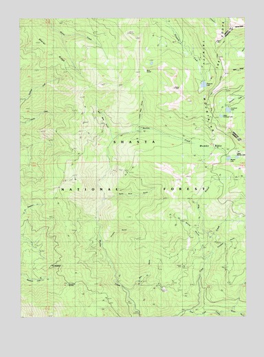
Mumbo Basin, CA USGS Topographic Map
Click on map above to begin viewing in our Map Viewer.

This topographic map contains these locations and features:
Feature Name Type Latitude Longitude GNIS ID View Map
Altoona MineMineN41.1357°W122.5464°256211View Map
Baker CreekStreamN41.1263°W122.5042°266403View Map
Big Bear GulchValleyN41.2001°W122.5747°256881View Map
Blue DivideRidgeN41.2279°W122.5559°257239View Map
Chrome GulchValleyN41.1557°W122.5786°258356View Map
Cinnabar GulchValleyN41.1513°W122.5178°258373View Map
Crow CreekStreamN41.1271°W122.5328°258941View Map
Doe GulchValleyN41.1360°W122.5642°259430View Map
Fred Williams TrailTrailN41.1799°W122.6034°260353View Map
Gumboat CampgroundLocaleN41.2129°W122.5097°277025View Map
Gumboat Trailhead ParkingLocaleN41.2088°W122.5197°277026View Map
Gumboot LakeLakeN41.2112°W122.5106°260981View Map
Integral MineMineN41.1463°W122.5364°261794View Map
Little Bear GulchValleyN41.2040°W122.5609°262529View Map
Mumbo BasinBasinN41.1951°W122.5195°263958View Map
Mumbo LakeLakeN41.1911°W122.5104°263959View Map
Picayune LakeLakeN41.2219°W122.5242°264693View Map
Ramshorn SummitSummitN41.1390°W122.5997°265169View Map
SalmonGapN41.1671°W122.5431°234607View Map
Sherer RidgeRidgeN41.2338°W122.6092°266100View Map
Snow Survey CabinLocaleN41.1988°W122.5261°277027View Map
Spike Buck GulchValleyN41.1738°W122.5772°267568View Map
The BedsteadRidgeN41.1451°W122.6047°268175View Map
Upper Gumboot LakeLakeN41.2087°W122.5146°268612View Map
Upper Mumbo LakeLakeN41.1915°W122.5060°268632View Map
West Branch Crow CreekStreamN41.1582°W122.5200°268865View Map
Willits RavineValleyN41.1501°W122.5239°269131View Map

Note: Coordinates in the location and feature list above are referenced to NAD83 datum.


Copyright (C) 2008-2024 Ryan Niemi / Sunset Dynamics ... All Rights Reserved