TopoQuest Logo
Do you find TopoQuest useful?
Help keep TopoQuest running and adding new maps/features by donating!
Bitcoin:  19c7KJd3qBynnjoSw5npx9KScwjBe4ifkT
Litecoin:  LXs6TkuXGGXo1vDsWCkWVdjQX94eUKd6ui
Home View Maps Find Maps Find Places Resources & Links


Mullen, Nebraska Topographic Map

USGS Map Title: Mullen, NE
USGS Map MRC: 42101A1
DRG (GeoTIFF) Download: o42101a1.tif


Neighboring USGS Topographic Map Quads:


  Mullen NW, NE  
42101B2
 

  Mullen NE, NE  
42101B1
 

  Barent Valley, NE  
42100B8
 

  Hecla, NE  
42101A2
 

  Mullen, NE  
42101A1
 

  Seneca SW, NE  
42100A8
 

  Dismal River Ranch NW, NE  
41101H2
 

  Dismal River Ranch NE, NE  
41101H1
 

  Shimmins Lake NW, NE  
41100H8


Map MRC Location:

N43°
W102°
N43°
W101°
H8 H7 H6 H5 H4 H3 H2 H1
G8 G7 G6 G5 G4 G3 G2 G1
F8 F7 F6 F5 F4 F3 F2 F1
E8 E7 E6 E5 E4 E3 E2 E1
D8 D7 D6 D5 D4 D3 D2 D1
C8 C7 C6 C5 C4 C3 C2 C1
B8 B7 B6 B5 B4 B3 B2 B1
A8 A7 A6 A5 A4 A3 A2 A1
N42°
W102°
N42°
W101°

Mullen, NE USGS 1:24K Topographic Map Preview:
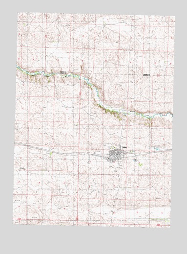
Mullen, NE USGS Topographic Map
Click on map above to begin viewing in our Map Viewer.

This topographic map contains these locations and features:
Feature Name Type Latitude Longitude GNIS ID View Map
Assembly of God ChurchChurchN42.0431°W101.0446°1836376View Map
Barnaby SchoolSchoolN42.0050°W101.0135°827188View Map
Cedarview CemeteryCemeteryN42.0450°W101.0371°1836387View Map
Harding SchoolSchoolN42.0106°W101.0893°829800View Map
Hooker County AirportAirportN42.0419°W101.0551°837642View Map
Hooker County CourthouseBuildingN42.0425°W101.0457°1836383View Map
Hooker County Fair GroundsLocaleN42.0444°W101.0588°1836396View Map
Hooker County LibraryBuildingN42.0422°W101.0454°1836385View Map
Hooker County Sheriff's OfficeBuildingN42.0426°W101.0455°1836384View Map
Lariat AuditoriumBuildingN42.0406°W101.0427°1836367View Map
Lee Boyer RanchLocaleN42.0333°W101.1199°1805101View Map
Morris RanchLocaleN42.1181°W101.0002°831428View Map
MullenLocaleN42.0422°W101.0427°1836369View Map
MullenPopulated PlaceN42.0428°W101.0427°831529View Map
Mullen Ambulance ServiceBuildingN42.0404°W101.0480°2553737View Map
Mullen City ParkParkN42.0422°W101.0457°1836381View Map
Mullen Dental Associates CenterHospitalN42.0428°W101.0446°1836380View Map
Mullen Elementary SchoolSchoolN42.0442°W101.0413°1836379View Map
Mullen Golf ClubLocaleN42.0381°W101.0665°1836386View Map
Mullen High SchoolSchoolN42.0453°W101.0457°1836378View Map
Mullen Post OfficePost OfficeN42.0431°W101.0420°1836370View Map
Mullen Volunteer Fire DepartmentBuildingN42.0406°W101.0494°1836371View Map
Pioneer Memorial Nursing HomeHospitalN42.0461°W101.0440°1836373View Map
Saint Josephs Episcopal ChurchChurchN42.0433°W101.0465°1836375View Map
Saint Marys Catholic ChurchChurchN42.0400°W101.0465°1836374View Map
Sandhills Family MedicineHospitalN42.0458°W101.0443°1836372View Map
Swimming Pool ParkParkN42.0397°W101.0488°1836382View Map
United Methodist ChurchChurchN42.0444°W101.0502°1836377View Map
Village of MullenCivilN42.0432°W101.0443°2399425View Map
Wright City Trailer CourtPopulated PlaceN42.0431°W101.0438°1836368View Map

Note: Coordinates in the location and feature list above are referenced to NAD83 datum.


Copyright (C) 2008-2024 Ryan Niemi / Sunset Dynamics ... All Rights Reserved