TopoQuest Logo
Do you find TopoQuest useful?
Help keep TopoQuest running and adding new maps/features by donating!
Bitcoin:  19c7KJd3qBynnjoSw5npx9KScwjBe4ifkT
Litecoin:  LXs6TkuXGGXo1vDsWCkWVdjQX94eUKd6ui
Home View Maps Find Maps Find Places Resources & Links


Muldoon, Texas Topographic Map

USGS Map Title: Muldoon, TX
USGS Map MRC: 29097G1
DRG (GeoTIFF) Download: o29097g1.tif


Neighboring USGS Topographic Map Quads:


  Togo, TX  
29097H2
 

  West Point, TX  
29097H1
 

  La Grange West, TX  
29096H8
 

  Cistern, TX  
29097G2
 

  Muldoon, TX  
29097G1
 

  Swiss Alp, TX  
29096G8
 

  Flatonia NW, TX  
29097F2
 

  Flatonia, TX  
29097F1
 

  Schulenburg, TX  
29096F8


Map MRC Location:

N30°
W98°
N30°
W97°
H8 H7 H6 H5 H4 H3 H2 H1
G8 G7 G6 G5 G4 G3 G2 G1
F8 F7 F6 F5 F4 F3 F2 F1
E8 E7 E6 E5 E4 E3 E2 E1
D8 D7 D6 D5 D4 D3 D2 D1
C8 C7 C6 C5 C4 C3 C2 C1
B8 B7 B6 B5 B4 B3 B2 B1
A8 A7 A6 A5 A4 A3 A2 A1
N29°
W98°
N29°
W97°

Muldoon, TX USGS 1:24K Topographic Map Preview:
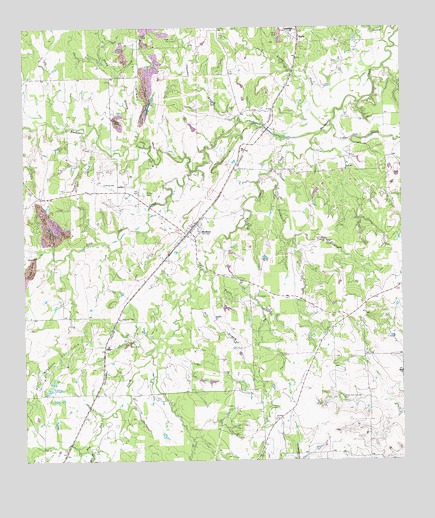
Muldoon, TX USGS Topographic Map
Click on map above to begin viewing in our Map Viewer.

This topographic map contains these locations and features:
Feature Name Type Latitude Longitude GNIS ID View Map
Black Jack Springs CemeteryCemeteryN29.7680°W97.0208°1330758View Map
Blackjack CreekStreamN29.8324°W97.0442°1330801View Map
Busby BranchStreamN29.8422°W97.0878°1372852View Map
Cedar CreekStreamN29.8469°W97.0228°1332401View Map
Chandler BranchStreamN29.8480°W97.0525°1373051View Map
Cherry Spraying Service AirportAirportN29.8312°W97.1027°1387228View Map
Dogwood CreekStreamN29.8111°W97.1183°1334458View Map
Flatonia DivisionCivilN29.7619°W97.1168°1938741View Map
FloyPopulated PlaceN29.7830°W97.0992°1378307View Map
Grand Prairie Memorial LibraryBuildingN29.8333°W97.0172°2014966View Map
Haw BranchStreamN29.7530°W97.1042°1337461View Map
Jack Young CreekStreamN29.8508°W97.0219°1374255View Map
Live Oak CreekStreamN29.8338°W97.0692°1374625View Map
MarlyPopulated PlaceN29.8716°W97.0333°1340971View Map
MuldoonPopulated PlaceN29.8158°W97.0711°1342244View Map
Muldoon Oil FieldOilfieldN29.7791°W97.1133°1342245View Map
Muldoon Post OfficePost OfficeN29.8178°W97.0695°2731557View Map
Muldoon Volunteer Fire DepartmentBuildingN29.8178°W97.0681°2552359View Map
Pin Oak CreekStreamN29.8441°W97.0278°1344028View Map
Pitman CemeteryCemeteryN29.8274°W97.0853°1344147View Map
Salt BranchStreamN29.7994°W97.0708°1346197View Map
Steinhauser LakeReservoirN29.8028°W97.1197°1865409View Map
Steinhauser Lake DamDamN29.8036°W97.1186°1865408View Map
Tuttle CreekStreamN29.8047°W97.0653°1348932View Map

Note: Coordinates in the location and feature list above are referenced to NAD83 datum.


Copyright (C) 2008-2024 Ryan Niemi / Sunset Dynamics ... All Rights Reserved