TopoQuest Logo
Do you find TopoQuest useful?
Help keep TopoQuest running and adding new maps/features by donating!
Bitcoin:  19c7KJd3qBynnjoSw5npx9KScwjBe4ifkT
Litecoin:  LXs6TkuXGGXo1vDsWCkWVdjQX94eUKd6ui
Home View Maps Find Maps Find Places Resources & Links


Mountain Lake, Michigan Topographic Map

USGS Map Title: Mountain Lake, MI
USGS Map MRC: 46087G8
DRG (GeoTIFF) Download: o46087g8.tif


Neighboring USGS Topographic Map Quads:


  Glovers Corner, MI  
46088H1
 

  Howe Lake, MI  
46087H8
 

  Huron Mountain, MI  
46087H7
 

  McComb Corner, MI  
46088G1
 

  Mountain Lake, MI  
46087G8
 

  Ives Hill, MI  
46087G7
 

  Summit Lake, MI  
46088F1
 

  Bulldog Lake, MI  
46087F8
 

  Silver Lake Basin, MI  
46087F7


Map MRC Location:

N47°
W88°
N47°
W87°
H8 H7 H6 H5 H4 H3 H2 H1
G8 G7 G6 G5 G4 G3 G2 G1
F8 F7 F6 F5 F4 F3 F2 F1
E8 E7 E6 E5 E4 E3 E2 E1
D8 D7 D6 D5 D4 D3 D2 D1
C8 C7 C6 C5 C4 C3 C2 C1
B8 B7 B6 B5 B4 B3 B2 B1
A8 A7 A6 A5 A4 A3 A2 A1
N46°
W88°
N46°
W87°

Mountain Lake, MI USGS 1:24K Topographic Map Preview:
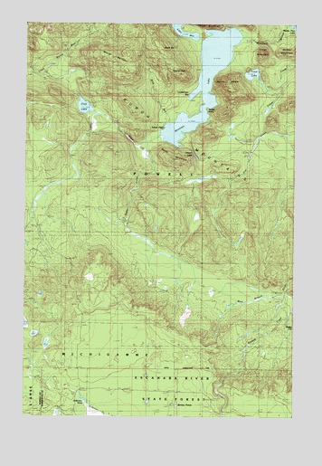
Mountain Lake, MI USGS Topographic Map
Click on map above to begin viewing in our Map Viewer.

This topographic map contains these locations and features:
Feature Name Type Latitude Longitude GNIS ID View Map
Anderson PondLakeN46.7548°W87.9718°2099864View Map
Bentley PondsLakeN46.7539°W87.9291°2098062View Map
Burnt MountainSummitN46.8316°W87.9318°622316View Map
Canyon LakeLakeN46.8332°W87.9213°622701View Map
Cedar CreekStreamN46.8388°W87.9387°622900View Map
Cliff LakeLakeN46.8485°W87.9730°2098061View Map
Cliff RiverStreamN46.8346°W87.9435°623462View Map
Dudley PointCapeN46.8471°W87.9154°624959View Map
Forty Foot FallsFallsN46.8328°W87.9736°2336616View Map
Lake AnnLakeN46.8716°W87.9264°620139View Map
Lumberman BayBayN46.8530°W87.9223°631212View Map
Mink RunStreamN46.8430°W87.9335°632456View Map
Mount BenisonSummitN46.8635°W87.9579°621098View Map
Mount HomerSummitN46.8552°W87.9054°628514View Map
Mount IdaSummitN46.8683°W87.9390°628921View Map
Mountain LakeLakeN46.8568°W87.9171°632853View Map
Mountain StreamStreamN46.8749°W87.8782°632854View Map
Mummy MountainSummitN46.8660°W87.8818°633115View Map
Tokiahok HeadBenchN46.8608°W87.9293°1614927View Map
Trout LakeLakeN46.8589°W87.8949°1615118View Map
Trout MountainSummitN46.8660°W87.8904°1615119View Map
Turkey Neck FallsFallsN46.8206°W87.9511°2336591View Map
Turner PointCapeN46.8421°W87.9493°1615187View Map
West Branch Salmon Trout RiverStreamN46.7896°W87.8793°1616067View Map

Note: Coordinates in the location and feature list above are referenced to NAD83 datum.


Copyright (C) 2008-2024 Ryan Niemi / Sunset Dynamics ... All Rights Reserved