TopoQuest Logo
Do you find TopoQuest useful?
Help keep TopoQuest running and adding new maps/features by donating!
Bitcoin:  19c7KJd3qBynnjoSw5npx9KScwjBe4ifkT
Litecoin:  LXs6TkuXGGXo1vDsWCkWVdjQX94eUKd6ui
Home View Maps Find Maps Find Places Resources & Links


Mount Vernon, Wisconsin Topographic Map

USGS Map Title: Mount Vernon, WI
USGS Map MRC: 42089H6
DRG (GeoTIFF) Download: o42089h6.tif


Neighboring USGS Topographic Map Quads:


  Blue Mounds, WI  
43089A7
 

  Cross Plains, WI  
43089A6
 

  Middleton, WI  
43089A5
 

  Daleyville, WI  
42089H7
 

  Mount Vernon, WI  
42089H6
 

  Verona, WI  
42089H5
 

  Blanchardville, WI  
42089G7
 

  New Glarus, WI  
42089G6
 

  Belleville, WI  
42089G5


Map MRC Location:

N43°
W90°
N43°
W89°
H8 H7 H6 H5 H4 H3 H2 H1
G8 G7 G6 G5 G4 G3 G2 G1
F8 F7 F6 F5 F4 F3 F2 F1
E8 E7 E6 E5 E4 E3 E2 E1
D8 D7 D6 D5 D4 D3 D2 D1
C8 C7 C6 C5 C4 C3 C2 C1
B8 B7 B6 B5 B4 B3 B2 B1
A8 A7 A6 A5 A4 A3 A2 A1
N42°
W90°
N42°
W89°

Mount Vernon, WI USGS 1:24K Topographic Map Preview:
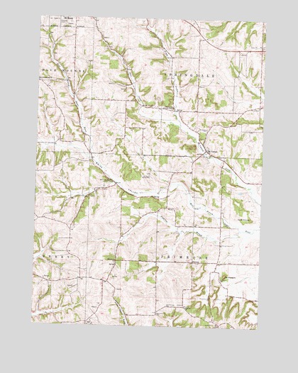
Mount Vernon, WI USGS Topographic Map
Click on map above to begin viewing in our Map Viewer.

This topographic map contains these locations and features:
Feature Name Type Latitude Longitude GNIS ID View Map
Britt ValleyValleyN42.9171°W89.6399°1562222View Map
Britt Valley SchoolSchoolN42.9339°W89.7090°1562223View Map
Cat Nip Hollow FarmLocaleN42.8853°W89.7283°2629150View Map
Deer CreekStreamN42.9558°W89.6710°1563822View Map
Devils ChimneyPillarN42.9194°W89.6312°1563927View Map
Dixon SchoolSchoolN42.9019°W89.7051°1564007View Map
Donald RockPillarN42.9639°W89.6751°1564051View Map
East Blue Mounds ChurchChurchN42.9742°W89.7496°1564278View Map
East Blue Mounds Lutheran CemeteryCemeteryN42.9742°W89.7490°2781251View Map
East Primrose CemeteryCemeteryN42.8835°W89.6763°1564365View Map
Fryes FeederStreamN42.9558°W89.6710°1565358View Map
Gonstead Airport (historical)AirportN43.0000°W89.7335°1582097View Map
Hecklers' StripAirportN42.9697°W89.6660°2444185View Map
Liberty FarmLocaleN42.9417°W89.6550°2629148View Map
Mount Horeb Wastewater Treatment FacilityLocaleN42.9878°W89.7422°2709438View Map
Mount PleasantSummitN42.8956°W89.6446°1569832View Map
Mount Pleasant CemeteryCemeteryN42.8944°W89.6468°1569835View Map
Mount VernonPopulated PlaceN42.9469°W89.6560°1569853View Map
Mount Vernon CemeteryCemeteryN42.9553°W89.6560°1569855View Map
Mount Vernon Landing Strip (historical)AirportN42.9361°W89.6871°1842573View Map
Mount Vernon School (historical)SchoolN42.9461°W89.6548°1842574View Map
Oak Hill CemeteryCemeteryN42.9644°W89.6275°1570637View Map
PrimrosePopulated PlaceN42.9014°W89.6623°1577779View Map
Primrose BranchStreamN42.9150°W89.6373°1571938View Map
Primrose Lutheran ChurchChurchN42.8828°W89.6657°1571939View Map
Sutter's Ridge FarmLocaleN42.9681°W89.6828°2629145View Map
Town of PrimroseCivilN42.9011°W89.6615°1583985View Map
Town of SpringdaleCivilN42.9878°W89.6605°1584191View Map
West Primrose CemeteryCemeteryN42.8803°W89.6813°1576550View Map

Note: Coordinates in the location and feature list above are referenced to NAD83 datum.


Copyright (C) 2008-2024 Ryan Niemi / Sunset Dynamics ... All Rights Reserved