TopoQuest Logo
Do you find TopoQuest useful?
Help keep TopoQuest running and adding new maps/features by donating!
Bitcoin:  19c7KJd3qBynnjoSw5npx9KScwjBe4ifkT
Litecoin:  LXs6TkuXGGXo1vDsWCkWVdjQX94eUKd6ui
Home View Maps Find Maps Find Places Resources & Links


Mount Tahepia, Montana Topographic Map

USGS Map Title: Mount Tahepia, MT
USGS Map MRC: 45112E8
DRG (GeoTIFF) Download: o45112e8.tif


Neighboring USGS Topographic Map Quads:


  Stine Mountain, MT  
45113F1
 

  Vipond Park, MT  
45112F8
 

  Cattle Gulch, MT  
45112F7
 

  Maurice Mountain, MT  
45113E1
 

  Mount Tahepia, MT  
45112E8
 

  Storm Peak, MT  
45112E7
 

  Elkhorn Hot Springs, MT  
45113D1
 

  Torrey Mountain, MT  
45112D8
 

  Twin Adams Mountain, MT  
45112D7


Map MRC Location:

N46°
W113°
N46°
W112°
H8 H7 H6 H5 H4 H3 H2 H1
G8 G7 G6 G5 G4 G3 G2 G1
F8 F7 F6 F5 F4 F3 F2 F1
E8 E7 E6 E5 E4 E3 E2 E1
D8 D7 D6 D5 D4 D3 D2 D1
C8 C7 C6 C5 C4 C3 C2 C1
B8 B7 B6 B5 B4 B3 B2 B1
A8 A7 A6 A5 A4 A3 A2 A1
N45°
W113°
N45°
W112°

Mount Tahepia, MT USGS 1:24K Topographic Map Preview:
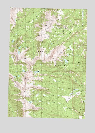
Mount Tahepia, MT USGS Topographic Map
Click on map above to begin viewing in our Map Viewer.

This topographic map contains these locations and features:
Feature Name Type Latitude Longitude GNIS ID View Map
Barbour HillSummitN45.5871°W112.9506°779350View Map
Brownes PeakSummitN45.5633°W112.8845°780470View Map
Canyon Creek Guest RanchLocaleN45.6244°W112.9459°801875View Map
Canyon Creek Recreation SiteLocaleN45.6241°W112.9445°794596View Map
Canyon LakeReservoirN45.5865°W112.9950°780913View Map
Cherry LakeLakeN45.5726°W112.9058°781198View Map
Cleopatra MineMineN45.6027°W112.9384°802391View Map
Cleve MineMineN45.6049°W112.9142°781374View Map
Cleve MountainSummitN45.6121°W112.9250°781375View Map
Cleve ParkFlatN45.6208°W112.9206°781376View Map
Elm - Orlu MineMineN45.5894°W112.9356°802395View Map
Franklin MineMineN45.6027°W112.9200°783690View Map
Gold Creek TrailTrailN45.6052°W112.9753°784055View Map
Grace LakeLakeN45.6107°W112.9923°771893View Map
Granite LakeLakeN45.5786°W112.9047°784172View Map
Granite MountainSummitN45.5680°W112.9311°784176View Map
Grayling LakeLakeN45.5794°W112.9843°784248View Map
Green LakeLakeN45.5657°W112.9094°784286View Map
Hecla (historical)LocaleN45.6055°W112.9314°1797352View Map
Hecla MinesMineN45.6013°W112.9356°784704View Map
Hecla Post Office (historical)Post OfficeN45.6055°W112.9314°1797241View Map
Hecla School (historical)SchoolN45.6055°W112.9314°1797351View Map
Keokirk MineMineN45.5921°W112.9392°802435View Map
Keokirk MineMineN45.5927°W112.9403°785690View Map
Keokirk MountainSummitN45.5938°W112.9511°785691View Map
Lion City (historical)Populated PlaceN45.6083°W112.9259°1797360View Map
Lion CreekStreamN45.6019°W112.9667°786190View Map
Lion LakeLakeN45.5737°W112.9853°786203View Map
Lion MountainSummitN45.6066°W112.9411°786208View Map
Long BranchStreamN45.5352°W112.8753°786513View Map
Long Branch LakeLakeN45.5288°W112.8963°786514View Map
Long LakeLakeN45.5326°W112.8927°786529View Map
Lower Cleve MineMineN45.6038°W112.9134°802393View Map
Minnie-Gaffney MineMineN45.5888°W112.9314°802366View Map
Mount AlversonSummitN45.5305°W112.9767°789821View Map
Mount TahepiaSummitN45.5438°W112.9723°791862View Map
Rainbow LakeLakeN45.5198°W112.8765°789342View Map
Sappington CreekStreamN45.6005°W112.9003°790023View Map
Schulz LakesLakeN45.5468°W112.9844°790141View Map
SE Section 3 MineMineN45.5980°W112.9336°802436View Map
Sharp MountainSummitN45.5671°W112.9786°790289View Map
Sheriff MountainSummitN45.6108°W112.9336°790408View Map
Silver King MineMineN45.5855°W112.9292°802344View Map
SW Section 11 MineMineN45.5896°W112.9370°802396View Map
Tahepia LakeLakeN45.5529°W112.9771°791861View Map
Teacup LakeLakeN45.5683°W112.9964°791929View Map
Tendoy LakeLakeN45.5176°W112.9650°791955View Map
Trapper LakeLakeN45.5844°W112.9325°792349View Map
Trapper MineMineN45.5958°W112.9153°802394View Map
Trapper MineMineN45.5966°W112.9153°792350View Map
True Blue MineMineN45.6049°W112.9292°802388View Map
Vera LakeLakeN45.5794°W112.9742°792687View Map
Waukena LakeLakeN45.5523°W112.9554°792891View Map
Waukena LakeReservoirN45.5533°W112.9509°795907View Map
Waukena Lake DamDamN45.5533°W112.9509°795906View Map

Note: Coordinates in the location and feature list above are referenced to NAD83 datum.


Copyright (C) 2008-2024 Ryan Niemi / Sunset Dynamics ... All Rights Reserved