TopoQuest Logo
Do you find TopoQuest useful?
Help keep TopoQuest running and adding new maps/features by donating!
Bitcoin:  19c7KJd3qBynnjoSw5npx9KScwjBe4ifkT
Litecoin:  LXs6TkuXGGXo1vDsWCkWVdjQX94eUKd6ui
Home View Maps Find Maps Find Places Resources & Links


Mount Jewett, Pennsylvania Topographic Map

USGS Map Title: Mount Jewett, PA
USGS Map MRC: 41078F6
DRG (GeoTIFF) Download: o41078f6.tif


Neighboring USGS Topographic Map Quads:


  Westline, PA  
41078G7
 

  Lewis Run, PA  
41078G6
 

  Cyclone, PA  
41078G5
 

  Kane, PA  
41078F7
 

  Mount Jewett, PA  
41078F6
 

  Hazel Hurst, PA  
41078F5
 

  James City, PA  
41078E7
 

  Wilcox, PA  
41078E6
 

  Glen Hazel, PA  
41078E5


Map MRC Location:

N42°
W79°
N42°
W78°
H8 H7 H6 H5 H4 H3 H2 H1
G8 G7 G6 G5 G4 G3 G2 G1
F8 F7 F6 F5 F4 F3 F2 F1
E8 E7 E6 E5 E4 E3 E2 E1
D8 D7 D6 D5 D4 D3 D2 D1
C8 C7 C6 C5 C4 C3 C2 C1
B8 B7 B6 B5 B4 B3 B2 B1
A8 A7 A6 A5 A4 A3 A2 A1
N41°
W79°
N41°
W78°

Mount Jewett, PA USGS 1:24K Topographic Map Preview:
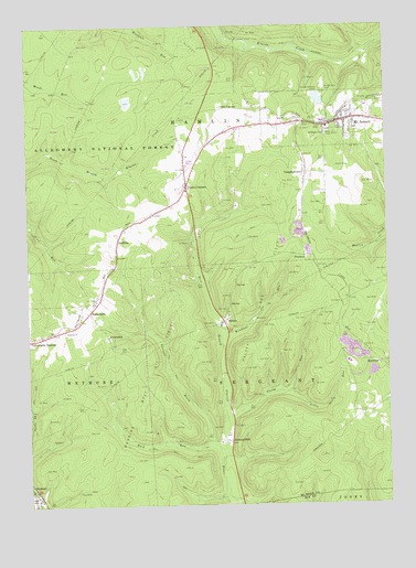
Mount Jewett, PA USGS Topographic Map
Click on map above to begin viewing in our Map Viewer.

This topographic map contains these locations and features:
Feature Name Type Latitude Longitude GNIS ID View Map
Beckwith RunStreamN41.6709°W78.7089°1212827View Map
Borough of Mount JewettCivilN41.7255°W78.6444°1215433View Map
Bridge View CemeteryCemeteryN41.7337°W78.6459°1209443View Map
Buck RunStreamN41.6370°W78.6828°1209453View Map
Burning WellLocaleN41.6417°W78.6800°1209461View Map
Burning Well Oil FieldOilfieldN41.6584°W78.7078°1209462View Map
CampbelltownPopulated PlaceN41.7120°W78.6528°1209479View Map
Cartwrights CrossingPopulated PlaceN41.6684°W78.7492°1209484View Map
CoontownPopulated PlaceN41.6690°W78.7217°1209530View Map
Duck PondReservoirN41.7305°W78.7143°1210426View Map
FreemanPopulated PlaceN41.6906°W78.6522°1209617View Map
GriffithsPopulated PlaceN41.6951°W78.7181°1209646View Map
Guffey Oil FieldOilfieldN41.7365°W78.6795°1209650View Map
HalseyPopulated PlaceN41.6728°W78.6811°1209655View Map
Halsey Gas FieldOilfieldN41.6792°W78.6689°1209656View Map
Howard HillSummitN41.7217°W78.6422°1210385View Map
HutchinsPopulated PlaceN41.6623°W78.6272°1209686View Map
KanesholmPopulated PlaceN41.6748°W78.7270°1209720View Map
LafayetteLocaleN41.7128°W78.6947°1210289View Map
Lafayette StationLocaleN41.7117°W78.6947°1212826View Map
Lanigan BrookStreamN41.6412°W78.6853°1178873View Map
Lantz CornersPopulated PlaceN41.7084°W78.6934°1209747View Map
Lebanon ChurchChurchN41.6706°W78.7373°1209749View Map
Little Sicily RunStreamN41.6548°W78.6600°1209774View Map
Marsh PondsReservoirN41.7377°W78.7111°1210453View Map
McKean LandfillLocaleN41.6653°W78.6375°2725980View Map
Mount JewettPopulated PlaceN41.7256°W78.6384°1209835View Map
Mount Jewett Area Ambulance AssociationBuildingN41.7254°W78.6351°2719682View Map
Mount Jewett Elementary SchoolSchoolN41.7237°W78.6447°1210398View Map
Mount Jewett Post OfficePost OfficeN41.7250°W78.6407°2772850View Map
Mount Jewett Volunteer Fire DepartmentBuildingN41.7243°W78.6396°2645294View Map
Nebo ChurchChurchN41.7259°W78.6586°1210198View Map
Pennsylvania State Police Troop C Kane StationBuildingN41.7146°W78.6943°2777331View Map
Saint Josephs ChurchChurchN41.7217°W78.6436°1209952View Map
Seven Mile SummitSummitN41.6867°W78.6439°1210384View Map
Sicily RunStreamN41.6437°W78.6814°1209980View Map
Stenstrom SchoolSchoolN41.7001°W78.7098°1210288View Map
Toby Springs SchoolSchoolN41.7184°W78.6872°1210290View Map
Windfall RunStreamN41.6690°W78.6822°1210124View Map

Note: Coordinates in the location and feature list above are referenced to NAD83 datum.


Copyright (C) 2008-2024 Ryan Niemi / Sunset Dynamics ... All Rights Reserved