TopoQuest Logo
Do you find TopoQuest useful?
Help keep TopoQuest running and adding new maps/features by donating!
Bitcoin:  19c7KJd3qBynnjoSw5npx9KScwjBe4ifkT
Litecoin:  LXs6TkuXGGXo1vDsWCkWVdjQX94eUKd6ui
Home View Maps Find Maps Find Places Resources & Links


Mount Henry, California Topographic Map

USGS Map Title: Mount Henry, CA
USGS Map MRC: 37118B7
DRG (GeoTIFF) Download: o37118b7.tif


Neighboring USGS Topographic Map Quads:


  Florence Lake, CA  
37118C8
 

  Mount Hilgard, CA  
37118C7
 

  Mount Tom, CA  
37118C6
 

  Ward Mountain, CA  
37118B8
 

  Mount Henry, CA  
37118B7
 

  Mount Darwin, CA  
37118B6
 

  Courtright Reservoir, CA  
37118A8
 

  Blackcap Mountain, CA  
37118A7
 

  Mount Goddard, CA  
37118A6


Map MRC Location:

N38°
W119°
N38°
W118°
H8 H7 H6 H5 H4 H3 H2 H1
G8 G7 G6 G5 G4 G3 G2 G1
F8 F7 F6 F5 F4 F3 F2 F1
E8 E7 E6 E5 E4 E3 E2 E1
D8 D7 D6 D5 D4 D3 D2 D1
C8 C7 C6 C5 C4 C3 C2 C1
B8 B7 B6 B5 B4 B3 B2 B1
A8 A7 A6 A5 A4 A3 A2 A1
N37°
W119°
N37°
W118°

Mount Henry, CA USGS 1:24K Topographic Map Preview:
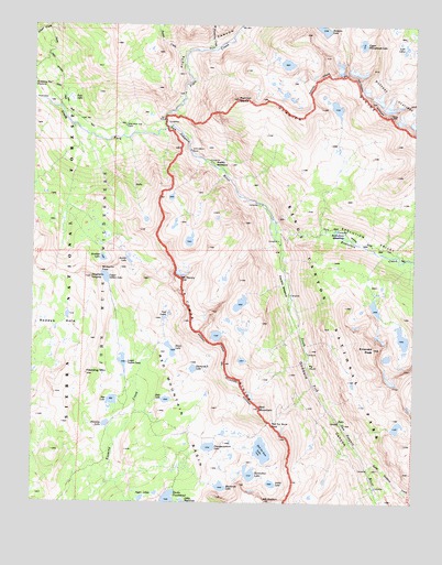
Mount Henry, CA USGS Topographic Map
Click on map above to begin viewing in our Map Viewer.

This topographic map contains these locations and features:
Feature Name Type Latitude Longitude GNIS ID View Map
Arctic LakeLakeN37.1300°W118.7970°256311View Map
Aspen MeadowFlatN37.2130°W118.8157°1667312View Map
Blackrock LakeLakeN37.1292°W118.8135°257174View Map
Bonita LakeLakeN37.1884°W118.8445°1667316View Map
Dale LakeLakeN37.1518°W118.8318°259018View Map
Davis LakeLakeN37.1650°W118.8304°259093View Map
Devils PunchbowlLakeN37.1258°W118.8307°259328View Map
Diamond-X LakeLakeN37.1600°W118.8229°259352View Map
Disappointment LakeLakeN37.1395°W118.8175°259388View Map
Emerald PeakSummitN37.1654°W118.7638°1658497View Map
Evolution CreekStreamN37.1972°W118.7962°260001View Map
Evolution MeadowFlatN37.1952°W118.7768°260003View Map
Evolution ValleyValleyN37.1965°W118.7949°260004View Map
Fleming LakeLakeN37.1455°W118.8516°260203View Map
Fleming MountainSummitN37.1587°W118.8581°260204View Map
Franklin MeadowFlatN37.1822°W118.7929°1667334View Map
Goddard CanyonValleyN37.1993°W118.7975°260628View Map
Heather LakeLakeN37.1888°W118.8529°1667336View Map
Hell for Sure LakeLakeN37.1386°W118.8001°261239View Map
Hell for Sure PassGapN37.1458°W118.7971°261242View Map
Horseshoe LakeLakeN37.1326°W118.8042°261528View Map
Jigger LakesLakeN37.1259°W118.8398°1667338View Map
John Muir RockPillarN37.2180°W118.8237°276384View Map
John Muir Trail CabinBuildingN37.2236°W118.8459°1667339View Map
John Muir WildernessReserveN37.2476°W118.8730°1654921View Map
Little Shot LakeLakeN37.1252°W118.8261°1667345View Map
Lobe LakesLakeN37.2413°W118.7579°262759View Map
Lower Indian LakeLakeN37.1619°W118.8460°263020View Map
Matthes GlaciersGlacierN37.2277°W118.7593°263269View Map
Mosquito PassGapN37.1858°W118.8529°263874View Map
Mount HenrySummitN37.1832°W118.8272°261271View Map
Mount HuttonSummitN37.1255°W118.7996°261664View Map
North Goddard CreekStreamN37.1341°W118.7643°264224View Map
Pavilion DomeSummitN37.2306°W118.8090°264573View Map
Pig ChuteValleyN37.1619°W118.7858°1667362View Map
Piute CanyonValleyN37.2234°W118.8331°264826View Map
Piute CreekStreamN37.2230°W118.8329°267132View Map
PotholesAreaN37.2308°W118.8732°1667363View Map
Rae LakeLakeN37.1517°W118.8495°265128View Map
Ramona LakeLakeN37.2497°W118.7824°265164View Map
Red MountainSummitN37.1498°W118.8012°265294View Map
Red Mountain BasinBasinN37.1347°W118.8179°265302View Map
Reddys HoleBasinN37.1647°W118.8696°1667366View Map
Tule LakeSwampN37.2222°W118.8634°1667373View Map
Turf LakesLakeN37.1732°W118.8328°268486View Map
Turret CreekStreamN37.2388°W118.8265°268501View Map
Upper Honeymoon LakeLakeN37.2451°W118.7682°268613View Map
Upper Indian LakeLakeN37.1839°W118.8520°268618View Map
West Pinnacles CreekStreamN37.2433°W118.8171°268932View Map
Zingheim HeightsSummitN37.1838°W118.8569°1667381View Map

Note: Coordinates in the location and feature list above are referenced to NAD83 datum.


Copyright (C) 2008-2024 Ryan Niemi / Sunset Dynamics ... All Rights Reserved