TopoQuest Logo
Do you find TopoQuest useful?
Help keep TopoQuest running and adding new maps/features by donating!
Bitcoin:  19c7KJd3qBynnjoSw5npx9KScwjBe4ifkT
Litecoin:  LXs6TkuXGGXo1vDsWCkWVdjQX94eUKd6ui
Home View Maps Find Maps Find Places Resources & Links


Mount Bruno, Oregon Topographic Map

USGS Map Title: Mount Bruno, OR
USGS Map MRC: 44121F8
DRG (GeoTIFF) Download: o44121f8.tif


Neighboring USGS Topographic Map Quads:


  Mother Lode Mountain, OR  
44122G1
 

  Breitenbush Hot Springs, OR  
44121G8
 

  Olallie Butte, OR  
44121G7
 

  Idanha, OR  
44122F1
 

  Mount Bruno, OR  
44121F8
 

  Mount Jefferson, OR  
44121F7
 

  Coffin Mountain, OR  
44122E1
 

  Marion Forks, OR  
44121E8
 

  Marion Lake, OR  
44121E7


Map MRC Location:

N45°
W122°
N45°
W121°
H8 H7 H6 H5 H4 H3 H2 H1
G8 G7 G6 G5 G4 G3 G2 G1
F8 F7 F6 F5 F4 F3 F2 F1
E8 E7 E6 E5 E4 E3 E2 E1
D8 D7 D6 D5 D4 D3 D2 D1
C8 C7 C6 C5 C4 C3 C2 C1
B8 B7 B6 B5 B4 B3 B2 B1
A8 A7 A6 A5 A4 A3 A2 A1
N44°
W122°
N44°
W121°

Mount Bruno, OR USGS 1:24K Topographic Map Preview:
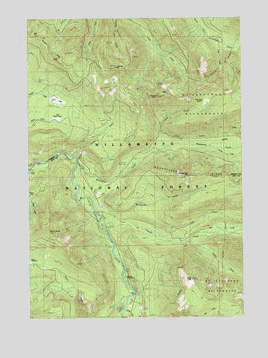
Mount Bruno, OR USGS Topographic Map
Click on map above to begin viewing in our Map Viewer.

This topographic map contains these locations and features:
Feature Name Type Latitude Longitude GNIS ID View Map
Bachelor Mountain TrailTrailN44.6262°W121.9923°1137382View Map
Big Springs Campground (historical)ParkN44.6923°W121.9848°1117680View Map
Boulder RidgeRidgeN44.7337°W121.9862°1163653View Map
Bruno MeadowsFlatN44.6481°W121.9998°1138703View Map
Cheat CreekStreamN44.6957°W121.9220°1118842View Map
Crag CreekStreamN44.7393°W121.8873°1119497View Map
Gale HillSummitN44.7442°W121.9980°1162999View Map
Grizzly CreekStreamN44.6551°W121.9092°1143101View Map
Little Pigeon PrairieSwampN44.7079°W121.9865°1123249View Map
Milk CreekStreamN44.6443°W121.9059°1146211View Map
Minto CreekStreamN44.6296°W121.9451°1146346View Map
Minto MountainSummitN44.6405°W121.9058°1124249View Map
Mount BrunoSummitN44.6607°W121.9892°1118146View Map
Outerson MountainSummitN44.7294°W121.9494°1125068View Map
Pamelia CreekStreamN44.6623°W121.9565°1147379View Map
Peasley LakeLakeN44.6714°W121.9587°1161753View Map
Pigeon PrairieSwampN44.7143°W121.9829°1125369View Map
Red CreekStreamN44.6607°W121.9273°1148290View Map
Riverside Recreation SiteLocaleN44.6415°W121.9448°1126063View Map
Russell CreekStreamN44.6948°W121.8920°1148857View Map
Sentinel CreekStreamN44.6965°W121.8937°1149232View Map
South Breitenbush TrailTrailN44.7429°W121.8798°1149906View Map
Spire RockPillarN44.7226°W121.9243°1127392View Map
Spring CreekStreamN44.6915°W121.9731°1157033View Map
Timber ButteSummitN44.7329°W121.9826°1136832View Map
Triangulation PeakSummitN44.7179°W121.9244°1128224View Map
Tunnel CreekStreamN44.6912°W121.9726°1128298View Map
Whitewater Campground (historical)ParkN44.6857°W121.9684°1129015View Map
Whitewater CreekStreamN44.6890°W121.9723°1152271View Map
Wild Cheat MeadowFlatN44.7156°W121.8971°1129044View Map
Woodpecker CreekStreamN44.6643°W121.9523°1129307View Map
Woodpecker HillSummitN44.6838°W121.9075°1136922View Map
Woodpecker RidgeRidgeN44.6832°W121.8934°1129308View Map
Woodpecker TrailTrailN44.6782°W121.8776°1152634View Map

Note: Coordinates in the location and feature list above are referenced to NAD83 datum.


Copyright (C) 2008-2024 Ryan Niemi / Sunset Dynamics ... All Rights Reserved