TopoQuest Logo
Do you find TopoQuest useful?
Help keep TopoQuest running and adding new maps/features by donating!
Bitcoin:  19c7KJd3qBynnjoSw5npx9KScwjBe4ifkT
Litecoin:  LXs6TkuXGGXo1vDsWCkWVdjQX94eUKd6ui
Home View Maps Find Maps Find Places Resources & Links


Mount Airy NW, Louisiana Topographic Map

USGS Map Title: Mount Airy NW, LA
USGS Map MRC: 30090B6
DRG (GeoTIFF) Download: o30090b6.tif


Neighboring USGS Topographic Map Quads:


  French Settlement, LA  
30090C7
 

  Whitehall, LA  
30090C6
 

  Killian, LA  
30090C5
 

  Sorrento, LA  
30090B7
 

  Mount Airy NW, LA  
30090B6
 

  Mount Airy NE, LA  
30090B5
 

  Convent, LA  
30090A7
 

  Lutcher, LA  
30090A6
 

  Reserve, LA  
30090A5


Map MRC Location:

N31°
W91°
N31°
W90°
H8 H7 H6 H5 H4 H3 H2 H1
G8 G7 G6 G5 G4 G3 G2 G1
F8 F7 F6 F5 F4 F3 F2 F1
E8 E7 E6 E5 E4 E3 E2 E1
D8 D7 D6 D5 D4 D3 D2 D1
C8 C7 C6 C5 C4 C3 C2 C1
B8 B7 B6 B5 B4 B3 B2 B1
A8 A7 A6 A5 A4 A3 A2 A1
N30°
W91°
N30°
W90°

Mount Airy NW, LA USGS 1:24K Topographic Map Preview:
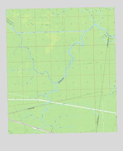
Mount Airy NW, LA USGS Topographic Map
Click on map above to begin viewing in our Map Viewer.

This topographic map contains these locations and features:
Feature Name Type Latitude Longitude GNIS ID View Map
Alligator IslandIslandN30.2177°W90.6301°559765View Map
Bayou AntoineStreamN30.1863°W90.7162°532429View Map
Bayou Chene BlancStreamN30.2335°W90.6481°553433View Map
Bayou FusilStreamN30.1396°W90.7120°559957View Map
Bayou Reponds PasStreamN30.1627°W90.7076°532752View Map
Bayou SecretStreamN30.1313°W90.6954°560080View Map
Black BayouStreamN30.2449°W90.6420°533166View Map
Blind BayouGutN30.2310°W90.7170°533215View Map
Bourgeois CanalCanalN30.1549°W90.6773°560257View Map
Coteau Chene BlancAreaN30.2358°W90.7131°551999View Map
Coteau Chene VerdeAreaN30.2188°W90.6954°552000View Map
Coteau FeivinAreaN30.2363°W90.6770°552001View Map
Devils ElbowBendN30.2377°W90.6390°552009View Map
Fiebleman Lake (historical)LakeN30.2274°W90.6834°552013View Map
Little Bayou Chene BlancStreamN30.2333°W90.6484°555049View Map
Number Twelve CanalCanalN30.1410°W90.6920°1627805View Map
Petite Amite RiverStreamN30.1752°W90.6948°555632View Map
Sarah RidgeRidgeN30.2377°W90.7284°552065View Map

Note: Coordinates in the location and feature list above are referenced to NAD83 datum.


Copyright (C) 2008-2024 Ryan Niemi / Sunset Dynamics ... All Rights Reserved