TopoQuest Logo
Do you find TopoQuest useful?
Help keep TopoQuest running and adding new maps/features by donating!
Bitcoin:  19c7KJd3qBynnjoSw5npx9KScwjBe4ifkT
Litecoin:  LXs6TkuXGGXo1vDsWCkWVdjQX94eUKd6ui
Home View Maps Find Maps Find Places Resources & Links


Mound Prairie, Minnesota Topographic Map

USGS Map Title: Mound Prairie, MN
USGS Map MRC: 43091G4
DRG (GeoTIFF) Download: o43091g4.tif


Neighboring USGS Topographic Map Quads:


  Witoka, MN  
43091H5
 

  Pickwick, MN  
43091H4
 

  Holmen, WI  
43091H3
 

  Houston, MN  
43091G5
 

  Mound Prairie, MN  
43091G4
 

  La Crescent, MN  
43091G3
 

  Sheldon, MN  
43091F5
 

  Caledonia, MN  
43091F4
 

  Brownsville, MN  
43091F3


Map MRC Location:

N44°
W92°
N44°
W91°
H8 H7 H6 H5 H4 H3 H2 H1
G8 G7 G6 G5 G4 G3 G2 G1
F8 F7 F6 F5 F4 F3 F2 F1
E8 E7 E6 E5 E4 E3 E2 E1
D8 D7 D6 D5 D4 D3 D2 D1
C8 C7 C6 C5 C4 C3 C2 C1
B8 B7 B6 B5 B4 B3 B2 B1
A8 A7 A6 A5 A4 A3 A2 A1
N43°
W92°
N43°
W91°

Mound Prairie, MN USGS 1:24K Topographic Map Preview:
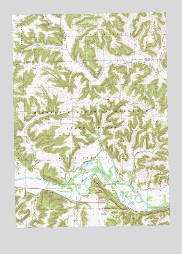
Mound Prairie, MN USGS Topographic Map
Click on map above to begin viewing in our Map Viewer.

This topographic map contains these locations and features:
Feature Name Type Latitude Longitude GNIS ID View Map
Baumgartner Group Structure DamDamN43.7883°W91.3851°1776473View Map
Blumentritt Detention DamDamN43.8750°W91.4418°1776576View Map
Brush ValleyValleyN43.7743°W91.4065°640565View Map
Crystal CreekStreamN43.7764°W91.4721°642525View Map
Day CreekStreamN43.7858°W91.4199°642661View Map
Fairbanks Family CemeteryCemeteryN43.7597°W91.4474°2050403View Map
Hargreaves Family CemeteryCemeteryN43.7597°W91.4107°2050404View Map
Hop HollowValleyN43.7713°W91.4904°645168View Map
Immanuel ChurchChurchN43.8183°W91.3893°645367View Map
Immanuel German Lutheran CemeteryCemeteryN43.8183°W91.3896°2050399View Map
Karl Rauk Detention DamDamN43.8316°W91.4368°1776467View Map
Lane ValleyValleyN43.8463°W91.3824°646473View Map
Loretta CemeteryCemeteryN43.8202°W91.4504°647187View Map
Mound PrairieLocaleN43.7883°W91.4515°648150View Map
Mound Prairie CemeteryCemeteryN43.7902°W91.4357°2050401View Map
Mound Prairie ChurchChurchN43.7802°W91.4154°648152View Map
Mound Prairie CreekStreamN43.7775°W91.4235°648153View Map
Mound Prairie Post Office (historical)Post OfficeN43.7883°W91.4515°2050590View Map
Pea RidgeRidgeN43.8733°W91.3885°649196View Map
Pine CreekPopulated PlaceN43.8452°W91.4035°654881View Map
Rose ValleyValleyN43.8511°W91.3975°650275View Map
Ruff Family CemeteryCemeteryN43.8069°W91.4021°2050400View Map
Sheldon Family CemeteryCemeteryN43.8444°W91.4446°2050397View Map
Silver CreekStreamN43.7797°W91.4938°652034View Map
South RidgePopulated PlaceN43.8252°W91.4271°654950View Map
South Ridge ChurchChurchN43.8216°W91.4032°652335View Map
Storer CreekStreamN43.7794°W91.4815°652702View Map
Tabor CemeteryCemeteryN43.8213°W91.4032°2050398View Map
Township of Mound PrairieCivilN43.7868°W91.4464°665051View Map
Valley High Country ClubLocaleN43.7572°W91.4313°659967View Map
Vix CemeteryCemeteryN43.7841°W91.4696°2050402View Map

Note: Coordinates in the location and feature list above are referenced to NAD83 datum.


Copyright (C) 2008-2024 Ryan Niemi / Sunset Dynamics ... All Rights Reserved