TopoQuest Logo
Do you find TopoQuest useful?
Help keep TopoQuest running and adding new maps/features by donating!
Bitcoin:  19c7KJd3qBynnjoSw5npx9KScwjBe4ifkT
Litecoin:  LXs6TkuXGGXo1vDsWCkWVdjQX94eUKd6ui
Home View Maps Find Maps Find Places Resources & Links


Moss Agate Reservoir, Wyoming Topographic Map

USGS Map Title: Moss Agate Reservoir, WY
USGS Map MRC: 42106C2
DRG (GeoTIFF) Download: o42106c2.tif


Neighboring USGS Topographic Map Quads:


  Mud Springs, WY  
42106D3
 

  Bates Creek Reservoir, WY  
42106D2
 

  Squaw Spring, WY  
42106D1
 

  Measel Spring Reservoir, WY  
42106C3
 

  Moss Agate Reservoir, WY  
42106C2
 

  Chalk Hills, WY  
42106C1
 

  Cameron Creek, WY  
42106B3
 

  Walker Draw NW, WY  
42106B2
 

  Big Charlie Lakes, WY  
42106B1


Map MRC Location:

N43°
W107°
N43°
W106°
H8 H7 H6 H5 H4 H3 H2 H1
G8 G7 G6 G5 G4 G3 G2 G1
F8 F7 F6 F5 F4 F3 F2 F1
E8 E7 E6 E5 E4 E3 E2 E1
D8 D7 D6 D5 D4 D3 D2 D1
C8 C7 C6 C5 C4 C3 C2 C1
B8 B7 B6 B5 B4 B3 B2 B1
A8 A7 A6 A5 A4 A3 A2 A1
N42°
W107°
N42°
W106°

Moss Agate Reservoir, WY USGS 1:24K Topographic Map Preview:
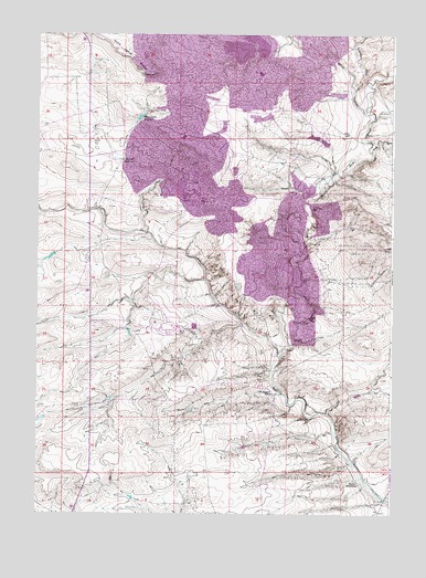
Moss Agate Reservoir, WY USGS Topographic Map
Click on map above to begin viewing in our Map Viewer.

This topographic map contains these locations and features:
Feature Name Type Latitude Longitude GNIS ID View Map
Arbor Number Five ClaimMineN42.3386°W106.1667°1726475View Map
Arbor Number Four ClaimMineN42.3442°W106.1667°1726474View Map
Chalk DrawValleyN42.3447°W106.1320°1586558View Map
Dave and T G S MineMineN42.3202°W106.1711°1726476View Map
Fresh Water DamDamN42.3666°W106.1772°1608174View Map
Fresh Water ReservoirReservoirN42.3666°W106.1772°1608175View Map
Heward ReservoirReservoirN42.3423°W106.2215°1589510View Map
Little Buck ClaimsMineN42.3122°W106.1333°1726473View Map
Mall Lease MineMineN42.3700°W106.1517°1726477View Map
Martha ClaimsMineN42.3300°W106.1464°1726478View Map
Medicine Bow Rim MineMineN42.3591°W106.1272°1726471View Map
Moss Agate ReservoirReservoirN42.3534°W106.2143°1591792View Map
North Walker MineMineN42.3291°W106.1461°1726469View Map
Nu Hot Spot Number Seven ClaimMineN42.2939°W106.1667°1726479View Map
Number 4 Evaporation DamDamN42.3700°W106.1739°1608172View Map
Number 4 Evaporation ReservoirReservoirN42.3700°W106.1739°1608173View Map
Old Bennett Place (historical)LocaleN42.2816°W106.1661°1597437View Map
Petrotomics MineMineN42.3302°W106.1864°1726480View Map
Sand CreekStreamN42.2908°W106.1642°1593840View Map
Shirley Basin MineMineN42.2833°W106.2006°1726472View Map
South Walker-Sullivan MineMineN42.3044°W106.1811°1726253View Map
Spring CreekStreamN42.3544°W106.1333°1594871View Map
Squaw CreekStreamN42.3614°W106.1384°1603301View Map
Sullivan MineMineN42.3183°W106.1453°1726470View Map
Teton CampLocaleN42.3489°W106.1411°1595383View Map
Utah ShaftMineN42.3705°W106.1928°1605583View Map
Walker HomesteadLocaleN42.2577°W106.1359°1596002View Map

Note: Coordinates in the location and feature list above are referenced to NAD83 datum.


Copyright (C) 2008-2024 Ryan Niemi / Sunset Dynamics ... All Rights Reserved