TopoQuest Logo
Do you find TopoQuest useful?
Help keep TopoQuest running and adding new maps/features by donating!
Bitcoin:  19c7KJd3qBynnjoSw5npx9KScwjBe4ifkT
Litecoin:  LXs6TkuXGGXo1vDsWCkWVdjQX94eUKd6ui
Home View Maps Find Maps Find Places Resources & Links


Mosquito Flat, Oregon Topographic Map

USGS Map Title: Mosquito Flat, OR
USGS Map MRC: 43119G1
DRG (GeoTIFF) Download: o43119g1.tif


Neighboring USGS Topographic Map Quads:


  West Myrtle Butte, OR  
43119H2
 

  Myrtle Park Meadows, OR  
43119H1
 

  Trout Creek, OR  
43118H8
 

  Landing Creek, OR  
43119G2
 

  Mosquito Flat, OR  
43119G1
 

  Devine Ridge North, OR  
43118G8
 

  Burns NW, OR  
43119F2
 

  Poison Creek, OR  
43119F1
 

  Devine Ridge South, OR  
43118F8


Map MRC Location:

N44°
W120°
N44°
W119°
H8 H7 H6 H5 H4 H3 H2 H1
G8 G7 G6 G5 G4 G3 G2 G1
F8 F7 F6 F5 F4 F3 F2 F1
E8 E7 E6 E5 E4 E3 E2 E1
D8 D7 D6 D5 D4 D3 D2 D1
C8 C7 C6 C5 C4 C3 C2 C1
B8 B7 B6 B5 B4 B3 B2 B1
A8 A7 A6 A5 A4 A3 A2 A1
N43°
W120°
N43°
W119°

Mosquito Flat, OR USGS 1:24K Topographic Map Preview:
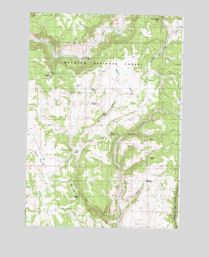
Mosquito Flat, OR USGS Topographic Map
Click on map above to begin viewing in our Map Viewer.

This topographic map contains these locations and features:
Feature Name Type Latitude Longitude GNIS ID View Map
Baker SpringSpringN43.7684°W119.0006°1137432View Map
Bob Bennett SpringSpringN43.8489°W119.0776°1138362View Map
Buck CreekStreamN43.7910°W119.0838°1138757View Map
Bull Gulch SpringSpringN43.8224°W119.0730°1138907View Map
Cow CampLocaleN43.8385°W119.1080°1140272View Map
Deer CreekStreamN43.8663°W119.0116°1140839View Map
Devine MonumentParkN43.7846°W119.0005°1140979View Map
Dixon RanchLocaleN43.8424°W119.0249°1156487View Map
Dry CreekStreamN43.7529°W119.0516°1141276View Map
Gravel RidgeRidgeN43.8332°W119.0344°1154217View Map
Groff RanchLocaleN43.7676°W119.0830°1133913View Map
Hixon Brandon SpringSpringN43.8725°W119.0201°1154221View Map
Landing Creek SpringSpringN43.7757°W119.1225°1154209View Map
Lone Pine SpringSpringN43.8160°W119.0606°1145361View Map
Mahogany RidgeRidgeN43.7554°W119.0677°1154220View Map
Mosquito FlatFlatN43.7899°W119.1147°1146496View Map
Peabody HomesteadLocaleN43.7765°W119.0297°1147519View Map
Peabody SpringSpringN43.7911°W119.0250°1147520View Map
Rice SpringSpringN43.8298°W119.0721°1148431View Map
Rimrock SpringSpringN43.8392°W119.1072°1148468View Map
T-6 SpringSpringN43.8025°W119.0256°1150804View Map
Varien CanyonValleyN43.7638°W119.0455°1154214View Map
Whiting RanchLocaleN43.7938°W119.0874°1152275View Map
Whiting SpringSpringN43.8050°W119.0537°1152276View Map

Note: Coordinates in the location and feature list above are referenced to NAD83 datum.


Copyright (C) 2008-2024 Ryan Niemi / Sunset Dynamics ... All Rights Reserved