TopoQuest Logo
Do you find TopoQuest useful?
Help keep TopoQuest running and adding new maps/features by donating!
Bitcoin:  19c7KJd3qBynnjoSw5npx9KScwjBe4ifkT
Litecoin:  LXs6TkuXGGXo1vDsWCkWVdjQX94eUKd6ui
Home View Maps Find Maps Find Places Resources & Links


Morrisonville, Wisconsin Topographic Map

USGS Map Title: Morrisonville, WI
USGS Map MRC: 43089C3
DRG (GeoTIFF) Download: o43089c3.tif


Neighboring USGS Topographic Map Quads:


  Poynette, WI  
43089D4
 

  Wyocena, WI  
43089D3
 

  Rio, WI  
43089D2
 

  Arlington, WI  
43089C4
 

  Morrisonville, WI  
43089C3
 

  North Bristol, WI  
43089C2
 

  Waunakee, WI  
43089B4
 

  De Forest, WI  
43089B3
 

  Sun Prairie, WI  
43089B2


Map MRC Location:

N44°
W90°
N44°
W89°
H8 H7 H6 H5 H4 H3 H2 H1
G8 G7 G6 G5 G4 G3 G2 G1
F8 F7 F6 F5 F4 F3 F2 F1
E8 E7 E6 E5 E4 E3 E2 E1
D8 D7 D6 D5 D4 D3 D2 D1
C8 C7 C6 C5 C4 C3 C2 C1
B8 B7 B6 B5 B4 B3 B2 B1
A8 A7 A6 A5 A4 A3 A2 A1
N43°
W90°
N43°
W89°

Morrisonville, WI USGS 1:24K Topographic Map Preview:
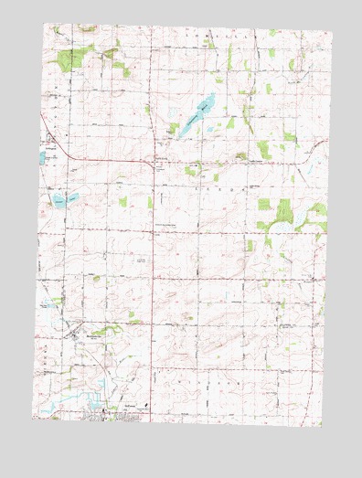
Morrisonville, WI USGS Topographic Map
Click on map above to begin viewing in our Map Viewer.

This topographic map contains these locations and features:
Feature Name Type Latitude Longitude GNIS ID View Map
Audubon Goose Pond State Natural AreaParkN43.3189°W89.3662°2055079View Map
Dane County Sheriff's Office - Northeast PrecinctBuildingN43.2532°W89.3148°2759820View Map
De Forest Area Community CenterBuildingN43.2530°W89.3437°1842373View Map
Del Monte AirportAirportN43.3214°W89.3209°1581862View Map
Elert AirportAirportN43.2640°W89.3225°1581940View Map
Empire Prairie SchoolSchoolN43.2964°W89.3240°1564643View Map
Goose LakeLakeN43.3201°W89.3601°1565651View Map
Greenwood CemeteryCemeteryN43.3296°W89.3249°1565862View Map
Happy Hour School (historical)SchoolN43.2667°W89.2996°1566058View Map
KeyeserPopulated PlaceN43.2967°W89.2559°1567451View Map
LaFollette SchoolSchoolN43.2967°W89.2751°1567692View Map
LeedsPopulated PlaceN43.3105°W89.3246°1567935View Map
Leeds CenterPopulated PlaceN43.3325°W89.2857°1567937View Map
Leeds Center CemeteryCemeteryN43.3254°W89.2845°1567936View Map
Leeds Elementary SchoolSchoolN43.3311°W89.3073°1842983View Map
Lord of Love Lutheran ChurchChurchN43.2530°W89.3437°1842508View Map
MorrisonvillePopulated PlaceN43.2772°W89.3596°1569760View Map
Morrisonville Elementary SchoolSchoolN43.2777°W89.3562°1842566View Map
Morrisonville International AirportAirportN43.2747°W89.3529°2444179View Map
North LeedsPopulated PlaceN43.3319°W89.3254°1570460View Map
North Windsor CemeteryCemeteryN43.2673°W89.2692°1842583View Map
North Windsor SchoolSchoolN43.2683°W89.2648°1570519View Map
North Windsor United Methodist ChurchChurchN43.2600°W89.2701°1570518View Map
Schoeneberg MarshSwampN43.3486°W89.3056°1573793View Map
Spring Prairie - Hauge CemeteryCemeteryN43.2820°W89.2549°1566139View Map
Spring Prairie Lutheran CemeteryCemeteryN43.2974°W89.2560°1843038View Map
Spring Prairie Lutheran ChurchChurchN43.2967°W89.2559°1843039View Map
Sullivan Field (historical)AirportN43.2539°W89.3273°1842705View Map
Town of LeedsCivilN43.3249°W89.3039°1583538View Map
United in Christ Lutheran CemeteryCemeteryN43.2706°W89.3547°2781304View Map
University of Wisconsin Experimental FarmSchoolN43.3005°W89.3271°1575943View Map
Village of ArlingtonCivilN43.3350°W89.3725°1582713View Map
Wanger-In Airport (historical)AirportN43.3122°W89.3196°1581015View Map
Zion CemeteryCemeteryN43.3100°W89.3361°1577133View Map

Note: Coordinates in the location and feature list above are referenced to NAD83 datum.


Copyright (C) 2008-2024 Ryan Niemi / Sunset Dynamics ... All Rights Reserved