TopoQuest Logo
Do you find TopoQuest useful?
Help keep TopoQuest running and adding new maps/features by donating!
Bitcoin:  19c7KJd3qBynnjoSw5npx9KScwjBe4ifkT
Litecoin:  LXs6TkuXGGXo1vDsWCkWVdjQX94eUKd6ui
Home View Maps Find Maps Find Places Resources & Links


Mormon Basin, Oregon Topographic Map

USGS Map Title: Mormon Basin, OR
USGS Map MRC: 44117D5
DRG (GeoTIFF) Download: o44117d5.tif


Neighboring USGS Topographic Map Quads:


  French Gulch, OR  
44117E6
 

  Lost Basin, OR  
44117E5
 

  Durkee, OR  
44117E4
 

  Bridgeport, OR  
44117D6
 

  Mormon Basin, OR  
44117D5
 

  Rye Valley, OR  
44117D4
 

  Cow Valley East, OR  
44117C6
 

  Becker Creek, OR  
44117C5
 

  Birch Creek Meadow, OR  
44117C4


Map MRC Location:

N45°
W118°
N45°
W117°
H8 H7 H6 H5 H4 H3 H2 H1
G8 G7 G6 G5 G4 G3 G2 G1
F8 F7 F6 F5 F4 F3 F2 F1
E8 E7 E6 E5 E4 E3 E2 E1
D8 D7 D6 D5 D4 D3 D2 D1
C8 C7 C6 C5 C4 C3 C2 C1
B8 B7 B6 B5 B4 B3 B2 B1
A8 A7 A6 A5 A4 A3 A2 A1
N44°
W118°
N44°
W117°

Mormon Basin, OR USGS 1:24K Topographic Map Preview:
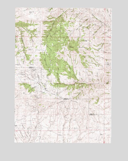
Mormon Basin, OR USGS Topographic Map
Click on map above to begin viewing in our Map Viewer.

This topographic map contains these locations and features:
Feature Name Type Latitude Longitude GNIS ID View Map
Áatway SpringSpringN44.4311°W117.5075°1127502View Map
Amelia (historical)LocaleN44.3902°W117.6244°1136003View Map
Basin Post Office (historical)Post OfficeN44.4263°W117.5983°1164205View Map
Bear ValleyBasinN44.4710°W117.5302°1133925View Map
Bear Valley GulchValleyN44.4852°W117.5094°1117399View Map
Blue Mud MineMineN44.4213°W117.5969°1133927View Map
Broken Pick MineMineN44.4488°W117.5033°1133926View Map
Brush Spray SpringSpringN44.4466°W117.6176°1118158View Map
Buckhorn MineMineN44.4188°W117.5991°1118235View Map
Burnt Cabin GulchValleyN44.4296°W117.5666°1118345View Map
Cake (historical)Populated PlaceN44.4207°W117.5733°1131903View Map
Cake Post Office (historical)Post OfficeN44.4207°W117.5733°1164997View Map
California GulchValleyN44.4210°W117.5866°1118466View Map
California MountainSummitN44.4146°W117.5394°1118470View Map
City GulchValleyN44.4252°W117.5913°1118954View Map
Cleveland MineMineN44.4199°W117.5846°1119016View Map
Cochran GulchValleyN44.4854°W117.5133°1119071View Map
Cottonwood SpringSpringN44.4610°W117.6077°1119351View Map
Cube SpringSpringN44.4096°W117.6247°1131889View Map
Devils CanyonValleyN44.4835°W117.6233°1119895View Map
Emigrant CreekStreamN44.4227°W117.5863°1120499View Map
Freezeout GulchValleyN44.4807°W117.5016°1120973View Map
French GulchValleyN44.4310°W117.5985°1158248View Map
Glengarry GulchValleyN44.4327°W117.6008°1121163View Map
Humboldt Basin (historical)Populated PlaceN44.4263°W117.6010°1131899View Map
Humboldt Basin Post Office (historical)Post OfficeN44.4263°W117.6010°1165422View Map
Humboldt MineMineN44.4257°W117.5994°1122125View Map
Last Chance GulchValleyN44.3788°W117.6058°1161702View Map
Little Deer CreekStreamN44.4471°W117.5158°1123179View Map
Mattie SpringSpringN44.4152°W117.6177°1131890View Map
Miller (historical)LocaleN44.4277°W117.5871°1131891View Map
Miller Post Office (historical)Post OfficeN44.4277°W117.5871°1165636View Map
Mine SpringSpringN44.4740°W117.5983°1131904View Map
Monohon Tunnel MineMineN44.4352°W117.6102°1124291View Map
Mormon BasinBasinN44.4271°W117.5899°1124363View Map
Mud SpringSpringN44.3829°W117.5139°1124488View Map
Oregon Chief MineMineN44.4238°W117.5433°1125021View Map
Overshot Group MineMineN44.4399°W117.6135°1125074View Map
Pedro Post Office (historical)Post OfficeN44.4679°W117.5302°1165775View Map
Pine CreekStreamN44.4807°W117.6191°1125388View Map
Puget Sound GulchValleyN44.4324°W117.5933°1125694View Map
Rainbow GulchValleyN44.4285°W117.5544°1125781View Map
Rainbow MineMineN44.4221°W117.5577°1125785View Map
Rainbow Mine Post Office (historical)Post OfficeN44.4221°W117.5658°1164625View Map
Rich GulchValleyN44.4235°W117.5955°1131902View Map
Robinson GulchValleyN44.4307°W117.5346°1126122View Map
Rock SpringSpringN44.4165°W117.5969°1126208View Map
Rooster Comb SpringSpringN44.4956°W117.6071°1126282View Map
Sampson GulchValleyN44.4563°W117.6108°1126540View Map
Skunk GulchValleyN44.4299°W117.5210°1127047View Map
Spirit HillSummitN44.4199°W117.6127°1127393View Map
Summit MineMineN44.4252°W117.5616°1127717View Map
Sunday HillSummitN44.4410°W117.6002°1136799View Map
Tater Patch GulchValleyN44.4910°W117.5216°1127897View Map
Thornton GulchValleyN44.4313°W117.5444°1128054View Map
Tuesday GulchValleyN44.4388°W117.5871°1131892View Map
Wagner GulchValleyN44.4299°W117.5374°1128569View Map
Washington GulchValleyN44.4299°W117.5160°1128705View Map

Note: Coordinates in the location and feature list above are referenced to NAD83 datum.


Copyright (C) 2008-2024 Ryan Niemi / Sunset Dynamics ... All Rights Reserved