TopoQuest Logo
Do you find TopoQuest useful?
Help keep TopoQuest running and adding new maps/features by donating!
Bitcoin:  19c7KJd3qBynnjoSw5npx9KScwjBe4ifkT
Litecoin:  LXs6TkuXGGXo1vDsWCkWVdjQX94eUKd6ui
Home View Maps Find Maps Find Places Resources & Links


Moreau NE, South Dakota Topographic Map

USGS Map Title: Moreau NE, SD
USGS Map MRC: 45100D3
DRG (GeoTIFF) Download: o45100d3.tif


Neighboring USGS Topographic Map Quads:


  Mobridge, SD  
45100E4
 

  Glenham, SD  
45100E3
 

  Selby SW, SD  
45100E2
 

  Moreau NW, SD  
45100D4
 

  Moreau NE, SD  
45100D3
 

  Akaska NW, SD  
45100D2
 

  Moreau, SD  
45100C4
 

  Moreau SE, SD  
45100C3
 

  Akaska SW, SD  
45100C2


Map MRC Location:

N46°
W101°
N46°
W100°
H8 H7 H6 H5 H4 H3 H2 H1
G8 G7 G6 G5 G4 G3 G2 G1
F8 F7 F6 F5 F4 F3 F2 F1
E8 E7 E6 E5 E4 E3 E2 E1
D8 D7 D6 D5 D4 D3 D2 D1
C8 C7 C6 C5 C4 C3 C2 C1
B8 B7 B6 B5 B4 B3 B2 B1
A8 A7 A6 A5 A4 A3 A2 A1
N45°
W101°
N45°
W100°

Moreau NE, SD USGS 1:24K Topographic Map Preview:
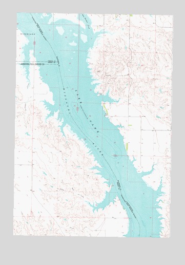
Moreau NE, SD USGS Topographic Map
Click on map above to begin viewing in our Map Viewer.

This topographic map contains these locations and features:
Feature Name Type Latitude Longitude GNIS ID View Map
Blue Blanket CreekStreamN45.4817°W100.3190°1253976View Map
Blue Blanket Recreation AreaParkN45.4980°W100.3457°1263605View Map
Bowdle Beach Recreation AreaParkN45.3767°W100.2574°1263600View Map
Ed Berens DamDamN45.4483°W100.2571°1260562View Map
Evarts (historical)LocaleN45.4486°W100.3060°1263674View Map
Evarts Cemetery (historical)CemeteryN45.4633°W100.3179°1263602View Map
Fox Island (historical)IslandN45.4342°W100.3137°1265485View Map
George Turner DamDamN45.4600°W100.2537°1260558View Map
I Molstad DamDamN45.4333°W100.3704°1260454View Map
John Liebelt DamDamN45.4450°W100.2621°1260561View Map
Lake Evarts (historical)LakeN45.4678°W100.3221°1263604View Map
Le Compte CreekStreamN45.4819°W100.3632°1256073View Map
Lindia Sattler DamDamN45.4700°W100.2754°1260559View Map
Little Bear CreekStreamN45.4014°W100.2932°1256150View Map
Lyman Ranch (historical)LocaleN45.4717°W100.3551°1263606View Map
Ree Indian Village (historical)LocaleN45.4975°W100.3712°1263608View Map
Richard Walth DamDamN45.4733°W100.2754°1260560View Map
Thomas Bay Recreation AreaParkN45.4550°W100.3160°1263603View Map
Township of KennedyCivilN45.4569°W100.2746°1268423View Map
Walth Bay Recreation AreaParkN45.4130°W100.2721°1263601View Map
Walworth (historical)LocaleN45.4511°W100.3101°1263678View Map

Note: Coordinates in the location and feature list above are referenced to NAD83 datum.


Copyright (C) 2008-2024 Ryan Niemi / Sunset Dynamics ... All Rights Reserved