TopoQuest Logo
Do you find TopoQuest useful?
Help keep TopoQuest running and adding new maps/features by donating!
Bitcoin:  19c7KJd3qBynnjoSw5npx9KScwjBe4ifkT
Litecoin:  LXs6TkuXGGXo1vDsWCkWVdjQX94eUKd6ui
Home View Maps Find Maps Find Places Resources & Links


Mooresville East, Indiana Topographic Map

USGS Map Title: Mooresville East, IN
USGS Map MRC: 39086E3
DRG (GeoTIFF) Download: o39086e3.tif


Neighboring USGS Topographic Map Quads:


  Plainfield, IN  
39086F4
 

  Bridgeport, IN  
39086F3
 

  Maywood, IN  
39086F2
 

  Mooresville West, IN  
39086E4
 

  Mooresville East, IN  
39086E3
 

  Bargersville, IN  
39086E2
 

  Martinsville, IN  
39086D4
 

  Cope, IN  
39086D3
 

  Trafalgar, IN  
39086D2


Map MRC Location:

N40°
W87°
N40°
W86°
H8 H7 H6 H5 H4 H3 H2 H1
G8 G7 G6 G5 G4 G3 G2 G1
F8 F7 F6 F5 F4 F3 F2 F1
E8 E7 E6 E5 E4 E3 E2 E1
D8 D7 D6 D5 D4 D3 D2 D1
C8 C7 C6 C5 C4 C3 C2 C1
B8 B7 B6 B5 B4 B3 B2 B1
A8 A7 A6 A5 A4 A3 A2 A1
N39°
W87°
N39°
W86°

Mooresville East, IN USGS 1:24K Topographic Map Preview:
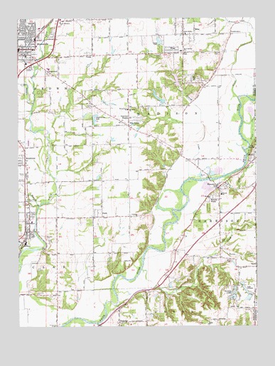
Mooresville East, IN USGS Topographic Map
Click on map above to begin viewing in our Map Viewer.

This topographic map contains these locations and features:
Feature Name Type Latitude Longitude GNIS ID View Map
Arens LakeReservoirN39.6121°W86.3246°448804View Map
Arens Lake DamDamN39.6100°W86.3267°448805View Map
BantaPopulated PlaceN39.5239°W86.2503°430477View Map
Banta CreekStreamN39.5320°W86.2694°430478View Map
Bethel ChapelChurchN39.6114°W86.2872°430907View Map
Bethel ChurchChurchN39.5009°W86.2758°430927View Map
Bluff CreekStreamN39.5612°W86.2647°431259View Map
BluffsPopulated PlaceN39.5689°W86.2511°431263View Map
BrooklynPopulated PlaceN39.5392°W86.3692°431572View Map
Brooklyn CemeteryCemeteryN39.5366°W86.3608°431573View Map
Brooklyn Elementary SchoolSchoolN39.5428°W86.3683°447333View Map
Brooklyn Fire Station 41BuildingN39.5392°W86.3709°2701417View Map
Brooklyn Police DepartmentBuildingN39.5388°W86.3694°2758133View Map
Brooklyn Rest ParkCemeteryN39.5584°W86.3721°431574View Map
Brooklyn Volunteer Fire DepartmentBuildingN39.5392°W86.3708°2625619View Map
BrookmoorPopulated PlaceN39.5675°W86.3747°431575View Map
Brown Township Fire and RescueBuildingN39.6197°W86.3619°2625769View Map
Brown Township Fire StationBuildingN39.6136°W86.3650°2701418View Map
Brown Township Fire Station 22BuildingN39.6196°W86.3619°2701419View Map
Centenary ChurchChurchN39.5448°W86.3130°432300View Map
Church of Christ of MooresvilleChurchN39.6236°W86.3658°2096290View Map
Church of the Ancient WayChurchN39.6161°W86.3708°2096291View Map
Crestview HeightsPopulated PlaceN39.5850°W86.3164°433120View Map
Crooked CreekStreamN39.5228°W86.3105°433162View Map
Crossroads Apostolic ChurchChurchN39.6164°W86.3678°2096292View Map
Crouse LakeReservoirN39.5608°W86.3328°448801View Map
Crouse Lake DamDamN39.5617°W86.3350°448802View Map
East Fork White Lick CreekStreamN39.5914°W86.3664°433903View Map
ExchangePopulated PlaceN39.5017°W86.3222°434276View Map
Fankboner LakeReservoirN39.5173°W86.2578°448799View Map
Fankboner Lake DamDamN39.5173°W86.2583°448800View Map
FieldsPopulated PlaceN39.5462°W86.3333°434475View Map
First Christian ChurchChurchN39.6192°W86.3742°2096294View Map
Five PointsPopulated PlaceN39.5814°W86.3169°434550View Map
Fox HillPopulated PlaceN39.6006°W86.2839°434738View Map
Franciscan Saint Francis Hospital - MooresvilleHospitalN39.6081°W86.3558°2660455View Map
Gander CreekStreamN39.6245°W86.2711°434934View Map
Goose CreekStreamN39.5923°W86.2592°435194View Map
Grace Missionary ChurchChurchN39.6234°W86.3525°435265View Map
Harrison Township Fire Department and RescueBuildingN39.5529°W86.2680°2625659View Map
Independent Order of Odd Fellows CemeteryCemeteryN39.5356°W86.2688°436679View Map
Kay Air AirportAirportN39.5872°W86.2731°2676894View Map
Lake DillmanReservoirN39.5143°W86.2554°433555View Map
LandersdalePopulated PlaceN39.6195°W86.2630°437600View Map
Leona LakeReservoirN39.6157°W86.3009°437782View Map
Leona Lake DamDamN39.6145°W86.3011°448806View Map
Lower Paradise LakeReservoirN39.5147°W86.2616°448796View Map
Lower Paradise Lake DamDamN39.5159°W86.2617°448795View Map
Lower Spring LakeReservoirN39.5900°W86.2967°447898View Map
Lower Spring Lake DamDamN39.5900°W86.2967°447897View Map
Lower Wildwood Lake DamDamN39.5967°W86.2900°447206View Map
Madison Township Fire Department Station 31BuildingN39.5749°W86.3159°2625975View Map
Madison Township Fire Department Station 32BuildingN39.6178°W86.2969°2626180View Map
Madison Township Fire Station 31BuildingN39.5750°W86.3159°2701421View Map
Mattingly FieldAirportN39.5024°W86.2633°2787265View Map
MillerPopulated PlaceN39.6206°W86.2819°439176View Map
Monical BranchStreamN39.5487°W86.3644°439325View Map
Monical CemeteryCemeteryN39.5519°W86.3696°451233View Map
MooresvillePopulated PlaceN39.6128°W86.3742°439412View Map
Mooresville CemeteryCemeteryN39.6105°W86.3663°439413View Map
Mooresville Church of GodChurchN39.6131°W86.3692°2096296View Map
Mooresville Fire Department Station 1BuildingN39.6051°W86.3631°2626126View Map
Mount Gilead ChurchChurchN39.5881°W86.3167°439568View Map
Mount Olive CemeteryCemeteryN39.6109°W86.2715°439613View Map
North Bluff CreekStreamN39.5684°W86.2553°440215View Map
North Madison Elementary SchoolSchoolN39.6120°W86.2892°440277View Map
North Madison Southern Baptist ChurchChurchN39.6187°W86.2880°440276View Map
Old Butterfield CemeteryCemeteryN39.5132°W86.3657°431908View Map
Orchard CreekStreamN39.5764°W86.3583°449519View Map
Owen Field (historical)AirportN39.6206°W86.3130°449273View Map
Paradise LakesReservoirN39.5123°W86.2614°440860View Map
Poplar Grove LakeReservoirN39.5844°W86.3347°452483View Map
Poplar Grove Lake DamDamN39.5850°W86.3350°448803View Map
Prospect BranchStreamN39.6220°W86.2539°441610View Map
RidgewoodPopulated PlaceN39.6034°W86.3594°442004View Map
Shiloh CemeteryCemeteryN39.5266°W86.2635°443386View Map
Sinking CreekStreamN39.5600°W86.2853°443551View Map
South Lake DillmanReservoirN39.5116°W86.2546°447885View Map
South Lake Dillman DamDamN39.5125°W86.2533°447886View Map
Stotts CreekStreamN39.5014°W86.3330°444241View Map
Terrace Mobile Home ParkPopulated PlaceN39.6103°W86.3014°2109620View Map
The BluffsCliffN39.5728°W86.2514°444665View Map
The Links At Heartland Crossing Golf CourseLocaleN39.6208°W86.3047°2109621View Map
Town of BrooklynCivilN39.5437°W86.3674°2396605View Map
Town of MooresvilleCivilN39.6038°W86.3677°2396780View Map
Township of HarrisonCivilN39.5391°W86.2747°453393View Map
Township of MadisonCivilN39.5856°W86.2990°453595View Map
Upper Paradise LakeReservoirN39.5119°W86.2627°448797View Map
Upper Paradise Lake DamDamN39.5123°W86.2614°448798View Map
Upper Spring LakeReservoirN39.5924°W86.3008°447883View Map
Upper Spring Lake DamDamN39.5917°W86.3000°447884View Map
Upper Wildwood LakeReservoirN39.6048°W86.2904°448807View Map
Upper Wildwood Lake DamDamN39.6034°W86.2900°448808View Map
Walnut Grove SchoolSchoolN39.5881°W86.3175°445430View Map
WaverlyPopulated PlaceN39.5570°W86.2714°445565View Map
Waverly Elementary SchoolSchoolN39.5534°W86.2686°445566View Map
Waverly United Methodist ChurchChurchN39.5572°W86.2703°2096287View Map
Waverly WoodsPopulated PlaceN39.5514°W86.2697°445567View Map
Web RunStreamN39.6234°W86.2592°445608View Map
Whetzel CemeteryCemeteryN39.5532°W86.2743°438446View Map
Wildwood LakeReservoirN39.5997°W86.2918°447205View Map
WiserPopulated PlaceN39.6123°W86.2936°446210View Map
YoungPopulated PlaceN39.6103°W86.3375°446409View Map

Note: Coordinates in the location and feature list above are referenced to NAD83 datum.


Copyright (C) 2008-2024 Ryan Niemi / Sunset Dynamics ... All Rights Reserved