TopoQuest Logo
Do you find TopoQuest useful?
Help keep TopoQuest running and adding new maps/features by donating!
Bitcoin:  19c7KJd3qBynnjoSw5npx9KScwjBe4ifkT
Litecoin:  LXs6TkuXGGXo1vDsWCkWVdjQX94eUKd6ui
Home View Maps Find Maps Find Places Resources & Links


Moore SW, Montana Topographic Map

USGS Map Title: Moore SW, MT
USGS Map MRC: 46109G6
DRG (GeoTIFF) Download: o46109g6.tif


Neighboring USGS Topographic Map Quads:


  Sipple, MT  
46109H7
 

  Moore, MT  
46109H6
 

  West Fork Beaver Creek, MT  
46109H5
 

  Buffalo, MT  
46109G7
 

  Moore SW, MT  
46109G6
 

  Crystal Lake, MT  
46109G5
 

  Judith Gap, MT  
46109F7
 

  Elephant Rocks, MT  
46109F6
 

  Yaple Bench, MT  
46109F5


Map MRC Location:

N47°
W110°
N47°
W109°
H8 H7 H6 H5 H4 H3 H2 H1
G8 G7 G6 G5 G4 G3 G2 G1
F8 F7 F6 F5 F4 F3 F2 F1
E8 E7 E6 E5 E4 E3 E2 E1
D8 D7 D6 D5 D4 D3 D2 D1
C8 C7 C6 C5 C4 C3 C2 C1
B8 B7 B6 B5 B4 B3 B2 B1
A8 A7 A6 A5 A4 A3 A2 A1
N46°
W110°
N46°
W109°

Moore SW, MT USGS 1:24K Topographic Map Preview:
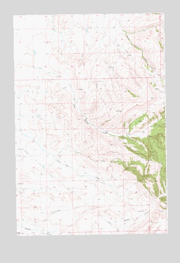
Moore SW, MT USGS Topographic Map
Click on map above to begin viewing in our Map Viewer.

This topographic map contains these locations and features:
Feature Name Type Latitude Longitude GNIS ID View Map
11N16E03AA__01 WellWellN46.7516°W109.6843°818087View Map
11N16E06AA__01 WellWellN46.7516°W109.7482°818088View Map
11N16E06AA__02 WellWellN46.7516°W109.7482°818089View Map
12N16E16DC__01 WellWellN46.7966°W109.7107°818374View Map
12N16E16DC__02 WellWellN46.7966°W109.7107°818375View Map
12N16E17BB__01 WellWellN46.8075°W109.7424°818426View Map
12N16E17BB__02 WellWellN46.8075°W109.7424°818427View Map
12N16E18AA__01 WellWellN46.8075°W109.7477°818428View Map
12N16E18AA__02 WellWellN46.8075°W109.7477°818429View Map
12N16E18AA__03 WellWellN46.8075°W109.7477°818430View Map
12N16E18AA__04 WellWellN46.8075°W109.7477°818431View Map
12N16E20BB__01 WellWellN46.7927°W109.7424°818353View Map
12N16E22BC__01 WellWellN46.7891°W109.6999°818337View Map
12N16E22CB__01 WellWellN46.7855°W109.6999°818297View Map
12N16E28AC__01 WellWellN46.7747°W109.7107°818222View Map
12N16E28AC__02 WellWellN46.7747°W109.7107°818223View Map
12N16E29AC__01 WellWellN46.7747°W109.7319°818224View Map
12N16E32CC__01 WellWellN46.7530°W109.7424°818099View Map
12N16E32CC__02 WellWellN46.7530°W109.7424°818100View Map
12N16E32DB__01 WellWellN46.7566°W109.7318°818117View Map
12N16E32DB__02 WellWellN46.7566°W109.7318°818118View Map
12N16E36AD__01 WellWellN46.7602°W109.6418°818135View Map
13N16E19DA__01 WellWellN46.8733°W109.7363°818987View Map
13N16E19DA__02 WellWellN46.8733°W109.7363°818988View Map
13N16E23CC__01 WellWellN46.8697°W109.6674°818966View Map
13N16E26AD__01 WellWellN46.8625°W109.6516°818901View Map
13N16E26DC__01 WellWellN46.8552°W109.6569°818819View Map
13N16E26DC__02 WellWellN46.8552°W109.6569°818820View Map
13N16E30DC__01 WellWellN46.8552°W109.7416°818821View Map
13N16E30DCAA01 WellWellN46.8561°W109.7402°818837View Map
13N16E32BD__01 WellWellN46.8480°W109.7257°818747View Map
13N16E32BD__02 WellWellN46.8480°W109.7257°818748View Map
13N16E32BD__03 WellWellN46.8480°W109.7257°818749View Map
13N16E32BDDD01 WellWellN46.8455°W109.7244°818734View Map
13N16E35BC__01 WellWellN46.8480°W109.6674°818745View Map
13N16E35BC__02 WellWellN46.8480°W109.6674°818746View Map
Manley School (historical)SchoolN46.7950°W109.7338°1722609View Map

Note: Coordinates in the location and feature list above are referenced to NAD83 datum.


Copyright (C) 2008-2024 Ryan Niemi / Sunset Dynamics ... All Rights Reserved