TopoQuest Logo
Do you find TopoQuest useful?
Help keep TopoQuest running and adding new maps/features by donating!
Bitcoin:  19c7KJd3qBynnjoSw5npx9KScwjBe4ifkT
Litecoin:  LXs6TkuXGGXo1vDsWCkWVdjQX94eUKd6ui
Home View Maps Find Maps Find Places Resources & Links


Montrose East, Colorado Topographic Map

USGS Map Title: Montrose East, CO
USGS Map MRC: 38107D7
DRG (GeoTIFF) Download: o38107d7.tif


Neighboring USGS Topographic Map Quads:


  Olathe, CO  
38107E8
 

  Red Rock Canyon, CO  
38107E7
 

  Grizzly Ridge, CO  
38107E6
 

  Montrose West, CO  
38107D8
 

  Montrose East, CO  
38107D7
 

  Cerro Summit, CO  
38107D6
 

  Government Springs, CO  
38107C8
 

  Colona, CO  
38107C7
 

  Buckhorn Lakes, CO  
38107C6


Map MRC Location:

N39°
W108°
N39°
W107°
H8 H7 H6 H5 H4 H3 H2 H1
G8 G7 G6 G5 G4 G3 G2 G1
F8 F7 F6 F5 F4 F3 F2 F1
E8 E7 E6 E5 E4 E3 E2 E1
D8 D7 D6 D5 D4 D3 D2 D1
C8 C7 C6 C5 C4 C3 C2 C1
B8 B7 B6 B5 B4 B3 B2 B1
A8 A7 A6 A5 A4 A3 A2 A1
N38°
W108°
N38°
W107°

Montrose East, CO USGS 1:24K Topographic Map Preview:
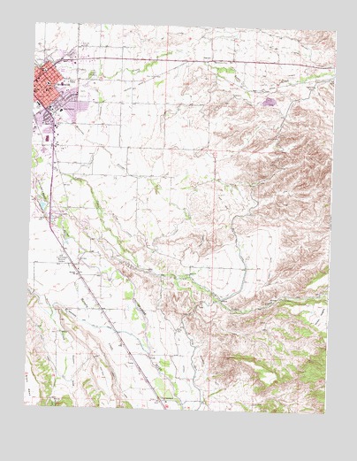
Montrose East, CO USGS Topographic Map
Click on map above to begin viewing in our Map Viewer.

This topographic map contains these locations and features:
Feature Name Type Latitude Longitude GNIS ID View Map
A B A LateralCanalN38.4850°W107.7737°188143View Map
A B C LateralCanalN38.4925°W107.7692°188144View Map
A B E LateralCanalN38.4964°W107.8209°203273View Map
A B LateralCanalN38.4969°W107.7726°203272View Map
A C LateralCanalN38.4767°W107.7901°188142View Map
A H LateralCanalN38.4119°W107.7931°188139View Map
A M B LateralCanalN38.4342°W107.8373°188141View Map
A M LateralCanalN38.4278°W107.8214°203332View Map
Altrusa ParkParkN38.4708°W107.8578°1795102View Map
Aquatic CenterBuildingN38.4703°W107.8745°1795259View Map
Button CemeteryCemeteryN38.4014°W107.8128°188134View Map
Cedar CemeteryCemeteryN38.4833°W107.8506°188129View Map
Centennial Middle SchoolSchoolN38.4799°W107.8632°1795100View Map
Chief Ouray Memorial ParkParkN38.4347°W107.8690°1795267View Map
Chipeta State ParkParkN38.4347°W107.8701°188140View Map
Christian Science SocietyChurchN38.4797°W107.8731°1795290View Map
Church of ChristChurchN38.4650°W107.8662°1795033View Map
City of MontroseCivilN38.4689°W107.8591°2411151View Map
Columbine Middle SchoolSchoolN38.4713°W107.8635°1795117View Map
Corey Gravel PitMineN38.4730°W107.8662°1745574View Map
Dolores CanyonValleyN38.3778°W107.8638°188136View Map
Dry Cedar CreekStreamN38.4564°W107.8720°188145View Map
Duckett DrawValleyN38.3998°W107.8611°188135View Map
FairviewPopulated PlaceN38.4889°W107.8031°188133View Map
Fairview DamDamN38.4783°W107.7706°199052View Map
Fairview ReservoirReservoirN38.4785°W107.7711°199053View Map
Faith Baptist ChurchChurchN38.4869°W107.8676°1795108View Map
Family Services Center Head StartSchoolN38.4814°W107.8640°1795285View Map
First Assembly of GodChurchN38.4825°W107.8581°1795107View Map
First Presbyterian ChurchChurchN38.4669°W107.8612°1795103View Map
Garrett DitchCanalN38.4222°W107.7739°188138View Map
Grace Baptist ChurchChurchN38.4800°W107.8656°1795099View Map
Horsefly CreekStreamN38.4269°W107.8540°188137View Map
Johnson Elementary SchoolSchoolN38.4808°W107.8634°1795101View Map
Johnson SchoolSchoolN38.4842°W107.8703°188130View Map
McDonald DitchCanalN38.3755°W107.7917°203331View Map
Mock Number 2 DamDamN38.3783°W107.8690°199526View Map
Mock ReservoirReservoirN38.3773°W107.8633°188123View Map
Montrose BLM HeliportAirportN38.4580°W107.8681°204520View Map
Montrose Botanic GardensParkN38.4650°W107.8528°1795104View Map
Montrose Chamber of Commerce - Visitors CenterBuildingN38.4875°W107.8656°1795266View Map
Montrose County FairgroundsLocaleN38.4875°W107.8734°1795109View Map
Montrose DivisionCivilN38.4262°W107.8383°1935527View Map
Montrose Fire Protection District Station 1BuildingN38.4768°W107.8713°1795121View Map
Montrose Fire Protection District Station 2BuildingN38.4213°W107.8547°2667359View Map
Montrose Golf CourseLocaleN38.4800°W107.8556°1795105View Map
Montrose High SchoolSchoolN38.4733°W107.8734°1795028View Map
Montrose Memorial HospitalHospitalN38.4800°W107.8691°1795098View Map
Montrose Memorial Hospital HeliportAirportN38.4803°W107.8695°204521View Map
Montrose PavilionBuildingN38.4658°W107.8528°1795288View Map
Montrose Police DepartmentBuildingN38.4790°W107.8748°1795248View Map
Montrose Senior CenterBuildingN38.4661°W107.8531°1795287View Map
Morgan SchoolSchoolN38.4772°W107.8748°188131View Map
Pamona SchoolSchoolN38.4717°W107.8670°188132View Map
Pomona Elementary SchoolSchoolN38.4719°W107.8676°1795119View Map
Riverside SchoolSchoolN38.4183°W107.8548°188127View Map
Rotary ParkParkN38.4714°W107.8651°1795118View Map
Saint John E V Lutheran ChurchChurchN38.4761°W107.8695°1795291View Map
Saint Marys Catholic ChurchChurchN38.4769°W107.8712°1795115View Map
Saint Marys Parish CenterBuildingN38.4775°W107.8701°1795116View Map
Saint Marys SchoolSchoolN38.4808°W107.8698°188128View Map
South CanalCanalN38.4380°W107.7906°203330View Map
The Church of Jesus Christ of Latter Day SaintsChurchN38.4708°W107.8567°1795289View Map
Tri - State CareFlight Medical TransportBuildingN38.4803°W107.8682°2716954View Map
UncompahgrePopulated PlaceN38.3780°W107.8187°188124View Map
Uncompahgre Farmers MarketLocaleN38.4886°W107.8720°1795306View Map
Uncompahgre Memorial GardensCemeteryN38.4250°W107.8612°188126View Map
United Church of Christ - Hillcrest Congregational WorshipChurchN38.4814°W107.8573°1795286View Map
United Methodist ChurchChurchN38.4805°W107.8745°1795249View Map
Ute Indian MuseumBuildingN38.4348°W107.8678°1795032View Map
VernalPopulated PlaceN38.3897°W107.8292°188125View Map
West Area Power Administration Operations Center HeliportAirportN38.4658°W107.8740°204519View Map
West CanalCanalN38.3933°W107.8670°203327View Map
Woods Stolport (historical)AirportN38.3886°W107.8237°204523View Map

Note: Coordinates in the location and feature list above are referenced to NAD83 datum.


Copyright (C) 2008-2024 Ryan Niemi / Sunset Dynamics ... All Rights Reserved