TopoQuest Logo
Do you find TopoQuest useful?
Help keep TopoQuest running and adding new maps/features by donating!
Bitcoin:  19c7KJd3qBynnjoSw5npx9KScwjBe4ifkT
Litecoin:  LXs6TkuXGGXo1vDsWCkWVdjQX94eUKd6ui
Home View Maps Find Maps Find Places Resources & Links


Monte Vista, Colorado Topographic Map

USGS Map Title: Monte Vista, CO
USGS Map MRC: 37106E2
DRG (GeoTIFF) Download: o37106e2.tif


Neighboring USGS Topographic Map Quads:


  Del Norte, CO  
37106F3
 

  Sevenmile Plaza, CO  
37106F2
 

  Center South, CO  
37106F1
 

  Dog Mountain, CO  
37106E3
 

  Monte Vista, CO  
37106E2
 

  Homelake, CO  
37106E1
 

  Greenie Mountain, CO  
37106D3
 

  Fulcher Gulch, CO  
37106D2
 

  Waverly, CO  
37106D1


Map MRC Location:

N38°
W107°
N38°
W106°
H8 H7 H6 H5 H4 H3 H2 H1
G8 G7 G6 G5 G4 G3 G2 G1
F8 F7 F6 F5 F4 F3 F2 F1
E8 E7 E6 E5 E4 E3 E2 E1
D8 D7 D6 D5 D4 D3 D2 D1
C8 C7 C6 C5 C4 C3 C2 C1
B8 B7 B6 B5 B4 B3 B2 B1
A8 A7 A6 A5 A4 A3 A2 A1
N37°
W107°
N37°
W106°

Monte Vista, CO USGS 1:24K Topographic Map Preview:
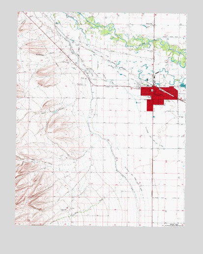
Monte Vista, CO USGS Topographic Map
Click on map above to begin viewing in our Map Viewer.

This topographic map contains these locations and features:
Feature Name Type Latitude Longitude GNIS ID View Map
Anderson DitchCanalN37.6014°W106.1881°190397View Map
Bill Metz Elementary SchoolSchoolN37.5795°W106.1514°190401View Map
Butler Irrigation DitchCanalN37.6238°W106.2002°2711401View Map
Cavalry Baptist ChurchChurchN37.5738°W106.1261°2696372View Map
Church of ChristChurchN37.5796°W106.1392°2696373View Map
Church of Jesus Christ of Latter - day SaintsChurchN37.5822°W106.1625°2696374View Map
City of Monte VistaCivilN37.5788°W106.1503°2411143View Map
City of Monte Vista Facilities BuildingBuildingN37.5814°W106.1600°2035923View Map
Colorado State Patrol Monte Vista PostBuildingN37.5813°W106.1594°2757321View Map
Consolidated SloughStreamN37.6089°W106.1778°190321View Map
Dry CreekStreamN37.5503°W106.1875°190391View Map
First Baptist Church of Monte VistaChurchN37.5781°W106.1491°2696375View Map
First Christian ChurchChurchN37.5789°W106.1478°2696376View Map
Fish DitchCanalN37.6109°W106.1337°2712083View Map
Kingdom Hall of Jehovah's WitnessesChurchN37.5825°W106.1752°2696396View Map
KSLV-AM (Monte Vista)TowerN37.6028°W106.1500°204042View Map
KSLV-FM (Monte Vista)TowerN37.6028°W106.1500°204167View Map
Lariat CemeteryCemeteryN37.5900°W106.2003°190396View Map
Lariat Community Baptist ChurchChurchN37.5737°W106.1524°2696377View Map
Limekiln CreekStreamN37.6231°W106.2320°190380View Map
Marsh Elementary SchoolSchoolN37.5796°W106.1387°190402View Map
MaxeyvillePopulated PlaceN37.6181°W106.1495°190399View Map
Monte VistaPopulated PlaceN37.5792°W106.1481°204764View Map
Monte Vista CemeteryCemeteryN37.5908°W106.1970°190395View Map
Monte Vista DivisionCivilN37.5098°W106.1751°1935526View Map
Monte Vista Emergency Medical ServicesBuildingN37.5753°W106.1498°2666943View Map
Monte Vista Fire DepartmentBuildingN37.5763°W106.1500°2666969View Map
Monte Vista High SchoolSchoolN37.5825°W106.1550°2025587View Map
Monte Vista LateralCanalN37.5167°W106.1370°203434View Map
Monte Vista Police DepartmentBuildingN37.5812°W106.1594°2696631View Map
Monte Vista Post OfficePost OfficeN37.5795°W106.1478°2750999View Map
Movie Manor Landing Area (historical)AirportN37.5825°W106.2009°190400View Map
Nicomodes GulchValleyN37.6055°W106.2112°190384View Map
Presbyterian Church - First of Monte VistaChurchN37.5795°W106.1492°2696378View Map
Raton CreekStreamN37.5700°W106.2048°190387View Map
Rio Grande and Lariat CanalCanalN37.5814°W106.1486°203432View Map
Rio Grande and Piedra Valley CanalCanalN37.5564°W106.1886°203430View Map
Rio Grande and San Luis CanalCanalN37.5536°W106.1525°203431View Map
Rio Grande Forest Supervisors OfficeLocaleN37.5825°W106.1820°197051View Map
Rock Creek CemeteryCemeteryN37.5086°W106.2134°190404View Map
Saint Joseph Catholic Church Monte VistaChurchN37.5759°W106.1513°2025656View Map
Saint Joseph SchoolSchoolN37.5758°W106.1514°190403View Map
Saint Peters Lutheran ChurchChurchN37.5770°W106.1339°2696394View Map
Saint Stephen the Martyr Episcopal ChurchChurchN37.5781°W106.1484°2696380View Map
San Luis Valley CemeteryCemeteryN37.5967°W106.2109°190393View Map
Seventh Day Adventist ChurchChurchN37.5797°W106.1367°2696395View Map
Star DitchCanalN37.5869°W106.1892°190398View Map
TorresPopulated PlaceN37.6067°W106.2045°190394View Map
United Methodist ChurchChurchN37.5790°W106.1485°2696381View Map
Valley Church of the NazareneChurchN37.5790°W106.1436°2696382View Map

Note: Coordinates in the location and feature list above are referenced to NAD83 datum.


Copyright (C) 2008-2024 Ryan Niemi / Sunset Dynamics ... All Rights Reserved