TopoQuest Logo
Do you find TopoQuest useful?
Help keep TopoQuest running and adding new maps/features by donating!
Bitcoin:  19c7KJd3qBynnjoSw5npx9KScwjBe4ifkT
Litecoin:  LXs6TkuXGGXo1vDsWCkWVdjQX94eUKd6ui
Home View Maps Find Maps Find Places Resources & Links


Monson West, Maine Topographic Map

USGS Map Title: Monson West, ME
USGS Map MRC: 45069C5
DRG (GeoTIFF) Download: o45069c5.tif


Neighboring USGS Topographic Map Quads:


  Big Squaw Pond, ME  
45069D6
 

  Greenville, ME  
45069D5
 

  Barren Mountain West, ME  
45069D4
 

  Bald Mountain Pond, ME  
45069C6
 

  Monson West, ME  
45069C5
 

  Monson East, ME  
45069C4
 

  Foster Ridge, ME  
45069B6
 

  Whetstone Pond, ME  
45069B5
 

  Guilford, ME  
45069B4


Map MRC Location:

N46°
W70°
N46°
W69°
H8 H7 H6 H5 H4 H3 H2 H1
G8 G7 G6 G5 G4 G3 G2 G1
F8 F7 F6 F5 F4 F3 F2 F1
E8 E7 E6 E5 E4 E3 E2 E1
D8 D7 D6 D5 D4 D3 D2 D1
C8 C7 C6 C5 C4 C3 C2 C1
B8 B7 B6 B5 B4 B3 B2 B1
A8 A7 A6 A5 A4 A3 A2 A1
N45°
W70°
N45°
W69°

Monson West, ME USGS 1:24K Topographic Map Preview:
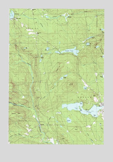
Monson West, ME USGS Topographic Map
Click on map above to begin viewing in our Map Viewer.

This topographic map contains these locations and features:
Feature Name Type Latitude Longitude GNIS ID View Map
Bear PondLakeN45.3386°W69.6039°561862View Map
Bell PondLakeN45.3428°W69.5215°562021View Map
Birch IslandIslandN45.2842°W69.5309°562308View Map
Blackstone BrookStreamN45.2556°W69.5795°562530View Map
BlanchardPopulated PlaceN45.2676°W69.5837°562557View Map
Brackett BrookStreamN45.2584°W69.6103°562833View Map
Buck HillSummitN45.3052°W69.5459°563106View Map
Bunker PondsLakeN45.3273°W69.5831°563191View Map
Bunker StreamStreamN45.3228°W69.5978°563193View Map
Burma SchoolSchoolN45.2681°W69.5181°563212View Map
Churchyard CemeteryCemeteryN45.2875°W69.5014°1910100View Map
Dennin BrookStreamN45.3692°W69.6176°565035View Map
Dennin SwampSwampN45.3578°W69.5809°565036View Map
Doe HillSummitN45.2647°W69.5339°565157View Map
Doe PondLakeN45.2723°W69.5456°565159View Map
Doughty HillSummitN45.3195°W69.5594°565237View Map
Doughty PondsLakeN45.3108°W69.5556°565239View Map
East Branch Piscataquis RiverStreamN45.2820°W69.5903°565566View Map
Glenwood CemeteryCemeteryN45.2660°W69.5892°2736960View Map
Gully BrookStreamN45.2903°W69.5931°567393View Map
Haskell SwampSwampN45.3670°W69.5626°567739View Map
Homer HillSummitN45.2953°W69.5148°568229View Map
Jackson BrookStreamN45.2709°W69.5851°568731View Map
Lake HebronReservoirN45.2807°W69.5137°567882View Map
Lily PondLakeN45.3402°W69.5088°569583View Map
Lily PondLakeN45.3381°W69.5739°569582View Map
Little Wilson DeadwaterLakeN45.3678°W69.5473°570104View Map
Lower Shirley CornerPopulated PlaceN45.3514°W69.5881°579486View Map
McLellan PondLakeN45.3486°W69.5186°571023View Map
MonsonPopulated PlaceN45.2870°W69.5012°571513View Map
Monson Community ChurchChurchN45.2875°W69.5012°1910122View Map
Monson Elementary School (historical)SchoolN45.2884°W69.5020°1910123View Map
Monson Post OfficePost OfficeN45.2861°W69.5004°1910124View Map
Moores PondLakeN45.3314°W69.5003°571569View Map
New Blanchard CemeteryCemeteryN45.2631°W69.5947°2736959View Map
ParrotPopulated PlaceN45.2551°W69.5539°579600View Map
Rabbit PondLakeN45.3561°W69.5019°573951View Map
Shirley MillsPopulated PlaceN45.3656°W69.6181°575421View Map
Shirley Mills Post OfficePost OfficeN45.3659°W69.6216°1910179View Map
Shirley PondReservoirN45.3691°W69.6213°575422View Map
Shirley Pond DamDamN45.3661°W69.6203°1773825View Map
Shirley Volunteer Fire DepartmentBuildingN45.3656°W69.6214°2553095View Map
Spectacle PondsLakeN45.3361°W69.5426°576017View Map
Town of MonsonCivilN45.2896°W69.5031°582603View Map
Towne CoveBayN45.2887°W69.5292°577239View Map
Towne PondLakeN45.3023°W69.5243°577240View Map
West Branch Piscataquis RiverStreamN45.2820°W69.5903°578080View Map
Whiting CoveBayN45.2767°W69.5101°578401View Map

Note: Coordinates in the location and feature list above are referenced to NAD83 datum.


Copyright (C) 2008-2024 Ryan Niemi / Sunset Dynamics ... All Rights Reserved