TopoQuest Logo
Do you find TopoQuest useful?
Help keep TopoQuest running and adding new maps/features by donating!
Bitcoin:  19c7KJd3qBynnjoSw5npx9KScwjBe4ifkT
Litecoin:  LXs6TkuXGGXo1vDsWCkWVdjQX94eUKd6ui
Home View Maps Find Maps Find Places Resources & Links


Monroe NW, Wisconsin Topographic Map

USGS Map Title: Monroe NW, WI
USGS Map MRC: 42089F6
DRG (GeoTIFF) Download: o42089f6.tif


Neighboring USGS Topographic Map Quads:


  Blanchardville, WI  
42089G7
 

  New Glarus, WI  
42089G6
 

  Belleville, WI  
42089G5
 

  Argyle, WI  
42089F7
 

  Monroe NW, WI  
42089F6
 

  Monticello, WI  
42089F5
 

  Browntown, WI  
42089E7
 

  Monroe, WI  
42089E6
 

  Juda, WI  
42089E5


Map MRC Location:

N43°
W90°
N43°
W89°
H8 H7 H6 H5 H4 H3 H2 H1
G8 G7 G6 G5 G4 G3 G2 G1
F8 F7 F6 F5 F4 F3 F2 F1
E8 E7 E6 E5 E4 E3 E2 E1
D8 D7 D6 D5 D4 D3 D2 D1
C8 C7 C6 C5 C4 C3 C2 C1
B8 B7 B6 B5 B4 B3 B2 B1
A8 A7 A6 A5 A4 A3 A2 A1
N42°
W90°
N42°
W89°

Monroe NW, WI USGS 1:24K Topographic Map Preview:
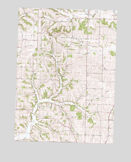
Monroe NW, WI USGS Topographic Map
Click on map above to begin viewing in our Map Viewer.

This topographic map contains these locations and features:
Feature Name Type Latitude Longitude GNIS ID View Map
Argus SchoolSchoolN42.6650°W89.6607°1560932View Map
Argus School BranchStreamN42.6572°W89.6662°1577356View Map
Benkert Bushnell CemeteryCemeteryN42.6700°W89.6612°1561560View Map
Benkert CemeteryCemeteryN42.7158°W89.6546°1561561View Map
Blackford SchoolSchoolN42.6614°W89.7229°1561896View Map
Buckskin SchoolSchoolN42.6870°W89.6935°1562342View Map
Buckskin School CreekStreamN42.6631°W89.7093°1562343View Map
Bushnell CreekStreamN42.6631°W89.7093°1562462View Map
Center Branch Hefty CreekStreamN42.7458°W89.6607°1562881View Map
Flying H AirportAirportN42.6612°W89.7367°1582089View Map
Garden Path GreenhousesBuildingN42.7422°W89.6606°2723740View Map
Hefty CreekStreamN42.7439°W89.6560°1566261View Map
Iliff SchoolSchoolN42.6328°W89.6721°1566858View Map
Lliff CemeteryCemeteryN42.6397°W89.6854°1568473View Map
Lone Pine DairyLocaleN42.7403°W89.7258°2723743View Map
Round Grove SchoolSchoolN42.6470°W89.6260°1572632View Map
Shooks Prairie CemeteryCemeteryN42.7203°W89.7429°1574068View Map
South Branch Hefty CreekStreamN42.7442°W89.6596°1574403View Map
Torkelson FarmLocaleN42.7250°W89.6767°2723747View Map
Town of MonroeCivilN42.6430°W89.6628°1583741View Map
Town of WashingtonCivilN42.7268°W89.6612°1584354View Map
Washington ChurchChurchN42.7239°W89.6812°1576237View Map
Weckerly DairyLocaleN42.6358°W89.6742°2723731View Map
William Beers DamDamN42.7367°W89.7451°1792665View Map

Note: Coordinates in the location and feature list above are referenced to NAD83 datum.


Copyright (C) 2008-2024 Ryan Niemi / Sunset Dynamics ... All Rights Reserved