TopoQuest Logo
Do you find TopoQuest useful?
Help keep TopoQuest running and adding new maps/features by donating!
Bitcoin:  19c7KJd3qBynnjoSw5npx9KScwjBe4ifkT
Litecoin:  LXs6TkuXGGXo1vDsWCkWVdjQX94eUKd6ui
Home View Maps Find Maps Find Places Resources & Links


Moberly, Kentucky Topographic Map

USGS Map Title: Moberly, KY
USGS Map MRC: 37084F2
DRG (GeoTIFF) Download: o37084f2.tif


Neighboring USGS Topographic Map Quads:


  Richmond North, KY  
37084G3
 

  Union City, KY  
37084G2
 

  Palmer, KY  
37084G1
 

  Richmond South, KY  
37084F3
 

  Moberly, KY  
37084F2
 

  Panola, KY  
37084F1
 

  Berea, KY  
37084E3
 

  Bighill, KY  
37084E2
 

  Alcorn, KY  
37084E1


Map MRC Location:

N38°
W85°
N38°
W84°
H8 H7 H6 H5 H4 H3 H2 H1
G8 G7 G6 G5 G4 G3 G2 G1
F8 F7 F6 F5 F4 F3 F2 F1
E8 E7 E6 E5 E4 E3 E2 E1
D8 D7 D6 D5 D4 D3 D2 D1
C8 C7 C6 C5 C4 C3 C2 C1
B8 B7 B6 B5 B4 B3 B2 B1
A8 A7 A6 A5 A4 A3 A2 A1
N37°
W85°
N37°
W84°

Moberly, KY USGS 1:24K Topographic Map Preview:
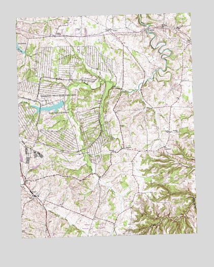
Moberly, KY USGS Topographic Map
Click on map above to begin viewing in our Map Viewer.

This topographic map contains these locations and features:
Feature Name Type Latitude Longitude GNIS ID View Map
Blue Grass Army DepotMilitaryN37.6995°W84.2218°2512049View Map
BrassfieldPopulated PlaceN37.6742°W84.1463°507575View Map
Brassfield Post Office (historical)Post OfficeN37.6737°W84.1428°2557527View Map
Brassfield Railroad Station (historical)LocaleN37.6743°W84.1457°2557536View Map
Brassfield SchoolSchoolN37.6826°W84.1366°487841View Map
Bybee Post Office (historical)Post OfficeN37.7338°W84.1256°2557569View Map
Central Kentucky Wildlife Management AreaParkN37.6270°W84.2016°516710View Map
Colyer Post Office (historical)Post OfficeN37.7032°W84.2079°2557547View Map
Concord SchoolSchoolN37.7429°W84.2035°489945View Map
Crooksville (historical)Populated PlaceN37.6593°W84.1945°2557520View Map
Eastern Kentucky University Meadow Brook FarmLocaleN37.7197°W84.1491°2557559View Map
EllistonPopulated PlaceN37.7409°W84.1552°507929View Map
Elliston Post Office (historical)Post OfficeN37.7411°W84.1549°2557562View Map
Evergreen Farm (historical)LocaleN37.7126°W84.1291°2557555View Map
Flatwoods CemeteryCemeteryN37.7498°W84.1466°492227View Map
Fredrick Post Office (historical)Post OfficeN37.6316°W84.1834°2557509View Map
Goodloe ChapelChurchN37.6831°W84.1424°492980View Map
Hays Fork ChurchChurchN37.6567°W84.2460°493938View Map
Heatherly CemeteryCemeteryN37.6523°W84.2132°2557515View Map
Hickory LickStreamN37.7073°W84.1630°494139View Map
Jones CemeteryCemeteryN37.6598°W84.1499°495479View Map
KingstonPopulated PlaceN37.6504°W84.2416°495769View Map
Kingston Post Office (historical)Post OfficeN37.6518°W84.2435°2557514View Map
Lake BuckReservoirN37.6702°W84.2487°2787916View Map
Lake GemReservoirN37.6653°W84.2386°2787917View Map
Lake VegaReservoirN37.6989°W84.2251°2787915View Map
Little Muddy CreekStreamN37.7010°W84.2143°496815View Map
MoberlyPopulated PlaceN37.7417°W84.1827°498460View Map
Moberly Post Office (historical)Post OfficeN37.7417°W84.1801°2557563View Map
Moberly Railroad Station (historical)LocaleN37.7421°W84.1828°2557570View Map
Moody CemeteryCemeteryN37.6474°W84.2420°498522View Map
Ogg and Covington Mill (historical)LocaleN37.7443°W84.1554°2557572View Map
Parks CemeteryCemeteryN37.6870°W84.1769°500200View Map
Pine Grove ChurchChurchN37.7117°W84.1330°500686View Map
Pleasant RunStreamN37.6603°W84.2465°2558306View Map
Poplar BranchStreamN37.6426°W84.1266°514709View Map
Reeds CrossingPopulated PlaceN37.7392°W84.2224°501699View Map
Sand Spring BranchStreamN37.7442°W84.1549°2558311View Map
Shiflet Post Office (historical)Post OfficeN37.7444°W84.2051°2557582View Map
SOF Maintenance Site HeliportAirportN37.6767°W84.2327°517480View Map
SpeedwellPopulated PlaceN37.6742°W84.1752°504047View Map
Speedwell Post Office (historical)Post OfficeN37.6742°W84.1737°2557528View Map
Speedwell SchoolSchoolN37.6729°W84.1819°504048View Map
Viny ForkStreamN37.7098°W84.1819°506062View Map
WacoPopulated PlaceN37.7426°W84.1441°506078View Map
Waco Baptist Church (historical)ChurchN37.7422°W84.1396°2557571View Map
Waco Elementary SchoolSchoolN37.7417°W84.1346°506079View Map
Waco Volunteer Fire DepartmentBuildingN37.7381°W84.1381°2637268View Map
Waco-Bybee DivisionCivilN37.7426°W84.1654°1937124View Map

Note: Coordinates in the location and feature list above are referenced to NAD83 datum.


Copyright (C) 2008-2024 Ryan Niemi / Sunset Dynamics ... All Rights Reserved