TopoQuest Logo
Do you find TopoQuest useful?
Help keep TopoQuest running and adding new maps/features by donating!
Bitcoin:  19c7KJd3qBynnjoSw5npx9KScwjBe4ifkT
Litecoin:  LXs6TkuXGGXo1vDsWCkWVdjQX94eUKd6ui
Home View Maps Find Maps Find Places Resources & Links


Minneapolis South, Kansas Topographic Map

USGS Map Title: Minneapolis South, KS
USGS Map MRC: 39097A6
DRG (GeoTIFF) Download: o39097a6.tif


Neighboring USGS Topographic Map Quads:


  Tescott NE, KS  
39097B7
 

  Minneapolis North, KS  
39097B6
 

  Wells, KS  
39097B5
 

  Tescott SE, KS  
39097A7
 

  Minneapolis South, KS  
39097A6
 

  Bennington, KS  
39097A5
 

  Culver, KS  
38097H7
 

  Trenton, KS  
38097H6
 

  New Cambria, KS  
38097H5


Map MRC Location:

N40°
W98°
N40°
W97°
H8 H7 H6 H5 H4 H3 H2 H1
G8 G7 G6 G5 G4 G3 G2 G1
F8 F7 F6 F5 F4 F3 F2 F1
E8 E7 E6 E5 E4 E3 E2 E1
D8 D7 D6 D5 D4 D3 D2 D1
C8 C7 C6 C5 C4 C3 C2 C1
B8 B7 B6 B5 B4 B3 B2 B1
A8 A7 A6 A5 A4 A3 A2 A1
N39°
W98°
N39°
W97°

Minneapolis South, KS USGS 1:24K Topographic Map Preview:
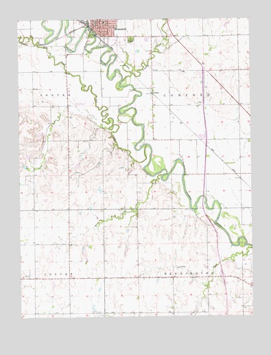
Minneapolis South, KS USGS Topographic Map
Click on map above to begin viewing in our Map Viewer.

This topographic map contains these locations and features:
Feature Name Type Latitude Longitude GNIS ID View Map
Ada Grain Company Grain Elevator Number 2LocaleN39.1231°W97.7118°2695452View Map
Battle CreekStreamN39.0594°W97.6736°476463View Map
City of MinneapolisCivilN39.1244°W97.6999°485622View Map
First Baptist ChurchChurchN39.1226°W97.7036°2689280View Map
First Presbyterian ChurchChurchN39.1219°W97.7056°2690575View Map
Highland CemeteryCemeteryN39.1162°W97.6893°476461View Map
Immaculate Conception Catholic ChurchChurchN39.1191°W97.7051°2690446View Map
KZUH - FM (Salina)BuildingN39.0149°W97.6290°2625331View Map
LindseyPopulated PlaceN39.0936°W97.6781°476462View Map
Lindsey CreekStreamN39.0989°W97.6945°476281View Map
MinneapolisPopulated PlaceN39.1219°W97.7067°476284View Map
Minneapolis Ambulance ServiceBuildingN39.1227°W97.7074°2696581View Map
Minneapolis Area Chamber of CommerceBuildingN39.1226°W97.7073°2692834View Map
Minneapolis Church of the NazareneChurchN39.1231°W97.7027°2690447View Map
Minneapolis City County AirportAirportN39.0953°W97.7222°481343View Map
Minneapolis City HallBuildingN39.1231°W97.7056°2693190View Map
Minneapolis Elementary SchoolSchoolN39.1239°W97.7036°2497389View Map
Minneapolis FairgroundsLocaleN39.1194°W97.7131°2692798View Map
Minneapolis Golf CourseLocaleN39.1159°W97.6940°2694587View Map
Minneapolis Police DepartmentBuildingN39.1226°W97.7073°2504093View Map
Minneapolis Post OfficePost OfficeN39.1225°W97.7067°2693858View Map
Minneapolis Raceway ParkLocaleN39.1084°W97.6524°2692835View Map
Minneapolis United Methodist ChurchChurchN39.1248°W97.7056°2689489View Map
Minneapolis Wastewater Treatment FacilityLocaleN39.1098°W97.6947°2692142View Map
Ottawa County CourthouseBuildingN39.1236°W97.7090°2625149View Map
Ottawa County Detention CenterBuildingN39.1237°W97.7090°2504354View Map
Ottawa County Historical MuseumBuildingN39.1211°W97.7085°2694976View Map
Ottawa County Rural Fire Department Station 2 MinneapolisBuildingN39.1231°W97.7057°2111705View Map
Ottawa County Sheriff's OfficeBuildingN39.1237°W97.7090°2503972View Map
Pipe CreekStreamN39.1217°W97.7125°476156View Map
Rock CityParkN39.0875°W97.7320°480375View Map
Salt CreekStreamN39.0722°W97.6817°476460View Map
Solomon Valley Airpark (historical)AirportN39.1117°W97.6823°481342View Map
Township of BenningtonCivilN39.0015°W97.6403°476459View Map
Township of ConcordCivilN39.0874°W97.6480°476282View Map

Note: Coordinates in the location and feature list above are referenced to NAD83 datum.


Copyright (C) 2008-2024 Ryan Niemi / Sunset Dynamics ... All Rights Reserved