TopoQuest Logo
Do you find TopoQuest useful?
Help keep TopoQuest running and adding new maps/features by donating!
Bitcoin:  19c7KJd3qBynnjoSw5npx9KScwjBe4ifkT
Litecoin:  LXs6TkuXGGXo1vDsWCkWVdjQX94eUKd6ui
Home View Maps Find Maps Find Places Resources & Links


Mineral Springs North, Arkansas Topographic Map

USGS Map Title: Mineral Springs North, AR
USGS Map MRC: 33093H8
DRG (GeoTIFF) Download: o33093h8.tif


Neighboring USGS Topographic Map Quads:


  Dierks, AR  
34094A1
 

  Center Point, AR  
34093A8
 

  Nathan, AR  
34093A7
 

  Silver Ridge, AR  
33094H1
 

  Mineral Springs North, AR  
33093H8
 

  Nashville, AR  
33093H7
 

  Ben Lomond, AR  
33094G1
 

  Mineral Springs South, AR  
33093G8
 

  Columbus, AR  
33093G7


Map MRC Location:

N34°
W94°
N34°
W93°
H8 H7 H6 H5 H4 H3 H2 H1
G8 G7 G6 G5 G4 G3 G2 G1
F8 F7 F6 F5 F4 F3 F2 F1
E8 E7 E6 E5 E4 E3 E2 E1
D8 D7 D6 D5 D4 D3 D2 D1
C8 C7 C6 C5 C4 C3 C2 C1
B8 B7 B6 B5 B4 B3 B2 B1
A8 A7 A6 A5 A4 A3 A2 A1
N33°
W94°
N33°
W93°

Mineral Springs North, AR USGS 1:24K Topographic Map Preview:
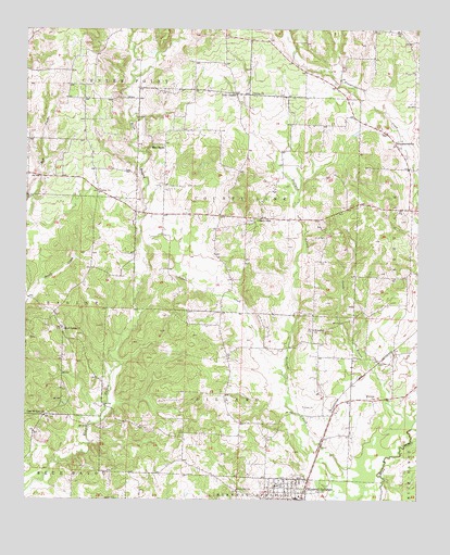
Mineral Springs North, AR USGS Topographic Map
Click on map above to begin viewing in our Map Viewer.

This topographic map contains these locations and features:
Feature Name Type Latitude Longitude GNIS ID View Map
Amity (historical)Populated PlaceN33.9271°W93.8788°62518View Map
Baber Store (historical)LocaleN33.9123°W93.9885°62525View Map
Bayou Store (historical)LocaleN33.9837°W93.9580°62529View Map
Blue BayouPopulated PlaceN33.9696°W93.9557°56933View Map
Blue Bayou ChurchChurchN33.9676°W93.9621°62537View Map
Bluff Spring ChurchChurchN33.9201°W93.9880°76383View Map
Bluff Springs CemeteryCemeteryN33.9209°W93.9885°62541View Map
City of Mineral SpringsCivilN33.8767°W93.9221°2404272View Map
County LineLocaleN33.9501°W93.9249°48084View Map
County Line CemeteryCemeteryN33.9493°W93.9285°62562View Map
County Line ChurchChurchN33.9490°W93.9274°62563View Map
County Line Rural Volunteer Fire DepartmentBuildingN33.9247°W93.9382°2116316View Map
Dildy School (historical)SchoolN33.9196°W93.9385°62572View Map
Dillard School (historical)SchoolN33.9029°W93.9369°62573View Map
Flint Hill ChurchChurchN33.8779°W93.9327°49133View Map
Forgy (historical)Populated PlaceN33.9482°W93.9441°62584View Map
Forty Five School (historical)SchoolN33.9007°W93.8905°62585View Map
Glenn Winchester AirportAirportN33.8811°W93.9277°2650744View Map
Holcombe Store (historical)LocaleN33.9248°W93.9910°62600View Map
Kirby School (historical)SchoolN33.9132°W93.8957°62609View Map
Lefever CreekStreamN33.9065°W93.9169°77473View Map
Little BayouStreamN33.9871°W93.9660°62610View Map
MidwayPopulated PlaceN33.9015°W93.8905°62615View Map
Midway ChurchChurchN33.9021°W93.8885°51948View Map
Mineral SpringsPopulated PlaceN33.8751°W93.9138°77672View Map
Mineral Springs Elementary SchoolSchoolN33.8789°W93.9205°62620View Map
Mineral Springs High SchoolSchoolN33.8787°W93.9187°62621View Map
Mineral Springs Police DepartmentBuildingN33.8755°W93.9144°2118967View Map
Mineral Springs School (historical)SchoolN33.8846°W93.9232°62622View Map
Mount Olive (historical)Populated PlaceN33.9496°W93.9069°62624View Map
New Mount Zion ChurchChurchN33.8979°W93.9938°77834View Map
Old 45 School (historical)SchoolN33.9229°W93.8899°62647View Map
Plainview Church (historical)ChurchN33.9923°W93.8952°62653View Map
Rock Springs School (historical)SchoolN33.9365°W93.9360°62663View Map
Sandy BranchStreamN33.8957°W93.8757°78295View Map
Shiloh CemeteryCemeteryN33.9448°W93.9043°54773View Map
Shiloh CemeteryCemeteryN33.8751°W93.9707°54782View Map
TemperancevillePopulated PlaceN33.9704°W93.8830°57204View Map
Temperanceville CemeteryCemeteryN33.9665°W93.8793°62686View Map
Temperanceville ChurchChurchN33.9659°W93.8791°62687View Map
Township of County LineCivilN33.9525°W93.9318°66679View Map
Township of DillardCivilN33.9040°W93.9365°66680View Map
Trinity Methodist ChurchChurchN33.9829°W93.9280°78578View Map
University of Arkansas Peach Experiment StationLocaleN33.9876°W93.9105°62694View Map
Wakefield (historical)Populated PlaceN33.9112°W93.8832°62707View Map
Wakefield ChurchChurchN33.9201°W93.9082°55944View Map
York ChapelLocaleN33.9832°W93.9332°78825View Map
Yorks Chapel School (historical)SchoolN33.9834°W93.9332°62712View Map

Note: Coordinates in the location and feature list above are referenced to NAD83 datum.


Copyright (C) 2008-2024 Ryan Niemi / Sunset Dynamics ... All Rights Reserved