TopoQuest Logo
Do you find TopoQuest useful?
Help keep TopoQuest running and adding new maps/features by donating!
Bitcoin:  19c7KJd3qBynnjoSw5npx9KScwjBe4ifkT
Litecoin:  LXs6TkuXGGXo1vDsWCkWVdjQX94eUKd6ui
Home View Maps Find Maps Find Places Resources & Links


Beaver Springs, Pennsylvania Topographic Map

USGS Map Title: Beaver Springs, PA
USGS Map MRC: 40077F2
DRG (GeoTIFF) Download: o40077f2.tif


Neighboring USGS Topographic Map Quads:


  Weikert, PA  
40077G3
 

  Beavertown, PA  
40077G2
 

  Middleburg, PA  
40077G1
 

  McClure, PA  
40077F3
 

  Beaver Springs, PA  
40077F2
 

  Richfield, PA  
40077F1
 

  Mexico, PA  
40077E3
 

  Millerstown, PA  
40077E2
 

  Reward, PA  
40077E1


Map MRC Location:

N41°
W78°
N41°
W77°
H8 H7 H6 H5 H4 H3 H2 H1
G8 G7 G6 G5 G4 G3 G2 G1
F8 F7 F6 F5 F4 F3 F2 F1
E8 E7 E6 E5 E4 E3 E2 E1
D8 D7 D6 D5 D4 D3 D2 D1
C8 C7 C6 C5 C4 C3 C2 C1
B8 B7 B6 B5 B4 B3 B2 B1
A8 A7 A6 A5 A4 A3 A2 A1
N40°
W78°
N40°
W77°

Beaver Springs, PA USGS 1:24K Topographic Map Preview:
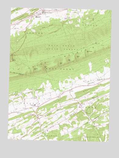
Beaver Springs, PA USGS Topographic Map
Click on map above to begin viewing in our Map Viewer.

This topographic map contains these locations and features:
Feature Name Type Latitude Longitude GNIS ID View Map
Adamsburg CemeteryCemeteryN40.7417°W77.2055°1168071View Map
Allen GapGapN40.7015°W77.1769°1168182View Map
Amey GapGapN40.6981°W77.1869°1168263View Map
Bear SpringSpringN40.7181°W77.1411°1168938View Map
Beaver SpringsPopulated PlaceN40.7462°W77.2094°1192110View Map
Beaver Springs Census Designated PlaceCensusN40.7449°W77.2169°2389186View Map
Beaver Springs Post OfficePost OfficeN40.7470°W77.2090°2768333View Map
Beaver Springs Volunteer Fire Company Station 10BuildingN40.7461°W77.2114°2652597View Map
Beaver-Adams SchoolSchoolN40.7490°W77.1922°1169053View Map
Black Dog ValleyValleyN40.6545°W77.1590°1169701View Map
Botteiger GapGapN40.6915°W77.2183°1198465View Map
BunkertownPopulated PlaceN40.6509°W77.2414°1170686View Map
CocolamusPopulated PlaceN40.6479°W77.2125°1172117View Map
Dunn ValleyValleyN40.6498°W77.2168°1173622View Map
Dunn Valley CreekStreamN40.6501°W77.2164°1202325View Map
East Juniata High SchoolSchoolN40.6584°W77.2167°1173825View Map
EvendalePopulated PlaceN40.6731°W77.1742°1174354View Map
Ferster GapGapN40.7048°W77.1664°1174713View Map
Flint RidgeRidgeN40.6715°W77.1550°1174907View Map
Gimberlings MillPopulated PlaceN40.6334°W77.2055°1197182View Map
KellervillePopulated PlaceN40.6598°W77.1605°1178325View Map
Koons CemeteryCemeteryN40.6537°W77.2411°1178644View Map
Lauvers ChurchChurchN40.6673°W77.1875°1179039View Map
Leister ValleyValleyN40.6444°W77.2108°1179177View Map
Liberty School (historical)SchoolN40.6376°W77.2405°1197179View Map
LoschsPopulated PlaceN40.6445°W77.1455°1179957View Map
Mitchell RunStreamN40.7434°W77.2228°1181376View Map
Niemonds ChurchChurchN40.6656°W77.1444°1182453View Map
Ore RidgeRidgeN40.7317°W77.2030°1183029View Map
Pa-638 ReservoirReservoirN40.7401°W77.1797°1195010View Map
Pa-638 ReservoirDamN40.7401°W77.1797°1195011View Map
Page ValleyValleyN40.6436°W77.1471°1183189View Map
Redbank SchoolSchoolN40.6687°W77.2050°1197177View Map
Richfield Ambulance League Station 9BuildingN40.6842°W77.1257°2719448View Map
Richfield Fire Company Station 9BuildingN40.6842°W77.1258°2645653View Map
Romig GapGapN40.7006°W77.2464°1185415View Map
Saint Johns ChurchChurchN40.6651°W77.2183°1186127View Map
Shellenberger GapGapN40.7098°W77.1542°1187443View Map
Shelley Private Airport (historical)AirportN40.6812°W77.1619°1194061View Map
Shelleys CemeteryCemeteryN40.6793°W77.1403°1170225View Map
Slim ValleyBasinN40.6715°W77.2311°1187815View Map
Stony RunPopulated PlaceN40.6517°W77.1530°1205086View Map
Stony Run School (historical)SchoolN40.6509°W77.1533°1197181View Map
SwalesPopulated PlaceN40.6545°W77.2278°1189123View Map
Swartz SchoolSchoolN40.6684°W77.1325°1197180View Map
Swartz ValleyValleyN40.6442°W77.1438°1189147View Map
Three Rivers ChurchChurchN40.7301°W77.2453°1189541View Map
Varner GapGapN40.6942°W77.2064°1190368View Map
West Snyder High SchoolSchoolN40.7417°W77.2180°1191113View Map

Note: Coordinates in the location and feature list above are referenced to NAD83 datum.


Copyright (C) 2008-2024 Ryan Niemi / Sunset Dynamics ... All Rights Reserved