TopoQuest Logo
Do you find TopoQuest useful?
Help keep TopoQuest running and adding new maps/features by donating!
Bitcoin:  19c7KJd3qBynnjoSw5npx9KScwjBe4ifkT
Litecoin:  LXs6TkuXGGXo1vDsWCkWVdjQX94eUKd6ui
Home View Maps Find Maps Find Places Resources & Links


Mineral Center, Minnesota Topographic Map

USGS Map Title: Mineral Center, MN
USGS Map MRC: 47089H7
DRG (GeoTIFF) Download: o47089h7.tif


Neighboring USGS Topographic Map Quads:


  South Fowl Lake, MN  
48089A8
 

  The Cascades, MN  
48089A7


  Farquhar Peak, MN  
47089H8
 

  Mineral Center, MN  
47089H7


  Hovland, MN  
47089G8


Map MRC Location:

N48°
W90°
N48°
W89°
H8 H7 H6 H5 H4 H3 H2 H1
G8 G7 G6 G5 G4 G3 G2 G1
F8 F7 F6 F5 F4 F3 F2 F1
E8 E7 E6 E5 E4 E3 E2 E1
D8 D7 D6 D5 D4 D3 D2 D1
C8 C7 C6 C5 C4 C3 C2 C1
B8 B7 B6 B5 B4 B3 B2 B1
A8 A7 A6 A5 A4 A3 A2 A1
N47°
W90°
N47°
W89°

Mineral Center, MN USGS 1:24K Topographic Map Preview:
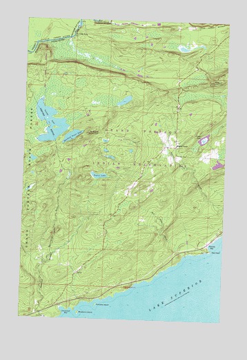
Mineral Center, MN USGS Topographic Map
Click on map above to begin viewing in our Map Viewer.

This topographic map contains these locations and features:
Feature Name Type Latitude Longitude GNIS ID View Map
Blueberry IslandIslandN47.8777°W89.8387°640301View Map
Cannonball BayBayN47.8788°W89.8479°640878View Map
Center LakeLakeN47.9510°W89.7631°641050View Map
Deronda BayBayN47.9057°W89.7562°642772View Map
Grand Portage National MonumentParkN47.9997°W89.7607°644333View Map
Grand Portage ReservationCivilN47.9615°W89.7595°654523View Map
Mineral CenterLocaleN47.9477°W89.7806°647902View Map
Mineral Center CemeteryCemeteryN47.9483°W89.7803°2072910View Map
Mineral Center Post Office (historical)Post OfficeN47.9478°W89.7806°2072900View Map
Mount MaudSummitN47.9752°W89.7587°647623View Map
Mount SophieSummitN47.9527°W89.8348°652257View Map
Pancake IslandIslandN47.8810°W89.8282°649136View Map
Partridge FallsFallsN47.9938°W89.8454°649174View Map
Partridge PortageAreaN47.9944°W89.8457°2570234View Map
Red RockCapeN47.9046°W89.7570°649875View Map
Red Rock CreekStreamN47.9027°W89.7690°649878View Map
Speckled Trout LakeLakeN47.9513°W89.8456°652368View Map
Swamp LakeLakeN47.9565°W89.8593°652881View Map
Taylor LakeLakeN47.9348°W89.8281°653052View Map

Note: Coordinates in the location and feature list above are referenced to NAD83 datum.


Copyright (C) 2008-2024 Ryan Niemi / Sunset Dynamics ... All Rights Reserved