TopoQuest Logo
Do you find TopoQuest useful?
Help keep TopoQuest running and adding new maps/features by donating!
Bitcoin:  19c7KJd3qBynnjoSw5npx9KScwjBe4ifkT
Litecoin:  LXs6TkuXGGXo1vDsWCkWVdjQX94eUKd6ui
Home View Maps Find Maps Find Places Resources & Links


Minco NE, Oklahoma Topographic Map

USGS Map Title: Minco NE, OK
USGS Map MRC: 35097D7
DRG (GeoTIFF) Download: o35097d7.tif


Neighboring USGS Topographic Map Quads:


  El Reno, OK  
35097E8
 

  Richland, OK  
35097E7
 

  Bethany, OK  
35097E6
 

  Union City, OK  
35097D8
 

  Minco NE, OK  
35097D7
 

  Mustang, OK  
35097D6
 

  Minco, OK  
35097C8
 

  Tuttle, OK  
35097C7
 

  Oklahoma City SW, OK  
35097C6


Map MRC Location:

N36°
W98°
N36°
W97°
H8 H7 H6 H5 H4 H3 H2 H1
G8 G7 G6 G5 G4 G3 G2 G1
F8 F7 F6 F5 F4 F3 F2 F1
E8 E7 E6 E5 E4 E3 E2 E1
D8 D7 D6 D5 D4 D3 D2 D1
C8 C7 C6 C5 C4 C3 C2 C1
B8 B7 B6 B5 B4 B3 B2 B1
A8 A7 A6 A5 A4 A3 A2 A1
N35°
W98°
N35°
W97°

Minco NE, OK USGS 1:24K Topographic Map Preview:
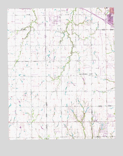
Minco NE, OK USGS Topographic Map
Click on map above to begin viewing in our Map Viewer.

This topographic map contains these locations and features:
Feature Name Type Latitude Longitude GNIS ID View Map
Banner Elementary SchoolSchoolN35.4938°W97.8493°1089845View Map
Chisholm ChurchChurchN35.3923°W97.7728°1091313View Map
Chisholm Shopping CenterLocaleN35.4928°W97.7600°1778202View Map
Chisholm Trial United Presbyterian ChurchChurchN35.4937°W97.7553°1790198View Map
Clarence E Page Municipal AirportAirportN35.4880°W97.8183°1102616View Map
Forehand CemeteryCemeteryN35.4794°W97.8303°1092926View Map
Integris Canadian Valley HospitalHospitalN35.4851°W97.7633°2695780View Map
Jacobs Acres DamDamN35.4001°W97.7987°1752411View Map
Jacobs Acres LakeReservoirN35.4001°W97.7987°1752412View Map
Lakehoma Acres DamDamN35.3851°W97.7670°1752413View Map
Lakehoma Acres LakeReservoirN35.3853°W97.7661°1752414View Map
Lakehoma ChurchChurchN35.3912°W97.7698°1094482View Map
Mid High SchoolSchoolN35.4942°W97.7623°1819481View Map
Mulvey Pond DamDamN35.4867°W97.7503°1751912View Map
Mustang Education CenterSchoolN35.3949°W97.7594°2712998View Map
Mustang Lake Number 1ReservoirN35.3885°W97.7657°1751861View Map
Mustang Lakehoma Elementary SchoolSchoolN35.3898°W97.7591°2712867View Map
Mustang Number 1 DamDamN35.3884°W97.7653°1751860View Map
Resurrection Lutheran ChurchChurchN35.4937°W97.7537°1790213View Map
Shedeck Elementary SchoolSchoolN35.4856°W97.7520°1819483View Map
Trinity Baptist Church of YukonChurchN35.4934°W97.7525°1790217View Map
West Point ChurchChurchN35.4492°W97.7950°1099594View Map

Note: Coordinates in the location and feature list above are referenced to NAD83 datum.


Copyright (C) 2008-2024 Ryan Niemi / Sunset Dynamics ... All Rights Reserved