TopoQuest Logo
Do you find TopoQuest useful?
Help keep TopoQuest running and adding new maps/features by donating!
Bitcoin:  19c7KJd3qBynnjoSw5npx9KScwjBe4ifkT
Litecoin:  LXs6TkuXGGXo1vDsWCkWVdjQX94eUKd6ui
Home View Maps Find Maps Find Places Resources & Links


Michigamme, Michigan Topographic Map

USGS Map Title: Michigamme, MI
USGS Map MRC: 46088E1
DRG (GeoTIFF) Download: o46088e1.tif


Neighboring USGS Topographic Map Quads:


  Mount Curwood, MI  
46088F2
 

  Summit Lake, MI  
46088F1
 

  Bulldog Lake, MI  
46087F8
 

  Three Lakes, MI  
46088E2
 

  Michigamme, MI  
46088E1
 

  Champion, MI  
46087E8
 

  Nelson Lake, MI  
46088D2
 

  Witch Lake NE, MI  
46088D1
 

  Republic, MI  
46087D8


Map MRC Location:

N47°
W89°
N47°
W88°
H8 H7 H6 H5 H4 H3 H2 H1
G8 G7 G6 G5 G4 G3 G2 G1
F8 F7 F6 F5 F4 F3 F2 F1
E8 E7 E6 E5 E4 E3 E2 E1
D8 D7 D6 D5 D4 D3 D2 D1
C8 C7 C6 C5 C4 C3 C2 C1
B8 B7 B6 B5 B4 B3 B2 B1
A8 A7 A6 A5 A4 A3 A2 A1
N46°
W89°
N46°
W88°

Michigamme, MI USGS 1:24K Topographic Map Preview:
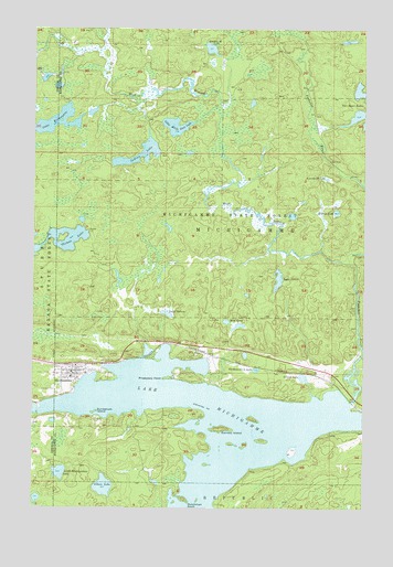
Michigamme, MI USGS Topographic Map
Click on map above to begin viewing in our Map Viewer.

This topographic map contains these locations and features:
Feature Name Type Latitude Longitude GNIS ID View Map
Arsenault LakeLakeN46.5859°W88.0144°620250View Map
Church in the WildwoodChurchN46.5347°W88.1103°2336690View Map
Dee Lundeen FallsFallsN46.5694°W88.0354°1617009View Map
Dutchman PointCapeN46.5019°W88.0668°625037View Map
Gibson LakeLakeN46.5054°W88.0982°626790View Map
Gravel LakeLakeN46.5340°W88.0227°627246View Map
Hilltop LakeLakeN46.5773°W88.0109°628334View Map
Indian LakeLakeN46.5923°W88.0851°628995View Map
Lake ArvidLakeN46.5600°W88.0316°620258View Map
Lake KeewaydinLakeN46.6007°W88.1166°629504View Map
Lake MichigammeLakeN46.5195°W88.0578°632202View Map
Lake SixteenLakeN46.5506°W88.0745°638040View Map
Lakeview CemeteryCemeteryN46.5308°W88.1154°630056View Map
Little Michigamme LakeLakeN46.5091°W88.1148°630691View Map
Little White Goat LakeLakeN46.5996°W88.0716°630816View Map
MichigammePopulated PlaceN46.5347°W88.1101°632193View Map
Michigamme - Spurr Township Volunteer Fire DepartmentBuildingN46.5349°W88.1103°2336691View Map
Michigamme Census Designated PlaceCensusN46.5334°W88.0626°2393127View Map
Michigamme Historical MuseumBuildingN46.5350°W88.1086°2336692View Map
Michigamme Post OfficePost OfficeN46.5350°W88.1069°2336693View Map
Michigamme Shores CampgroundLocaleN46.5319°W88.0097°2336758View Map
Michigamme StationLocaleN46.5369°W88.1083°2336694View Map
Mud LakeLakeN46.5486°W88.0521°633046View Map
Northwestern LakeLakeN46.5361°W88.0411°633726View Map
Peshekee RiverStreamN46.5274°W88.0049°634690View Map
Presbytery PointCapeN46.5338°W88.0751°635423View Map
Ramsay IslandIslandN46.5205°W88.0540°635620View Map
Sam Cohodas Historical MarkerParkN46.5264°W88.0039°2336770View Map
Sam Cohodas Lodge Historical MarkerParkN46.5264°W88.0039°2336769View Map
Section Twenty-eight LakeLakeN46.6199°W88.0586°637538View Map
Sundstrum IslandIslandN46.5249°W88.1015°639073View Map
Thomas LakeLakeN46.5697°W88.1099°1614756View Map
West Branch Peshekee RiverStreamN46.5641°W88.0054°1616059View Map

Note: Coordinates in the location and feature list above are referenced to NAD83 datum.


Copyright (C) 2008-2024 Ryan Niemi / Sunset Dynamics ... All Rights Reserved