TopoQuest Logo
Do you find TopoQuest useful?
Help keep TopoQuest running and adding new maps/features by donating!
Bitcoin:  19c7KJd3qBynnjoSw5npx9KScwjBe4ifkT
Litecoin:  LXs6TkuXGGXo1vDsWCkWVdjQX94eUKd6ui
Home View Maps Find Maps Find Places Resources & Links


Miccosukee NE, Georgia Topographic Map

USGS Map Title: Miccosukee NE, GA
USGS Map MRC: 30084F1
DRG (GeoTIFF) Download: o30084f1.tif


Neighboring USGS Topographic Map Quads:


  Cairo South, GA  
30084G2
 

  Pine Park, GA  
30084G1
 

  Thomasville, GA  
30083G8
 

  Beachton, GA  
30084F2
 

  Miccosukee NE, GA  
30084F1
 

  Metcalf, GA  
30083F8
 

  Bradfordville, FL  
30084E2
 

  Miccosukee, FL  
30084E1
 

  Lake Miccosukee, FL  
30083E8


Map MRC Location:

N31°
W85°
N31°
W84°
H8 H7 H6 H5 H4 H3 H2 H1
G8 G7 G6 G5 G4 G3 G2 G1
F8 F7 F6 F5 F4 F3 F2 F1
E8 E7 E6 E5 E4 E3 E2 E1
D8 D7 D6 D5 D4 D3 D2 D1
C8 C7 C6 C5 C4 C3 C2 C1
B8 B7 B6 B5 B4 B3 B2 B1
A8 A7 A6 A5 A4 A3 A2 A1
N30°
W85°
N30°
W84°

Miccosukee NE, GA USGS 1:24K Topographic Map Preview:
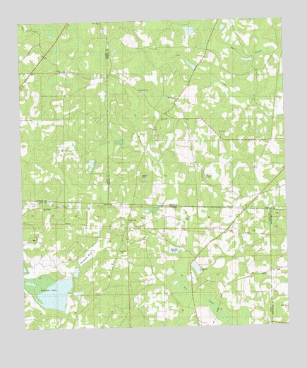
Miccosukee NE, GA USGS Topographic Map
Click on map above to begin viewing in our Map Viewer.

This topographic map contains these locations and features:
Feature Name Type Latitude Longitude GNIS ID View Map
Antioch ChurchChurchN30.7046°W84.0310°310557View Map
Blalock CemeteryCemeteryN30.6866°W84.0682°354765View Map
Brown-Bethel ChurchChurchN30.6746°W84.1152°279485View Map
Copeland CemeteryCemeteryN30.7224°W84.0691°312961View Map
Ferguson PondLakeN30.6483°W84.0429°282422View Map
Foshalee LakeLakeN30.6425°W84.1165°282722View Map
Gin House PondLakeN30.6482°W84.0659°283088View Map
Mercy Seat ChurchChurchN30.7496°W84.0868°318041View Map
Mount Olive ChurchChurchN30.7302°W84.1046°318721View Map
Mount Sinai ChurchChurchN30.6905°W84.0129°318875View Map
Murray PondLakeN30.6566°W84.0539°287490View Map
New Hope ChurchChurchN30.6749°W84.1046°287639View Map
Original PondLakeN30.6872°W84.0376°320096View Map
Saint Philip ChurchChurchN30.6424°W84.0574°290380View Map
Slater BranchStreamN30.7383°W84.0052°323071View Map
Spring Hill CemeteryCemeteryN30.7188°W84.0513°323406View Map
Spring Hill ChurchChurchN30.7105°W84.0582°323408View Map
Springhill CemeteryCemeteryN30.7107°W84.0577°343829View Map
Thompson PondBasinN30.6558°W84.0938°292227View Map
Titi BranchStreamN30.6916°W84.0593°324199View Map
Trinity ChurchChurchN30.7285°W84.0830°324298View Map
Whitfield Store (historical)LocaleN30.6769°W84.0724°343856View Map

Note: Coordinates in the location and feature list above are referenced to NAD83 datum.


Copyright (C) 2008-2024 Ryan Niemi / Sunset Dynamics ... All Rights Reserved