TopoQuest Logo
Do you find TopoQuest useful?
Help keep TopoQuest running and adding new maps/features by donating!
Bitcoin:  19c7KJd3qBynnjoSw5npx9KScwjBe4ifkT
Litecoin:  LXs6TkuXGGXo1vDsWCkWVdjQX94eUKd6ui
Home View Maps Find Maps Find Places Resources & Links


Miami, Missouri Topographic Map

USGS Map Title: Miami, MO
USGS Map MRC: 39093C2
DRG (GeoTIFF) Download: o39093c2.tif


Neighboring USGS Topographic Map Quads:


  Bosworth, MO  
39093D3
 

  Brunswick West, MO  
39093D2
 

  Brunswick East, MO  
39093D1
 

  Miami Station, MO  
39093C3
 

  Miami, MO  
39093C2
 

  New Frankfort, MO  
39093C1
 

  Malta Bend, MO  
39093B3
 

  Marshall North, MO  
39093B2
 

  Slater, MO  
39093B1


Map MRC Location:

N40°
W94°
N40°
W93°
H8 H7 H6 H5 H4 H3 H2 H1
G8 G7 G6 G5 G4 G3 G2 G1
F8 F7 F6 F5 F4 F3 F2 F1
E8 E7 E6 E5 E4 E3 E2 E1
D8 D7 D6 D5 D4 D3 D2 D1
C8 C7 C6 C5 C4 C3 C2 C1
B8 B7 B6 B5 B4 B3 B2 B1
A8 A7 A6 A5 A4 A3 A2 A1
N39°
W94°
N39°
W93°

Miami, MO USGS 1:24K Topographic Map Preview:
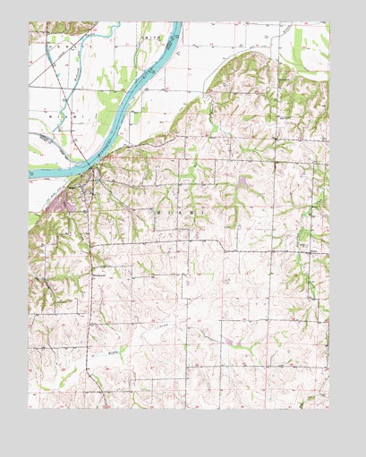
Miami, MO USGS Topographic Map
Click on map above to begin viewing in our Map Viewer.

This topographic map contains these locations and features:
Feature Name Type Latitude Longitude GNIS ID View Map
Bates School (historical)SchoolN39.2561°W93.2171°743554View Map
Bell BranchStreamN39.3253°W93.2308°713896View Map
Bethel ChurchChurchN39.3028°W93.1344°714066View Map
Bluff School (historical)SchoolN39.3384°W93.1888°743557View Map
Burruss School (historical)SchoolN39.3439°W93.2360°746994View Map
Christian CemeteryCemeteryN39.2958°W93.2207°715813View Map
City of MiamiCivilN39.3226°W93.2257°2395108View Map
Elson Lake DamDamN39.3250°W93.1619°761469View Map
Elson ReservoirReservoirN39.3234°W93.1613°761470View Map
Harmony ChurchChurchN39.3559°W93.1463°719115View Map
Lower Miami BendBendN39.3733°W93.1883°2109543View Map
MiamiPopulated PlaceN39.3214°W93.2280°722260View Map
Miami CemeteryCemeteryN39.3202°W93.2254°2702920View Map
Miami Elementary SchoolSchoolN39.2931°W93.2233°727747View Map
Miami Post OfficePost OfficeN39.3212°W93.2278°2782899View Map
Middle Miami BendBendN39.3528°W93.2075°2109542View Map
Pleasant Grove School (historical)SchoolN39.3445°W93.1416°743588View Map
Reynolds School (historical)SchoolN39.2784°W93.2344°743595View Map
Ross School (historical)SchoolN39.2659°W93.1727°743598View Map
SharonPopulated PlaceN39.3006°W93.1333°741261View Map
Sharon School (historical)SchoolN39.3000°W93.1330°743603View Map
Shilo ChurchChurchN39.3439°W93.1424°726355View Map
Township of MiamiCivilN39.2824°W93.1934°767365View Map
Upper Miami BendBendN39.3300°W93.2242°2109541View Map
Wakenda CreekStreamN39.3297°W93.2269°730243View Map
Wheeler School (historical)SchoolN39.3014°W93.1669°743612View Map

Note: Coordinates in the location and feature list above are referenced to NAD83 datum.


Copyright (C) 2008-2024 Ryan Niemi / Sunset Dynamics ... All Rights Reserved