TopoQuest Logo
Do you find TopoQuest useful?
Help keep TopoQuest running and adding new maps/features by donating!
Bitcoin:  19c7KJd3qBynnjoSw5npx9KScwjBe4ifkT
Litecoin:  LXs6TkuXGGXo1vDsWCkWVdjQX94eUKd6ui
Home View Maps Find Maps Find Places Resources & Links


Mexico East, Missouri Topographic Map

USGS Map Title: Mexico East, MO
USGS Map MRC: 39091B7
DRG (GeoTIFF) Download: o39091b7.tif


Neighboring USGS Topographic Map Quads:


  Molino, MO  
39091C8
 

  Santa Fe, MO  
39091C7
 

  Hutchison, MO  
39091C6
 

  Mexico West, MO  
39091B8
 

  Mexico East, MO  
39091B7
 

  Laddonia, MO  
39091B6
 

  Auxvasse, MO  
39091A8
 

  Mexico SE, MO  
39091A7
 

  Martinsburg, MO  
39091A6


Map MRC Location:

N40°
W92°
N40°
W91°
H8 H7 H6 H5 H4 H3 H2 H1
G8 G7 G6 G5 G4 G3 G2 G1
F8 F7 F6 F5 F4 F3 F2 F1
E8 E7 E6 E5 E4 E3 E2 E1
D8 D7 D6 D5 D4 D3 D2 D1
C8 C7 C6 C5 C4 C3 C2 C1
B8 B7 B6 B5 B4 B3 B2 B1
A8 A7 A6 A5 A4 A3 A2 A1
N39°
W92°
N39°
W91°

Mexico East, MO USGS 1:24K Topographic Map Preview:
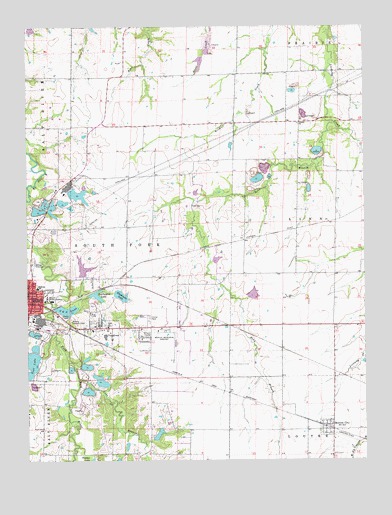
Mexico East, MO USGS Topographic Map
Click on map above to begin viewing in our Map Viewer.

This topographic map contains these locations and features:
Feature Name Type Latitude Longitude GNIS ID View Map
Audrain CountyCivilN39.2158°W91.8416°758458View Map
Audrain County Sheriff's OfficeBuildingN39.1681°W91.8187°2752569View Map
Bean BranchStreamN39.2223°W91.7616°713766View Map
Benton CityPopulated PlaceN39.1345°W91.7652°729432View Map
Benton City CemeteryCemeteryN39.1328°W91.7632°2681352View Map
Benton City Post OfficePost OfficeN39.1353°W91.7639°2783165View Map
Blackmore LakeLakeN39.1725°W91.8404°714330View Map
Blackmore Lake DamDamN39.1734°W91.8418°760952View Map
Burlington LakeReservoirN39.1727°W91.8495°758256View Map
Burlington Lake DamDamN39.1734°W91.8518°761387View Map
C and A LakeReservoirN39.1684°W91.8605°758257View Map
C and A Lake DamDamN39.1684°W91.8652°760360View Map
City of MexicoCivilN39.1626°W91.8711°2395107View Map
Diane Lake (historical)ReservoirN39.1817°W91.8152°761312View Map
Diane Lake DamDamN39.1817°W91.8152°761311View Map
East Lawn Memorial CemeteryCemeteryN39.1645°W91.8482°717317View Map
Erisman School (historical)SchoolN39.1789°W91.7607°744341View Map
Fairchild DamDamN39.1717°W91.7935°760904View Map
Hedgedale School (historical)SchoolN39.2153°W91.7741°744340View Map
Howard Fairchild LakeReservoirN39.1729°W91.7916°760905View Map
KXEO-AM (Mexico)TowerN39.1670°W91.8624°759231View Map
Lawder School (historical)SchoolN39.1637°W91.8296°744342View Map
Leirheimer Lake DamDamN39.2417°W91.8102°762177View Map
Liberty School (historical)SchoolN39.1273°W91.8293°744344View Map
Lierheimer Lake DamDamN39.1784°W91.8552°761909View Map
Little Dixie Fire Protection District Station 1 HeadquartersBuildingN39.1748°W91.8735°2621155View Map
Littleby ChurchChurchN39.2220°W91.7746°729539View Map
Littleby Station (historical)BuildingN39.1887°W91.7949°744140View Map
Long BranchStreamN39.1484°W91.8564°721511View Map
McGee DamDamN39.1317°W91.8285°762733View Map
McMillan Elementary SchoolSchoolN39.1748°W91.8715°722156View Map
Mexico Country ClubLocaleN39.1650°W91.8591°755318View Map
Mexico Memorial AirportAirportN39.1580°W91.8221°758810View Map
Missouri Military AcademySchoolN39.1720°W91.8679°722476View Map
Number 101 LakeReservoirN39.1725°W91.8404°760953View Map
Oren McGees DamDamN39.1300°W91.8385°760294View Map
Pehle Lake DamDamN39.2300°W91.8302°765075View Map
Prairie Lea School (historical)SchoolN39.2142°W91.8274°744339View Map
Teal LakeReservoirN39.1525°W91.8741°760319View Map
Teal Lake DamDamN39.1550°W91.8702°760318View Map
Township of South ForkCivilN39.1575°W91.8344°766247View Map
VandiverPopulated PlaceN39.1631°W91.8435°728141View Map
Village of Benton CityCivilN39.1345°W91.7649°2398097View Map
Village of VandiverCivilN39.1622°W91.8472°2400046View Map
Washington School (historical)SchoolN39.1342°W91.8694°744343View Map

Note: Coordinates in the location and feature list above are referenced to NAD83 datum.


Copyright (C) 2008-2024 Ryan Niemi / Sunset Dynamics ... All Rights Reserved