TopoQuest Logo
Do you find TopoQuest useful?
Help keep TopoQuest running and adding new maps/features by donating!
Bitcoin:  19c7KJd3qBynnjoSw5npx9KScwjBe4ifkT
Litecoin:  LXs6TkuXGGXo1vDsWCkWVdjQX94eUKd6ui
Home View Maps Find Maps Find Places Resources & Links


Mellette, South Dakota Topographic Map

USGS Map Title: Mellette, SD
USGS Map MRC: 45098B4
DRG (GeoTIFF) Download: o45098b4.tif


Neighboring USGS Topographic Map Quads:


  Rudolph, SD  
45098C5
 

  Warner, SD  
45098C4
 

  Stratford, SD  
45098C3
 

  Northville, SD  
45098B5
 

  Mellette, SD  
45098B4
 

  Brentford, SD  
45098B3
 

  Athol, SD  
45098A5
 

  Gallup, SD  
45098A4
 

  Brentford SE, SD  
45098A3


Map MRC Location:

N46°
W99°
N46°
W98°
H8 H7 H6 H5 H4 H3 H2 H1
G8 G7 G6 G5 G4 G3 G2 G1
F8 F7 F6 F5 F4 F3 F2 F1
E8 E7 E6 E5 E4 E3 E2 E1
D8 D7 D6 D5 D4 D3 D2 D1
C8 C7 C6 C5 C4 C3 C2 C1
B8 B7 B6 B5 B4 B3 B2 B1
A8 A7 A6 A5 A4 A3 A2 A1
N45°
W99°
N45°
W98°

Mellette, SD USGS 1:24K Topographic Map Preview:
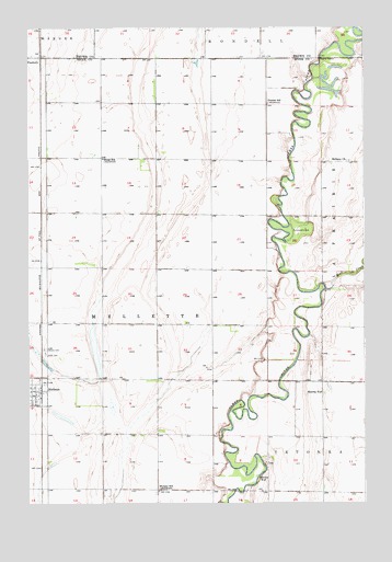
Mellette, SD USGS Topographic Map
Click on map above to begin viewing in our Map Viewer.

This topographic map contains these locations and features:
Feature Name Type Latitude Longitude GNIS ID View Map
Armadale (historical)LocaleN45.1866°W98.3840°1263246View Map
Armadale GroveAreaN45.1958°W98.3984°1263232View Map
Armadale ParkParkN45.1969°W98.4004°1253683View Map
Bethany CemeteryCemeteryN45.2148°W98.3807°2779337View Map
Bethany ChurchChurchN45.2150°W98.3804°1253881View Map
Borge SchoolSchoolN45.2155°W98.4723°1254016View Map
Calvary CemeteryCemeteryN45.1652°W98.4940°1254199View Map
City of MelletteCivilN45.1544°W98.4983°1267473View Map
Dunker SchoolSchoolN45.2303°W98.4109°1254800View Map
DuxburyPopulated PlaceN45.2411°W98.4951°1260999View Map
MellettePopulated PlaceN45.1544°W98.4976°1256431View Map
Mellette CemeteryCemeteryN45.1642°W98.4938°2779342View Map
Mellette Fire DepartmentBuildingN45.1551°W98.4972°2580714View Map
Mellette Post OfficePost OfficeN45.1546°W98.4966°2710583View Map
Morgan SchoolSchoolN45.1283°W98.4520°1256536View Map
Mud CreekStreamN45.1811°W98.3898°1256582View Map
Township of MelletteCivilN45.1620°W98.4789°1267888View Map

Note: Coordinates in the location and feature list above are referenced to NAD83 datum.


Copyright (C) 2008-2024 Ryan Niemi / Sunset Dynamics ... All Rights Reserved