TopoQuest Logo
Do you find TopoQuest useful?
Help keep TopoQuest running and adding new maps/features by donating!
Bitcoin:  19c7KJd3qBynnjoSw5npx9KScwjBe4ifkT
Litecoin:  LXs6TkuXGGXo1vDsWCkWVdjQX94eUKd6ui
Home View Maps Find Maps Find Places Resources & Links


Medford NW, Wisconsin Topographic Map

USGS Map Title: Medford NW, WI
USGS Map MRC: 45090B4
DRG (GeoTIFF) Download: o45090b4.tif


Neighboring USGS Topographic Map Quads:


  Jump River Fire Tower, WI  
45090C5
 

  Mondeaux Dam, WI  
45090C4
 

  Westboro, WI  
45090C3
 

  Perkinstown, WI  
45090B5
 

  Medford NW, WI  
45090B4
 

  Medford, WI  
45090B3
 

  Lublin SE, WI  
45090A5
 

  Medford SW, WI  
45090A4
 

  Stetsonville, WI  
45090A3


Map MRC Location:

N46°
W91°
N46°
W90°
H8 H7 H6 H5 H4 H3 H2 H1
G8 G7 G6 G5 G4 G3 G2 G1
F8 F7 F6 F5 F4 F3 F2 F1
E8 E7 E6 E5 E4 E3 E2 E1
D8 D7 D6 D5 D4 D3 D2 D1
C8 C7 C6 C5 C4 C3 C2 C1
B8 B7 B6 B5 B4 B3 B2 B1
A8 A7 A6 A5 A4 A3 A2 A1
N45°
W91°
N45°
W90°

Medford NW, WI USGS 1:24K Topographic Map Preview:
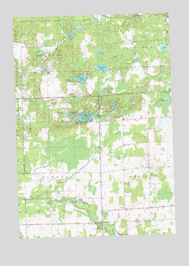
Medford NW, WI USGS Topographic Map
Click on map above to begin viewing in our Map Viewer.

This topographic map contains these locations and features:
Feature Name Type Latitude Longitude GNIS ID View Map
0.4 ReservoirReservoirN45.1583°W90.4835°1793337View Map
0.4 ReservoirReservoirN45.1886°W90.4680°1793205View Map
0.6 ReservoirReservoirN45.2400°W90.4518°1793368View Map
1.5 ReservoirReservoirN45.1750°W90.4235°1793245View Map
Anderson LakeLakeN45.2005°W90.3791°1578653View Map
Blank LakeLakeN45.2300°W90.4773°1578812View Map
Bradow Dam D 8092DamN45.1900°W90.4351°1792839View Map
Brookside SchoolSchoolN45.1405°W90.4157°1578862View Map
Clear LakeLakeN45.1913°W90.4403°1579015View Map
Clear LakeReservoirN45.1933°W90.4335°1792053View Map
Clear Lake DamDamN45.1933°W90.4335°1792052View Map
Cleveland School (historical)SchoolN45.1327°W90.4532°1840314View Map
Cronin LakeLakeN45.2303°W90.3799°1579063View Map
Dr Walther W Meyer Number 1 D4754 DamDamN45.2400°W90.4518°1793367View Map
Esadore LakeLakeN45.1922°W90.4466°1579216View Map
Farm View School (historical)SchoolN45.1622°W90.4160°1840315View Map
Grassy Knoll LakeLakeN45.2199°W90.4299°1579357View Map
Hammel TownhallBuildingN45.1616°W90.4940°1833637View Map
Leuthey CreekStreamN45.1905°W90.4882°1580969View Map
Leuthey LakeLakeN45.1954°W90.4616°1579648View Map
Long LakeLakeN45.2288°W90.4312°1579737View Map
Matt Ochs LakeLakeN45.2201°W90.4759°1579825View Map
Meadowbrook School (historical)SchoolN45.1616°W90.4540°1840328View Map
Meadownook School (historical)SchoolN45.1630°W90.3765°1840329View Map
Meyer 1 G3582.1 DamDamN45.1883°W90.4085°1793236View Map
Meyer 2 G3582.1 DamDamN45.1950°W90.4085°1793237View Map
Meyer 4 G3582.1 DamDamN45.1950°W90.4268°1793238View Map
Meyer 5 G3582.1 DamDamN45.1950°W90.4085°1793240View Map
Meyer 6 E1355.1 DamDamN45.1750°W90.4235°1793244View Map
Molitor CemeteryCemeteryN45.2175°W90.4954°1579896View Map
Molitor TownhallBuildingN45.2175°W90.4738°1833654View Map
Mud LakeLakeN45.1907°W90.4515°1579946View Map
MuratPopulated PlaceN45.1894°W90.4457°1579972View Map
Nick Henrichs G-9011 DamDamN45.1583°W90.4835°1793336View Map
Patrick J Meyer 3NW78801 DamDamN45.1883°W90.4668°1793204View Map
Paugel CreekStreamN45.1497°W90.4824°1580099View Map
Pechstein LakeLakeN45.2058°W90.4293°1580103View Map
Perch LakeLakeN45.2422°W90.4465°1580109View Map
Pine Tree School (historical)SchoolN45.2186°W90.4940°1840331View Map
Romeo LakeReservoirN45.1950°W90.4085°1793241View Map
Sackett LakeLakeN45.2143°W90.4467°1580306View Map
Sackett Lake Recreation AreaLocaleN45.2177°W90.4449°1580902View Map
Schoolhouse LakeLakeN45.1936°W90.4544°1580361View Map
Steenhoven DamDamN45.2400°W90.4518°1792674View Map
Thielke School (historical)SchoolN45.1405°W90.3951°1840336View Map
Tiffany LakeReservoirN45.1950°W90.4268°1793239View Map
Town of HammelCivilN45.1613°W90.4950°1583341View Map
Town of MolitorCivilN45.2474°W90.4946°1583734View Map
Washington CreekStreamN45.1511°W90.4760°1580728View Map
Washington FlowageReservoirN45.1899°W90.4356°1580729View Map
Washington FlowageReservoirN45.1928°W90.4359°1792840View Map
Wayside School (historical)SchoolN45.1327°W90.4946°1840337View Map

Note: Coordinates in the location and feature list above are referenced to NAD83 datum.


Copyright (C) 2008-2024 Ryan Niemi / Sunset Dynamics ... All Rights Reserved