TopoQuest Logo
Do you find TopoQuest useful?
Help keep TopoQuest running and adding new maps/features by donating!
Bitcoin:  19c7KJd3qBynnjoSw5npx9KScwjBe4ifkT
Litecoin:  LXs6TkuXGGXo1vDsWCkWVdjQX94eUKd6ui
Home View Maps Find Maps Find Places Resources & Links


Medford East, Minnesota Topographic Map

USGS Map Title: Medford East, MN
USGS Map MRC: 44093B2
DRG (GeoTIFF) Download: o44093b2.tif


Neighboring USGS Topographic Map Quads:


  Faribault, MN  
44093C3
 

  Cannon City, MN  
44093C2
 

  Nerstrand, MN  
44093C1
 

  Medford West, MN  
44093B3
 

  Medford East, MN  
44093B2
 

  Moland, MN  
44093B1
 

  Saco, MN  
44093A3
 

  Owatonna, MN  
44093A2
 

  Owatonna SE, MN  
44093A1


Map MRC Location:

N45°
W94°
N45°
W93°
H8 H7 H6 H5 H4 H3 H2 H1
G8 G7 G6 G5 G4 G3 G2 G1
F8 F7 F6 F5 F4 F3 F2 F1
E8 E7 E6 E5 E4 E3 E2 E1
D8 D7 D6 D5 D4 D3 D2 D1
C8 C7 C6 C5 C4 C3 C2 C1
B8 B7 B6 B5 B4 B3 B2 B1
A8 A7 A6 A5 A4 A3 A2 A1
N44°
W94°
N44°
W93°

Medford East, MN USGS 1:24K Topographic Map Preview:
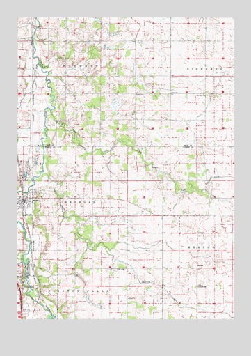
Medford East, MN USGS Topographic Map
Click on map above to begin viewing in our Map Viewer.

This topographic map contains these locations and features:
Feature Name Type Latitude Longitude GNIS ID View Map
Christ the King ChurchChurchN44.1755°W93.2485°2051355View Map
City of MedfordCivilN44.1685°W93.2481°2395080View Map
Clinton FallsPopulated PlaceN44.1389°W93.2469°641339View Map
Clinton Falls Post Office (historical)Post OfficeN44.1389°W93.2469°2051262View Map
Congregational United Church of ChristChurchN44.1719°W93.2472°2051353View Map
County Ditch Number EighteenCanalN44.1644°W93.1960°641740View Map
County Ditch Number NineteenCanalN44.2147°W93.1397°641758View Map
Crane CreekStreamN44.1497°W93.2466°642424View Map
Eklund CemeteryCemeteryN44.2183°W93.1774°643222View Map
Grand View Memorial GardensCemeteryN44.1269°W93.2449°644338View Map
Heritage Halls Transportation MuseumBuildingN44.1333°W93.2494°2051417View Map
Interchange 45CrossingN44.1389°W93.2494°2051409View Map
MedfordPopulated PlaceN44.1741°W93.2463°647731View Map
MedfordLocaleN44.1722°W93.2460°2051352View Map
Medford City HallBuildingN44.1714°W93.2410°2051348View Map
Medford CreekStreamN44.1864°W93.2352°647732View Map
Medford Post OfficePost OfficeN44.1749°W93.2471°2051350View Map
Medford Public SchoolSchoolN44.1736°W93.2424°2051356View Map
Medford Trailer ParkPopulated PlaceN44.1741°W93.2463°2051351View Map
Medford Volunteer Fire DepartmentBuildingN44.1712°W93.2420°2051349View Map
MertonPopulated PlaceN44.1461°W93.1466°654826View Map
Merton Post Office (historical)Post OfficeN44.1461°W93.1466°2051249View Map
Mud CreekStreamN44.2305°W93.2383°648202View Map
Oak Hill CemeteryCemeteryN44.1419°W93.2497°648812View Map
Perry SchoolSchoolN44.2186°W93.1616°649308View Map
Richland CemeteryCemeteryN44.2183°W93.1427°650065View Map
Rock SchoolSchoolN44.1680°W93.1460°650204View Map
Rush CreekStreamN44.2114°W93.2305°650393View Map
School Number 2086SchoolN44.1386°W93.1463°651499View Map
Township of Clinton FallsCivilN44.1330°W93.2231°663828View Map
Township of MedfordCivilN44.1753°W93.2247°664947View Map
Township of WalcottCivilN44.2370°W93.2188°665896View Map
Trinity Lutheran ChurchChurchN44.1727°W93.2499°2051354View Map
Union CemeteryCemeteryN44.1894°W93.2433°653492View Map
WalcottPopulated PlaceN44.2333°W93.1835°654527View Map

Note: Coordinates in the location and feature list above are referenced to NAD83 datum.


Copyright (C) 2008-2024 Ryan Niemi / Sunset Dynamics ... All Rights Reserved