TopoQuest Logo
Do you find TopoQuest useful?
Help keep TopoQuest running and adding new maps/features by donating!
Bitcoin:  19c7KJd3qBynnjoSw5npx9KScwjBe4ifkT
Litecoin:  LXs6TkuXGGXo1vDsWCkWVdjQX94eUKd6ui
Home View Maps Find Maps Find Places Resources & Links


Mecosta, Michigan Topographic Map

USGS Map Title: Mecosta, MI
USGS Map MRC: 43085E2
DRG (GeoTIFF) Download: o43085e2.tif


Neighboring USGS Topographic Map Quads:


  Chippewa Lake South, MI  
43085F3
 

  Mecosta NW, MI  
43085F2
 

  Sherman City, MI  
43085F1
 

  Altona, MI  
43085E3
 

  Mecosta, MI  
43085E2
 

  Blanchard, MI  
43085E1
 

  Lakeview, MI  
43085D3
 

  Six Lakes, MI  
43085D2
 

  Edmore, MI  
43085D1


Map MRC Location:

N44°
W86°
N44°
W85°
H8 H7 H6 H5 H4 H3 H2 H1
G8 G7 G6 G5 G4 G3 G2 G1
F8 F7 F6 F5 F4 F3 F2 F1
E8 E7 E6 E5 E4 E3 E2 E1
D8 D7 D6 D5 D4 D3 D2 D1
C8 C7 C6 C5 C4 C3 C2 C1
B8 B7 B6 B5 B4 B3 B2 B1
A8 A7 A6 A5 A4 A3 A2 A1
N43°
W86°
N43°
W85°

Mecosta, MI USGS 1:24K Topographic Map Preview:
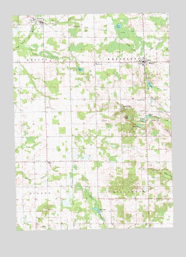
Mecosta, MI USGS Topographic Map
Click on map above to begin viewing in our Map Viewer.

This topographic map contains these locations and features:
Feature Name Type Latitude Longitude GNIS ID View Map
Black LakesLakeN43.5120°W85.1862°621518View Map
Chippewa Hills Assembly of God ChurchChurchN43.5944°W85.1450°2518877View Map
Chippewa Hills Baptist ChurchChurchN43.5989°W85.1356°2518876View Map
Cross ChurchChurchN43.6248°W85.1464°624118View Map
East Schrader CreekStreamN43.6070°W85.2456°625259View Map
Fourth LakeLakeN43.5644°W85.1588°626347View Map
Halls CornerPopulated PlaceN43.5398°W85.2248°1617603View Map
Harris LakeLakeN43.5627°W85.1470°627845View Map
MecostaPopulated PlaceN43.6203°W85.2264°632065View Map
Mecosta Elementary SchoolSchoolN43.6225°W85.2331°2519020View Map
Mecosta Post OfficePost OfficeN43.6208°W85.2250°2519018View Map
Mecosta Station (historical)LocaleN43.6242°W85.2344°2519017View Map
Meeker LakeLakeN43.5647°W85.1435°632074View Map
Morgan CemeteryCemeteryN43.6150°W85.1934°632685View Map
Morton CemeteryCemeteryN43.5711°W85.2250°632739View Map
Morton Township Fire and Rescue Mecosta StationBuildingN43.6216°W85.2269°2626836View Map
Morton Township LibraryBuildingN43.6217°W85.2300°2519019View Map
Mud LakeLakeN43.6174°W85.1652°632970View Map
New Hope United Methodist ChurchChurchN43.5975°W85.2450°2519022View Map
Pickerel LakeLakeN43.5928°W85.1967°634787View Map
Pine LakeLakeN43.5831°W85.1412°634964View Map
RemusPopulated PlaceN43.5967°W85.1448°635795View Map
Remus Elementary SchoolSchoolN43.5959°W85.1411°632066View Map
Remus Post OfficePost OfficeN43.5967°W85.1503°2518873View Map
Remus Station (historical)LocaleN43.5958°W85.1464°2518871View Map
Saint Michael CemeteryCemeteryN43.5958°W85.1853°2519054View Map
Saint Michael ChurchChurchN43.5967°W85.1850°2518999View Map
Saint Michael SchoolSchoolN43.5959°W85.1839°636951View Map
Saint Paul's Lutheran ChurchChurchN43.5953°W85.1503°2518875View Map
Schoner LakeLakeN43.5708°W85.1636°637360View Map
Third LakeLakeN43.5595°W85.1504°1614735View Map
Township of MillbrookCivilN43.5099°W85.1450°1626742View Map
Township of WheatlandCivilN43.5966°W85.1455°1627256View Map
Village of MecostaCivilN43.6211°W85.2305°2399303View Map
Wamboldt CemeteryCemeteryN43.5742°W85.1459°1615753View Map
Wesleyan Holiness CampgroundLocaleN43.5689°W85.2478°2519026View Map
Wheatland Church of Christ Historical MarkerParkN43.6247°W85.1464°2519060View Map
Wheatland Township Fire DepartmentBuildingN43.5956°W85.1450°2626844View Map
Wheatland Township LibraryBuildingN43.5975°W85.1472°2518870View Map

Note: Coordinates in the location and feature list above are referenced to NAD83 datum.


Copyright (C) 2008-2024 Ryan Niemi / Sunset Dynamics ... All Rights Reserved