TopoQuest Logo
Do you find TopoQuest useful?
Help keep TopoQuest running and adding new maps/features by donating!
Bitcoin:  19c7KJd3qBynnjoSw5npx9KScwjBe4ifkT
Litecoin:  LXs6TkuXGGXo1vDsWCkWVdjQX94eUKd6ui
Home View Maps Find Maps Find Places Resources & Links


McDowell, Kentucky Topographic Map

USGS Map Title: McDowell, KY
USGS Map MRC: 37082D6
DRG (GeoTIFF) Download: o37082d6.tif


Neighboring USGS Topographic Map Quads:


  Martin, KY  
37082E7
 

  Harold, KY  
37082E6
 

  Broad Bottom, KY  
37082E5
 

  Wayland, KY  
37082D7
 

  McDowell, KY  
37082D6
 

  Pikeville, KY  
37082D5
 

  Kite, KY  
37082C7
 

  Wheelwright, KY  
37082C6
 

  Dorton, KY  
37082C5


Map MRC Location:

N38°
W83°
N38°
W82°
H8 H7 H6 H5 H4 H3 H2 H1
G8 G7 G6 G5 G4 G3 G2 G1
F8 F7 F6 F5 F4 F3 F2 F1
E8 E7 E6 E5 E4 E3 E2 E1
D8 D7 D6 D5 D4 D3 D2 D1
C8 C7 C6 C5 C4 C3 C2 C1
B8 B7 B6 B5 B4 B3 B2 B1
A8 A7 A6 A5 A4 A3 A2 A1
N37°
W83°
N37°
W82°

McDowell, KY USGS 1:24K Topographic Map Preview:
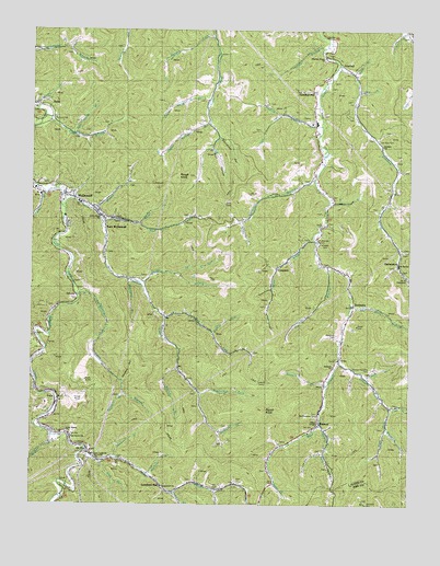
McDowell, KY USGS Topographic Map
Click on map above to begin viewing in our Map Viewer.

This topographic map contains these locations and features:
Feature Name Type Latitude Longitude GNIS ID View Map
Akers BranchStreamN37.4548°W82.6515°485801View Map
Andy BranchStreamN37.4084°W82.6385°485953View Map
Antioch SchoolSchoolN37.4390°W82.6543°486003View Map
BeaverPopulated PlaceN37.3968°W82.6543°486604View Map
Biglick BranchStreamN37.4109°W82.7013°487297View Map
Border Railroad Station (historical)LocaleN37.4254°W82.7430°2097299View Map
Branham CreekStreamN37.4898°W82.6493°487832View Map
Bryant BranchStreamN37.3932°W82.7424°488161View Map
Bryant Branch SchoolSchoolN37.3923°W82.7424°488162View Map
Buckhorn ForkStreamN37.3943°W82.6874°488269View Map
Buckhorn HollowValleyN37.3923°W82.6697°488272View Map
Buzzard RockSummitN37.3793°W82.6496°2120545View Map
Church of Christ at GalvestonChurchN37.4351°W82.6257°509596View Map
Church of God of ProphecyChurchN37.3759°W82.6715°509591View Map
Church of God of ProphecyChurchN37.3868°W82.7277°509593View Map
Clear CreekStreamN37.3893°W82.7304°489611View Map
Clear Creek ChurchChurchN37.3882°W82.7288°509594View Map
Clear Creek SchoolSchoolN37.3862°W82.7252°489621View Map
CraynorPopulated PlaceN37.4370°W82.6688°507776View Map
Deal BranchStreamN37.4837°W82.6421°490735View Map
Doty BranchStreamN37.4568°W82.7457°491034View Map
DriftPopulated PlaceN37.4804°W82.7477°491113View Map
Drift Presbyterian ChurchChurchN37.4807°W82.7471°509602View Map
Dry BranchStreamN37.4379°W82.6515°491146View Map
East McDowellPopulated PlaceN37.4476°W82.7252°491492View Map
Elliott ChapelChurchN37.3962°W82.6540°509589View Map
Emmanuel Full Gospel ChurchChurchN37.3801°W82.7052°509592View Map
First Baptist ChurchChurchN37.4548°W82.7390°509600View Map
Frasure BranchStreamN37.4751°W82.6543°492466View Map
Frasure Branch SchoolSchoolN37.4759°W82.6560°492467View Map
Frasure CreekStreamN37.4529°W82.7390°492468View Map
Frozen CreekStreamN37.4784°W82.7485°492580View Map
GalvestonPopulated PlaceN37.4401°W82.6288°492660View Map
Galveston Post Office (historical)Post OfficeN37.4401°W82.6288°509781View Map
Gap ForkStreamN37.4204°W82.6896°492679View Map
Gearhart SchoolSchoolN37.4126°W82.7490°492759View Map
Gearheart BranchStreamN37.4340°W82.7179°492760View Map
GrethelPopulated PlaceN37.4912°W82.6477°493369View Map
Grethel ChurchChurchN37.4698°W82.6338°493370View Map
Grethel Post OfficePost OfficeN37.4829°W82.6571°508136View Map
Grethel-Teaberry DivisionCivilN37.4664°W82.6513°1937163View Map
Hall ForkStreamN37.4493°W82.7265°493584View Map
Hall SchoolSchoolN37.4343°W82.7138°493593View Map
Hamilton BranchStreamN37.4604°W82.6565°493613View Map
Hays BranchStreamN37.3865°W82.7263°493928View Map
Head of Frasure Creek SchoolSchoolN37.4051°W82.6935°493962View Map
Head of Little Mud SchoolSchoolN37.4873°W82.6890°493963View Map
Hi HatPopulated PlaceN37.3918°W82.7290°494104View Map
Hollybush CemeteryCemeteryN37.4195°W82.6490°494421View Map
Hoods ForkStreamN37.4334°W82.7143°494497View Map
Hopkins BranchStreamN37.4043°W82.7185°494543View Map
Indian Grave HollowValleyN37.4019°W82.7401°509793View Map
Lambert SchoolSchoolN37.3809°W82.6968°495940View Map
Lambert StationLocaleN37.3798°W82.7054°495941View Map
Lee Alley CemeteryCemeteryN37.4718°W82.6354°509587View Map
Lee Alley SchoolSchoolN37.4690°W82.6346°496147View Map
Left Beaver Volunteer Fire and RescueBuildingN37.3980°W82.7445°2636656View Map
Left Beaver Volunteer Fire Department and Rescue Squad Station 2BuildingN37.4513°W82.7271°2637386View Map
Left Fork Frasure BranchStreamN37.4776°W82.6674°496215View Map
Left Fork Hoods ForkStreamN37.4357°W82.7007°496226View Map
Left Fork Tinker ForkStreamN37.4009°W82.6310°509459View Map
Little BranchStreamN37.4495°W82.6796°496639View Map
Little Nancy ChurchChurchN37.3940°W82.7374°496816View Map
Little Rosa Church of Old Regular BaptistChurchN37.4509°W82.7268°509599View Map
Lower Wolfpen BranchStreamN37.4812°W82.6918°497315View Map
Margarett ForkStreamN37.3954°W82.6318°509588View Map
McDowellPopulated PlaceN37.4559°W82.7363°497842View Map
McDowell ARH HospitalHospitalN37.4567°W82.7472°509585View Map
McDowell Census Designated PlaceCensusN37.4590°W82.7341°2629652View Map
McDowell DivisionCivilN37.4320°W82.7275°1937121View Map
Middle Branch Frasure CreekStreamN37.4526°W82.7302°498097View Map
Mink BranchStreamN37.4445°W82.6554°498410View Map
Mink Branch SchoolSchoolN37.4384°W82.6677°498411View Map
Mitchell BranchStreamN37.4068°W82.6515°498445View Map
Moore ForkStreamN37.3807°W82.6688°498552View Map
Morgan ForkStreamN37.4979°W82.6902°498592View Map
Mouth of Branham Creek SchoolSchoolN37.4937°W82.6538°498966View Map
Mud Creek Lookout TowerTowerN37.4079°W82.6718°517248View Map
Mud Creek Volunteer Fire DepartmentBuildingN37.4784°W82.6567°2636383View Map
Mud Creek Volunteer Fire Department Station 2BuildingN37.4086°W82.6520°2637409View Map
Neck BranchStreamN37.4418°W82.6279°499209View Map
Neck Branch SchoolSchoolN37.4426°W82.6277°499210View Map
Ned ForkStreamN37.4240°W82.7054°499212View Map
Ned Fork SchoolSchoolN37.4257°W82.6996°499213View Map
Newman BranchStreamN37.3873°W82.7215°499435View Map
Newsom CemeteryCemeteryN37.3754°W82.6382°499441View Map
Newsom HollowValleyN37.4073°W82.7193°499442View Map
Old Primitive Baptist ChurchChurchN37.3984°W82.6546°509590View Map
OrkneyPopulated PlaceN37.4301°W82.7352°508757View Map
Osborne BranchStreamN37.3784°W82.7021°500009View Map
Pilgrim Rest ChurchChurchN37.4195°W82.7485°500631View Map
Pilgrims Home Church of Old Regular BaptistChurchN37.4926°W82.6532°509601View Map
Pine Grove Baptist ChurchChurchN37.3932°W82.7360°509595View Map
Polly Spencer BranchStreamN37.4726°W82.7368°501019View Map
Poplarlick ForkStreamN37.4045°W82.6938°501137View Map
PricePopulated PlaceN37.4026°W82.7421°501316View Map
Red Morg BranchStreamN37.4276°W82.6440°501666View Map
Reynolds BranchStreamN37.3829°W82.7107°501743View Map
Reynolds BranchStreamN37.3790°W82.6871°501744View Map
Rich HollowValleyN37.4691°W82.6905°501791View Map
Right Fork Tinker ForkStreamN37.4009°W82.6310°509460View Map
Rough BranchStreamN37.4490°W82.7143°502376View Map
Rough KnobSummitN37.4609°W82.7018°502388View Map
Samaria ChurchChurchN37.4118°W82.6499°502879View Map
Signal KnobSummitN37.4004°W82.6724°503491View Map
Simpson BranchStreamN37.4768°W82.7454°503532View Map
Simpson Branch SchoolSchoolN37.4720°W82.7307°503533View Map
Spewing Camp BranchStreamN37.4301°W82.7343°504061View Map
Spewing Camp SchoolSchoolN37.4132°W82.7282°504062View Map
Step BranchStreamN37.4260°W82.7423°2097298View Map
Stonecoal HollowValleyN37.4720°W82.6880°504476View Map
Sturgill BranchStreamN37.4995°W82.6268°504615View Map
Sword BranchStreamN37.4884°W82.6435°504860View Map
Tackett BranchStreamN37.4948°W82.6540°504905View Map
Tackett ForkStreamN37.3968°W82.6535°504909View Map
Tackett Fork SchoolSchoolN37.3898°W82.6513°504911View Map
TeaberryPopulated PlaceN37.4268°W82.6429°505050View Map
Teaberry SchoolSchoolN37.4159°W82.6477°505051View Map
The Little Rachel Church of Jesus Christ of Old Regular BaptistChurchN37.4379°W82.6288°509597View Map
Thomas Hamilton CemeteryCemeteryN37.4104°W82.6379°509586View Map
Tinker ForkStreamN37.4126°W82.6479°509862View Map
Tinker Fork SchoolSchoolN37.3995°W82.6310°505290View Map
Upper Wolfpen BranchStreamN37.4751°W82.6918°505922View Map
Will Hamilton SchoolSchoolN37.4490°W82.6810°506770View Map
Zion ChurchChurchN37.4451°W82.6546°507281View Map
Zion Church of Old Regular BaptistChurchN37.4509°W82.6782°509598View Map

Note: Coordinates in the location and feature list above are referenced to NAD83 datum.


Copyright (C) 2008-2024 Ryan Niemi / Sunset Dynamics ... All Rights Reserved