TopoQuest Logo
Do you find TopoQuest useful?
Help keep TopoQuest running and adding new maps/features by donating!
Bitcoin:  19c7KJd3qBynnjoSw5npx9KScwjBe4ifkT
Litecoin:  LXs6TkuXGGXo1vDsWCkWVdjQX94eUKd6ui
Home View Maps Find Maps Find Places Resources & Links


Maytown, Washington Topographic Map

USGS Map Title: Maytown, WA
USGS Map MRC: 46122H8
DRG (GeoTIFF) Download: o46122h8.tif


Neighboring USGS Topographic Map Quads:


  Summit Lake, WA  
47123A1
 

  Tumwater, WA  
47122A8
 

  Lacey, WA  
47122A7
 

  Littlerock, WA  
46123H1
 

  Maytown, WA  
46122H8
 

  East Olympia, WA  
46122H7
 

  Rochester, WA  
46123G1
 

  Violet Prairie, WA  
46122G8
 

  Bucoda, WA  
46122G7


Map MRC Location:

N47°
W123°
N47°
W122°
H8 H7 H6 H5 H4 H3 H2 H1
G8 G7 G6 G5 G4 G3 G2 G1
F8 F7 F6 F5 F4 F3 F2 F1
E8 E7 E6 E5 E4 E3 E2 E1
D8 D7 D6 D5 D4 D3 D2 D1
C8 C7 C6 C5 C4 C3 C2 C1
B8 B7 B6 B5 B4 B3 B2 B1
A8 A7 A6 A5 A4 A3 A2 A1
N46°
W123°
N46°
W122°

Maytown, WA USGS 1:24K Topographic Map Preview:
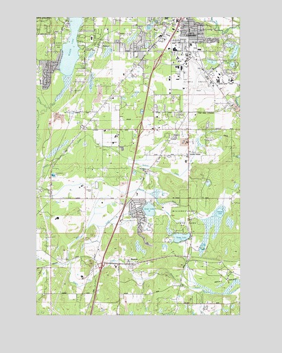
Maytown, WA USGS Topographic Map
Click on map above to begin viewing in our Map Viewer.

This topographic map contains these locations and features:
Feature Name Type Latitude Longitude GNIS ID View Map
Allen CreekStreamN46.9198°W122.9365°1512918View Map
BelmorePopulated PlaceN46.9873°W122.9624°1510818View Map
Black LakeLakeN46.9924°W122.9780°1503407View Map
Black Lake Elementary SchoolSchoolN46.9912°W122.9673°1515015View Map
BushPopulated PlaceN46.9790°W122.8790°1514862View Map
Bush PrairieFlatN46.9943°W122.9238°1503676View Map
City of TumwaterCivilN46.9905°W122.9164°2412111View Map
Cricket FieldAirportN46.9278°W122.9676°1533820View Map
Deep LakeLakeN46.9074°W122.9125°1504395View Map
Dempsey CreekStreamN46.9618°W122.9946°1511612View Map
MaytownPopulated PlaceN46.8976°W122.9435°1533530View Map
McLane / Black Lake Fire Department Station 95BuildingN46.9945°W122.9859°2619659View Map
Millersylvania State ParkParkN46.9126°W122.9110°1506716View Map
Mountain View Christian Church of the NazareneChurchN46.9867°W122.9200°2608859View Map
Munn LakeLakeN46.9850°W122.8794°1506894View Map
Nazarene Christian SchoolSchoolN46.9862°W122.9171°1515016View Map
Northwest Helicopters HeliportAirportN46.9748°W122.9001°1534004View Map
Olympia Army Air Field (historical)MilitaryN46.9728°W122.9008°2093981View Map
Olympia Regional AirportAirportN46.9705°W122.9022°1513977View Map
Olympic Memorial Garden CemeteryCemeteryN46.9970°W122.9214°1507182View Map
Peter G Schmidt Elementary SchoolSchoolN46.9883°W122.9053°1531118View Map
Pitman LakeLakeN46.9176°W122.8887°1507474View Map
Scott LakeLakeN46.9190°W122.9319°1508174View Map
South UnionPopulated PlaceN46.9432°W122.9074°1511329View Map
Springer LakeLakeN46.9412°W122.8759°1508647View Map
Susan LakeLakeN46.9879°W122.8827°1513220View Map
Thurston County Fire District 6 East Olympia Fire District Station 63BuildingN46.9419°W122.9071°2643318View Map
Trails End LakeLakeN46.9799°W122.8810°1509071View Map
Trosper LakeLakeN46.9958°W122.9318°1509084View Map
Tumwater Fire Department HeadquartersBuildingN46.9850°W122.9096°2619353View Map
Tumwater High SchoolSchoolN46.9862°W122.9163°1515014View Map
Tumwater Middle SchoolSchoolN46.9916°W122.9251°1515018View Map
Tumwater Police DepartmentBuildingN46.9847°W122.9117°2721988View Map
Tumwater Post OfficePost OfficeN46.9858°W122.9053°2781681View Map
West Thurston Regional Fire Authority Central Battalion Station 1 - 6 MaytownBuildingN46.8959°W122.9500°2619538View Map
West Thurston Regional Fire Authority North Battalion Station 1 - 2 LittlerockBuildingN46.9302°W122.9911°2619522View Map
West Thurston Regional Fire Authority North Battalion Station 1 - 4 - Scott LakeBuildingN46.9201°W122.9392°2619540View Map

Note: Coordinates in the location and feature list above are referenced to NAD83 datum.


Copyright (C) 2008-2024 Ryan Niemi / Sunset Dynamics ... All Rights Reserved