TopoQuest Logo
Do you find TopoQuest useful?
Help keep TopoQuest running and adding new maps/features by donating!
Bitcoin:  19c7KJd3qBynnjoSw5npx9KScwjBe4ifkT
Litecoin:  LXs6TkuXGGXo1vDsWCkWVdjQX94eUKd6ui
Home View Maps Find Maps Find Places Resources & Links


Massena, Iowa Topographic Map

USGS Map Title: Massena, IA
USGS Map MRC: 41094C7
DRG (GeoTIFF) Download: o41094c7.tif


Neighboring USGS Topographic Map Quads:


  Wiota, IA  
41094D8
 

  Anita, IA  
41094D7
 

  Adair South, IA  
41094D6
 

  Anita SW, IA  
41094C8
 

  Massena, IA  
41094C7
 

  Fontanelle SW, IA  
41094C6
 

  Grant, IA  
41094B8
 

  Dewey, IA  
41094B7
 

  Bridgewater, IA  
41094B6


Map MRC Location:

N42°
W95°
N42°
W94°
H8 H7 H6 H5 H4 H3 H2 H1
G8 G7 G6 G5 G4 G3 G2 G1
F8 F7 F6 F5 F4 F3 F2 F1
E8 E7 E6 E5 E4 E3 E2 E1
D8 D7 D6 D5 D4 D3 D2 D1
C8 C7 C6 C5 C4 C3 C2 C1
B8 B7 B6 B5 B4 B3 B2 B1
A8 A7 A6 A5 A4 A3 A2 A1
N41°
W95°
N41°
W94°

Massena, IA USGS 1:24K Topographic Map Preview:
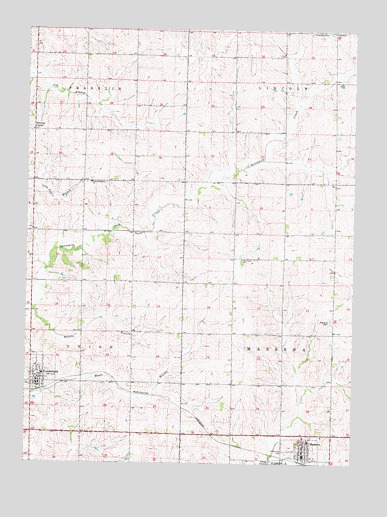
Massena, IA USGS Topographic Map
Click on map above to begin viewing in our Map Viewer.

This topographic map contains these locations and features:
Feature Name Type Latitude Longitude GNIS ID View Map
C and M Elementary SchoolSchoolN41.2736°W94.8683°1969164View Map
CAM Middle SchoolSchoolN41.2564°W94.7672°1969148View Map
CAM South Elementary SchoolSchoolN41.2564°W94.7669°2720050View Map
Christian ChurchChurchN41.2544°W94.7686°1969147View Map
City of CumberlandCivilN41.2731°W94.8707°2393694View Map
City of MassenaCivilN41.2506°W94.7698°2395042View Map
CumberlandPopulated PlaceN41.2742°W94.8703°455754View Map
Cumberland (historical)LocaleN41.2708°W94.8703°1969165View Map
Cumberland City HallBuildingN41.2722°W94.8703°1969161View Map
Cumberland Post OfficePost OfficeN41.2722°W94.8703°1969159View Map
Cumberland Public LibraryBuildingN41.2722°W94.8703°1969160View Map
Cumberland Volunteer Fire DepartmentBuildingN41.2736°W94.8701°1969162View Map
First Baptist ChurchChurchN41.2744°W94.8703°1969166View Map
First Evangelical ChurchChurchN41.3308°W94.8505°456600View Map
Franklin Lutheran CemeteryCemeteryN41.3317°W94.8508°1969171View Map
Lincoln Center CemeteryCemeteryN41.3740°W94.7670°1969170View Map
MassenaPopulated PlaceN41.2542°W94.7683°458849View Map
Massena (historical)LocaleN41.2505°W94.7691°1969143View Map
Massena Baptist ChurchChurchN41.2539°W94.7686°1969146View Map
Massena CemeteryCemeteryN41.2913°W94.7591°458850View Map
Massena City HallBuildingN41.2522°W94.7686°1969139View Map
Massena Fire DepartmentBuildingN41.2536°W94.7692°1969138View Map
Massena LibraryBuildingN41.2522°W94.7686°1969140View Map
Massena Medical CenterHospitalN41.2514°W94.7683°1969141View Map
Massena Post OfficePost OfficeN41.2517°W94.7691°1969142View Map
Norway CenterPopulated PlaceN41.3458°W94.8725°464673View Map
Norway Center CemeteryCemeteryN41.3458°W94.8635°1969168View Map
Pettitts BranchStreamN41.2939°W94.8719°460108View Map
Pine Grove ChurchChurchN41.3092°W94.7925°460168View Map
Saint Patricks CemeteryCemeteryN41.2535°W94.7762°461244View Map
Saint Patricks ChurchChurchN41.2561°W94.7691°1969144View Map
Township of FranklinCivilN41.3744°W94.8708°467851View Map
Township of LincolnCivilN41.3743°W94.7577°468244View Map
Township of MassenaCivilN41.2876°W94.7578°468367View Map
Township of UnionCivilN41.2876°W94.8711°468813View Map
Twenty-first Century Co-op ElevatorLocaleN41.2722°W94.8703°1969163View Map
United Methodist ChurchChurchN41.2542°W94.7697°1969145View Map
United Methodist ChurchChurchN41.2769°W94.8678°1969167View Map

Note: Coordinates in the location and feature list above are referenced to NAD83 datum.


Copyright (C) 2008-2024 Ryan Niemi / Sunset Dynamics ... All Rights Reserved