TopoQuest Logo
Do you find TopoQuest useful?
Help keep TopoQuest running and adding new maps/features by donating!
Bitcoin:  19c7KJd3qBynnjoSw5npx9KScwjBe4ifkT
Litecoin:  LXs6TkuXGGXo1vDsWCkWVdjQX94eUKd6ui
Home View Maps Find Maps Find Places Resources & Links


Mason, Texas Topographic Map

USGS Map Title: Mason, TX
USGS Map MRC: 30099F2
DRG (GeoTIFF) Download: o30099f2.tif


Neighboring USGS Topographic Map Quads:


  Grit, TX  
30099G3
 

  Purdy Hill, TX  
30099G2
 

  Fly Gap, TX  
30099G1
 

  Turtle Creek, TX  
30099F3
 

  Mason, TX  
30099F2
 

  Art, TX  
30099F1
 

  Monument Mountain SE, TX  
30099E3
 

  Panther Creek, TX  
30099E2
 

  Loyal Valley, TX  
30099E1


Map MRC Location:

N31°
W100°
N31°
W99°
H8 H7 H6 H5 H4 H3 H2 H1
G8 G7 G6 G5 G4 G3 G2 G1
F8 F7 F6 F5 F4 F3 F2 F1
E8 E7 E6 E5 E4 E3 E2 E1
D8 D7 D6 D5 D4 D3 D2 D1
C8 C7 C6 C5 C4 C3 C2 C1
B8 B7 B6 B5 B4 B3 B2 B1
A8 A7 A6 A5 A4 A3 A2 A1
N30°
W100°
N30°
W99°

Mason, TX USGS 1:24K Topographic Map Preview:
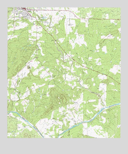
Mason, TX USGS Topographic Map
Click on map above to begin viewing in our Map Viewer.

This topographic map contains these locations and features:
Feature Name Type Latitude Longitude GNIS ID View Map
Bast CreekStreamN30.6332°W99.1820°1351580View Map
City of MasonCivilN30.7480°W99.2287°2411048View Map
Comanche CreekStreamN30.6546°W99.1414°1373169View Map
GrossvillePopulated PlaceN30.6841°W99.2014°1379865View Map
Hick SpringsSpringN30.7341°W99.2220°1359105View Map
Hog BranchStreamN30.6730°W99.1645°1374088View Map
Jordan MountainSummitN30.7180°W99.1456°1360429View Map
MasonPopulated PlaceN30.7488°W99.2306°1362252View Map
Mason Ambulance ServiceBuildingN30.7473°W99.2341°2655855View Map
Mason City HallBuildingN30.7481°W99.2334°2753838View Map
Mason CountyCivilN30.7177°W99.2261°1383942View Map
Mason County AirportAirportN30.7362°W99.1858°1387160View Map
Mason County Law Enforcement CenterBuildingN30.7481°W99.2323°2738734View Map
Mason County MuseumBuildingN30.7466°W99.2337°2014576View Map
Mason County Sheriff's OfficeBuildingN30.7485°W99.2318°2750378View Map
Mason Elementary and Junior High SchoolSchoolN30.7443°W99.2414°2007736View Map
Mason Post OfficePost OfficeN30.7437°W99.2279°2731441View Map
Mason Volunteer Fire DepartmentBuildingN30.7473°W99.2337°2551182View Map
Odeon TheaterBuildingN30.7482°W99.2334°2742403View Map
Rafael CreekStreamN30.7032°W99.1884°1365947View Map
Rock CreekStreamN30.6374°W99.2237°1366639View Map
Todd CreekStreamN30.6705°W99.2406°1384174View Map
Todd MountainSummitN30.6930°W99.2270°1384175View Map
Wolf BranchStreamN30.7313°W99.1970°1372221View Map

Note: Coordinates in the location and feature list above are referenced to NAD83 datum.


Copyright (C) 2008-2024 Ryan Niemi / Sunset Dynamics ... All Rights Reserved