TopoQuest Logo
Do you find TopoQuest useful?
Help keep TopoQuest running and adding new maps/features by donating!
Bitcoin:  19c7KJd3qBynnjoSw5npx9KScwjBe4ifkT
Litecoin:  LXs6TkuXGGXo1vDsWCkWVdjQX94eUKd6ui
Home View Maps Find Maps Find Places Resources & Links


Beach Haven, New Jersey Topographic Map

USGS Map Title: Beach Haven, NJ
USGS Map MRC: 39074E2
DRG (GeoTIFF) Download: o39074e2.tif


Neighboring USGS Topographic Map Quads:


  West Creek, NJ  
39074F3
 

  Ship Bottom, NJ  
39074F2
 

  Long Beach NE, NJ  
39074F1
 

  Tuckerton, NJ  
39074E3
 

  Beach Haven, NJ  
39074E2


  Brigantine Inlet, NJ  
39074D3


Map MRC Location:

N40°
W75°
N40°
W74°
H8 H7 H6 H5 H4 H3 H2 H1
G8 G7 G6 G5 G4 G3 G2 G1
F8 F7 F6 F5 F4 F3 F2 F1
E8 E7 E6 E5 E4 E3 E2 E1
D8 D7 D6 D5 D4 D3 D2 D1
C8 C7 C6 C5 C4 C3 C2 C1
B8 B7 B6 B5 B4 B3 B2 B1
A8 A7 A6 A5 A4 A3 A2 A1
N39°
W75°
N39°
W74°

Beach Haven, NJ USGS 1:24K Topographic Map Preview:
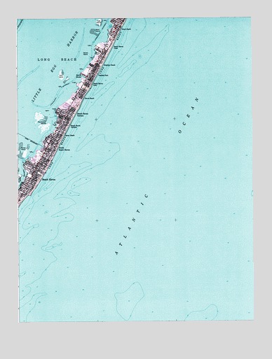
Beach Haven, NJ USGS Topographic Map
Click on map above to begin viewing in our Map Viewer.

This topographic map contains these locations and features:
Feature Name Type Latitude Longitude GNIS ID View Map
Beach HavenPopulated PlaceN39.5593°W74.2432°874569View Map
Beach Haven (historical)AirportN39.5937°W74.2196°882324View Map
Beach Haven CrestPopulated PlaceN39.6126°W74.2029°874570View Map
Beach Haven Elementary SchoolSchoolN39.5675°W74.2357°2333373View Map
Beach Haven First Aid SquadBuildingN39.5636°W74.2413°2659824View Map
Beach Haven GardensPopulated PlaceN39.5823°W74.2271°874571View Map
Beach Haven InletChannelN39.5085°W74.2496°882774View Map
Beach Haven ParkPopulated PlaceN39.5976°W74.2126°874573View Map
Beach Haven Police DepartmentBuildingN39.5629°W74.2410°2730601View Map
Beach Haven Post OfficePost OfficeN39.5671°W74.2380°2780621View Map
Beach Haven TerracePopulated PlaceN39.5862°W74.2235°874574View Map
Beach Haven Volunteer Fire Company 1BuildingN39.5625°W74.2412°2401985View Map
Borough of Beach HavenCivilN39.5658°W74.2487°885152View Map
Brant BeachPopulated PlaceN39.6210°W74.1971°874909View Map
Brighton BeachPopulated PlaceN39.6065°W74.2079°874943View Map
Daniel IslandIslandN39.6104°W74.2115°875794View Map
Ham IslandIslandN39.6015°W74.2263°876899View Map
Harris HarborBayN39.6012°W74.2151°876964View Map
Haven BeachPopulated PlaceN39.5935°W74.2157°876996View Map
High IslandIslandN39.6235°W74.2060°877094View Map
Liberty ThorofareChannelN39.5593°W74.2468°877753View Map
Long Beach Post OfficePost OfficeN39.6130°W74.2020°2780623View Map
Long Beach Township Police DepartmentBuildingN39.6159°W74.1995°2730830View Map
Marshelder IslandsIslandN39.5835°W74.2354°878153View Map
North Beach HavenPopulated PlaceN39.5732°W74.2315°882041View Map
North Beach Haven Census Designated PlaceCensusN39.6007°W74.2119°2389563View Map
Parker IslandIslandN39.5698°W74.2463°879126View Map
Peahala ParkPopulated PlaceN39.6021°W74.2115°879182View Map
Sand IslandIslandN39.6196°W74.2082°880250View Map
Spray BeachPopulated PlaceN39.5785°W74.2296°880792View Map
The DunesSummitN39.5896°W74.2182°882796View Map
Township of Long BeachCivilN39.6105°W74.2277°882066View Map

Note: Coordinates in the location and feature list above are referenced to NAD83 datum.


Copyright (C) 2008-2024 Ryan Niemi / Sunset Dynamics ... All Rights Reserved