TopoQuest Logo
Do you find TopoQuest useful?
Help keep TopoQuest running and adding new maps/features by donating!
Bitcoin:  19c7KJd3qBynnjoSw5npx9KScwjBe4ifkT
Litecoin:  LXs6TkuXGGXo1vDsWCkWVdjQX94eUKd6ui
Home View Maps Find Maps Find Places Resources & Links


Marcus, Washington Topographic Map

USGS Map Title: Marcus, WA
USGS Map MRC: 48118F1
DRG (GeoTIFF) Download: o48118f1.tif


Neighboring USGS Topographic Map Quads:


  Orient, WA  
48118G2
 

  Bossburg, WA  
48118G1
 

  China Bend, WA  
48117G8
 

  Boyds, WA  
48118F2
 

  Marcus, WA  
48118F1
 

  Echo Valley, WA  
48117F8
 

  Bangs Mountain, WA  
48118E2
 

  Kettle Falls, WA  
48118E1
 

  Colville, WA  
48117E8


Map MRC Location:

N49°
W119°
N49°
W118°
H8 H7 H6 H5 H4 H3 H2 H1
G8 G7 G6 G5 G4 G3 G2 G1
F8 F7 F6 F5 F4 F3 F2 F1
E8 E7 E6 E5 E4 E3 E2 E1
D8 D7 D6 D5 D4 D3 D2 D1
C8 C7 C6 C5 C4 C3 C2 C1
B8 B7 B6 B5 B4 B3 B2 B1
A8 A7 A6 A5 A4 A3 A2 A1
N48°
W119°
N48°
W118°

Marcus, WA USGS 1:24K Topographic Map Preview:
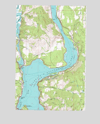
Marcus, WA USGS Topographic Map
Click on map above to begin viewing in our Map Viewer.

This topographic map contains these locations and features:
Feature Name Type Latitude Longitude GNIS ID View Map
Bass LakeLakeN48.6326°W118.0009°1516182View Map
BearPopulated PlaceN48.7107°W118.0442°1516215View Map
Blue Town (historical)Populated PlaceN48.6257°W118.1219°1530577View Map
Bossburg CemeteryCemeteryN48.7432°W118.0482°1516807View Map
China CreekStreamN48.7143°W118.0342°1517720View Map
Columbia QuarryMineN48.6416°W118.1230°1517980View Map
Deadman CreekStreamN48.7077°W118.1217°1530854View Map
Dipper MineMineN48.7391°W118.0875°1518783View Map
East MarcusPopulated PlaceN48.6685°W118.0450°1530558View Map
EvansPopulated PlaceN48.7135°W118.0253°1519396View Map
Evans CampgroundLocaleN48.6980°W118.0175°1519397View Map
Evans PondLakeN48.7113°W118.0247°1519402View Map
Flat Creek FieldAirportN48.7025°W118.0461°2443235View Map
Godfrey (historical)Populated PlaceN48.7085°W118.1164°1530559View Map
Gold HillSummitN48.6296°W118.0525°1520098View Map
Gold Ledge MineMineN48.6332°W118.0542°1520104View Map
Gold Reef MineMineN48.6293°W118.0264°1520107View Map
Grandview CemeteryCemeteryN48.6695°W118.0394°1520199View Map
Harlin LakeLakeN48.7264°W118.0862°1520549View Map
HarterPopulated PlaceN48.6321°W118.1203°1520580View Map
Hedlund BridgeBridgeN48.6735°W118.1167°1520666View Map
Hill LakeLakeN48.6480°W118.0043°1520809View Map
Hyatt LakeLakeN48.6593°W118.0214°1521110View Map
Joint Protection Ferry County Fire District 3 - Stevens County Fire District 8 BarneysBuildingN48.6273°W118.1238°2643891View Map
Kamloops IslandIslandN48.6757°W118.1147°1521558View Map
Kamloops Island CampgroundLocaleN48.6791°W118.1172°1529565View Map
Katy CreekStreamN48.6588°W118.1161°1521576View Map
Kelley MountainSummitN48.7010°W118.0914°1530483View Map
Kelly HillSummitN48.7302°W118.0897°1521599View Map
Kettle Falls (historical)FallsN48.6393°W118.1094°1530609View Map
Kettle Falls BridgeBridgeN48.6258°W118.1177°2608001View Map
Kettle RiverStreamN48.6727°W118.1139°1521637View Map
Kettle River ArmBayN48.7227°W118.1219°1521638View Map
Kettle River CampgroundLocaleN48.7146°W118.1214°1521639View Map
Kifer QuarryMineN48.6485°W118.1242°1521658View Map
Lakeside Mobile Home ParkPopulated PlaceN48.6259°W118.1230°2607307View Map
MarcusPopulated PlaceN48.6632°W118.0683°1522718View Map
Marcus FlatsBarN48.6430°W118.0947°1529433View Map
Marcus IslandIslandN48.6682°W118.0572°1522719View Map
Marcus Island CampgroundLocaleN48.6691°W118.0575°1529563View Map
Marcus Post OfficePost OfficeN48.6644°W118.0591°2606977View Map
Martin SpringSpringN48.6387°W118.0618°1522774View Map
Matneys SpursLocaleN48.6566°W118.1125°1522804View Map
Nancy CreekStreamN48.6546°W118.1114°1523563View Map
NapoleonLocaleN48.7368°W118.1150°1528813View Map
Napoleon MineMineN48.7363°W118.1014°1523574View Map
Pingston CreekStreamN48.6518°W118.0842°1524458View Map
Pot HolesAreaN48.7202°W118.0061°1524597View Map
PowellPopulated PlaceN48.7052°W118.0208°1524608View Map
Presbyterian Church of MarcusChurchN48.6649°W118.0629°2609657View Map
Saint Pauls Mission (historical)ChurchN48.6288°W118.1064°1529564View Map
Saint Pauls Mission State Historical SiteParkN48.6291°W118.1061°1525373View Map
Seven DevilsCliffN48.6768°W118.0161°1528812View Map
Six Mile Bar (historical)BarN48.7143°W118.0344°1530605View Map
Snag Cove CampgroundLocaleN48.7324°W118.0594°1525996View Map
SPCC SpurLocaleN48.7005°W118.1180°1526336View Map
Stevens (historical)LocaleN48.6260°W118.1022°1530521View Map
Town of MarcusCivilN48.6643°W118.0601°2412955View Map
Turtle LakeLakeN48.6258°W118.0078°1527484View Map
Vanasse MineMineN48.6374°W118.0078°1527682View Map

Note: Coordinates in the location and feature list above are referenced to NAD83 datum.


Copyright (C) 2008-2024 Ryan Niemi / Sunset Dynamics ... All Rights Reserved