TopoQuest Logo
Do you find TopoQuest useful?
Help keep TopoQuest running and adding new maps/features by donating!
Bitcoin:  19c7KJd3qBynnjoSw5npx9KScwjBe4ifkT
Litecoin:  LXs6TkuXGGXo1vDsWCkWVdjQX94eUKd6ui
Home View Maps Find Maps Find Places Resources & Links


Malta West, Montana Topographic Map

USGS Map Title: Malta West, MT
USGS Map MRC: 48107C8
DRG (GeoTIFF) Download: o48107c8.tif


Neighboring USGS Topographic Map Quads:


  Dodson NE, MT  
48108D1
 

  Malta NW, MT  
48107D8
 

  Malta NE, MT  
48107D7
 

  Wagner, MT  
48108C1
 

  Malta West, MT  
48107C8
 

  Malta East, MT  
48107C7
 

  West Alkali Reservoir, MT  
48108B1
 

  Bennett Lake NW, MT  
48107B8
 

  Bennett Lake, MT  
48107B7


Map MRC Location:

N49°
W108°
N49°
W107°
H8 H7 H6 H5 H4 H3 H2 H1
G8 G7 G6 G5 G4 G3 G2 G1
F8 F7 F6 F5 F4 F3 F2 F1
E8 E7 E6 E5 E4 E3 E2 E1
D8 D7 D6 D5 D4 D3 D2 D1
C8 C7 C6 C5 C4 C3 C2 C1
B8 B7 B6 B5 B4 B3 B2 B1
A8 A7 A6 A5 A4 A3 A2 A1
N48°
W108°
N48°
W107°

Malta West, MT USGS 1:24K Topographic Map Preview:
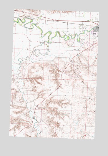
Malta West, MT USGS Topographic Map
Click on map above to begin viewing in our Map Viewer.

This topographic map contains these locations and features:
Feature Name Type Latitude Longitude GNIS ID View Map
29N29E14ADBB01 WellWellN48.2731°W107.9160°1634560View Map
29N30E18BBDC01 WellWellN48.2744°W107.8865°1634563View Map
Alkali CreekStreamN48.3433°W107.9487°768189View Map
Assembly of God ChurchChurchN48.3558°W107.8796°1721801View Map
Early Day Outlaws Historical MarkerParkN48.3694°W107.9687°1721857View Map
Edgewater CampgroundLocaleN48.3625°W107.8779°1721825View Map
Elim Lutheran ChurchChurchN48.3519°W107.8751°1721797View Map
Exeter (historical)LocaleN48.3661°W107.9721°1722069View Map
Exeter CreekStreamN48.3597°W107.9682°771266View Map
Lafond School (historical)SchoolN48.3714°W107.9535°1721908View Map
Little Rocky Mountains Historical MarkerParkN48.3444°W107.8771°1813129View Map
Little White ChurchChurchN48.3583°W107.8754°1721798View Map
Malta AirportAirportN48.3683°W107.9127°2650698View Map
Malta AmbulanceBuildingN48.3571°W107.8785°2637831View Map
Malta DivisionCivilN48.3132°W107.8910°1940666View Map
Malta Lutheran ChurchChurchN48.3569°W107.8796°1721800View Map
Marion Hills Country ClubLocaleN48.3431°W107.8951°1721784View Map
Onwatt DamDamN48.2533°W107.8773°797651View Map
Phillips CountyCivilN48.2592°W107.9132°1720023View Map
Phillips County CourthouseBuildingN48.3572°W107.8785°1721781View Map
Phillips County MuseumBuildingN48.3597°W107.8771°1721817View Map
Phillips County Sheriff's DepartmentBuildingN48.3572°W107.8784°1721780View Map
Riverview ParkParkN48.3528°W107.8923°1721792View Map
Saint Mary SchoolSchoolN48.3531°W107.8765°1722005View Map
Saint Marys Catholic ChurchChurchN48.3531°W107.8762°1721802View Map
Taylor CouleeValleyN48.3350°W107.9137°777431View Map
United States Border Patrol Malta StationBuildingN48.3621°W107.8771°2548918View Map

Note: Coordinates in the location and feature list above are referenced to NAD83 datum.


Copyright (C) 2008-2024 Ryan Niemi / Sunset Dynamics ... All Rights Reserved