TopoQuest Logo
Do you find TopoQuest useful?
Help keep TopoQuest running and adding new maps/features by donating!
Bitcoin:  19c7KJd3qBynnjoSw5npx9KScwjBe4ifkT
Litecoin:  LXs6TkuXGGXo1vDsWCkWVdjQX94eUKd6ui
Home View Maps Find Maps Find Places Resources & Links


Madrid, New Mexico Topographic Map

USGS Map Title: Madrid, NM
USGS Map MRC: 35106D2
DRG (GeoTIFF) Download: o35106d2.tif


Neighboring USGS Topographic Map Quads:


  Santo Domingo Pueblo, NM  
35106E3
 

  Tetilla Peak, NM  
35106E2
 

  Turquoise Hill, NM  
35106E1
 

  San Felipe Pueblo NE, NM  
35106D3
 

  Madrid, NM  
35106D2
 

  Picture Rock, NM  
35106D1
 

  Hagan, NM  
35106C3
 

  Golden, NM  
35106C2
 

  Captain Davis Mountain, NM  
35106C1


Map MRC Location:

N36°
W107°
N36°
W106°
H8 H7 H6 H5 H4 H3 H2 H1
G8 G7 G6 G5 G4 G3 G2 G1
F8 F7 F6 F5 F4 F3 F2 F1
E8 E7 E6 E5 E4 E3 E2 E1
D8 D7 D6 D5 D4 D3 D2 D1
C8 C7 C6 C5 C4 C3 C2 C1
B8 B7 B6 B5 B4 B3 B2 B1
A8 A7 A6 A5 A4 A3 A2 A1
N35°
W107°
N35°
W106°

Madrid, NM USGS 1:24K Topographic Map Preview:
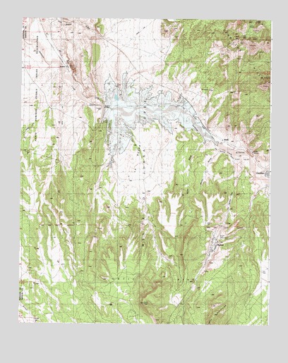
Madrid, NM USGS Topographic Map
Click on map above to begin viewing in our Map Viewer.

This topographic map contains these locations and features:
Feature Name Type Latitude Longitude GNIS ID View Map
Alamitos or Juan Salas GrantCivilN35.4431°W106.1381°914449View Map
Anthracite Number Eight MineMineN35.4084°W106.1528°940157View Map
Anthracite Number Thirty Two MineMineN35.4948°W106.1334°918009View Map
Armington MineMineN35.4948°W106.1334°918010View Map
Arroyo LargoStreamN35.4920°W106.2484°897645View Map
Black Hornet ProspectMineN35.4934°W106.1386°918012View Map
Central HotelLocaleN35.4364°W106.1261°935720View Map
Cerrillos HillsRangeN35.4745°W106.1267°928706View Map
Cerrillos Historical MarkerParkN35.4375°W106.1250°932225View Map
Cerrillos Opera House Historic SiteBuildingN35.4375°W106.1256°933797View Map
Cerrillos Public School (historical)SchoolN35.4453°W106.1278°934287View Map
Cerro ChatoSummitN35.3836°W106.1872°897884View Map
Devils ThroneCliffN35.4461°W106.1325°888352View Map
Evelyn Coal MineMineN35.4067°W106.1367°917131View Map
Galisteo DamDamN35.4617°W106.2089°923787View Map
Galisteo ReservoirReservoirN35.4617°W106.2089°923788View Map
Hotel MacLocaleN35.4373°W106.1264°933723View Map
Jones Coal MineMineN35.4084°W106.1528°917129View Map
La BolsaAreaN35.4439°W106.1886°890771View Map
Los Cerrillos Mining DistrictLocaleN35.4375°W106.1259°934336View Map
Los Cerrillos Protestant CemeteryCemeteryN35.4373°W106.1250°931234View Map
MadridPopulated PlaceN35.4067°W106.1525°899746View Map
Madrid Boarding House Historic SiteBuildingN35.4067°W106.1525°934470View Map
Madrid CemeteryCemeteryN35.4164°W106.1569°891534View Map
Madrid Census Designated PlaceCensusN35.4033°W106.1538°2408159View Map
Madrid Historic DistrictLocaleN35.4067°W106.1525°934442View Map
Madrid Post OfficePost OfficeN35.4067°W106.1525°938219View Map
Mesita de Juana Lopez GrantCivilN35.4492°W106.1903°918257View Map
Miller GulchValleyN35.4534°W106.1584°892056View Map
Mount Chalchihuitl Turquois MineMineN35.4373°W106.1253°934402View Map
Palace Hotel (historical)BuildingN35.4375°W106.1256°934286View Map
RG-24629X9 Water WellWellN35.4542°W106.1375°922910View Map
RG-26043 Water WellWellN35.4578°W106.1328°922915View Map
RG-27088 Water WellWellN35.4356°W106.1261°922917View Map
RG-28309 Water WellWellN35.4139°W106.1314°927236View Map
RG-29045 Water WellWellN35.4214°W106.1261°922889View Map
RG-29562 Water WellWellN35.4389°W106.1306°922920View Map
RosarioPopulated PlaceN35.4803°W106.2275°899880View Map
Rosario CemeteryCemeteryN35.4803°W106.2275°931233View Map
Saint Joseph ChurchChurchN35.4375°W106.1256°920546View Map
Santa Fe County Volunteer Fire Madrid DistrictBuildingN35.4049°W106.1540°2658184View Map
Santa Fe County Volunteer Fire Turquoise Trail District Station 1BuildingN35.4355°W106.1259°2658157View Map
Tom Payne GulchValleyN35.4998°W106.2456°895735View Map
Tom Payne MineMineN35.4989°W106.1325°914577View Map
Union MineMineN35.4145°W106.1522°940158View Map
Waldo (historical)Populated PlaceN35.4506°W106.1478°918402View Map
Waldo Coke Ovens Historic SiteLocaleN35.4373°W106.1259°934403View Map
Waldo GulchMineN35.4334°W106.1572°918015View Map
Waldo GulchValleyN35.4478°W106.1495°896189View Map
Waldo MesaSummitN35.4209°W106.1547°923743View Map
Waldo Post Office (historical)Post OfficeN35.4506°W106.1478°937621View Map
White Ash MineMineN35.4145°W106.1522°940159View Map

Note: Coordinates in the location and feature list above are referenced to NAD83 datum.


Copyright (C) 2008-2024 Ryan Niemi / Sunset Dynamics ... All Rights Reserved