TopoQuest Logo
Do you find TopoQuest useful?
Help keep TopoQuest running and adding new maps/features by donating!
Bitcoin:  19c7KJd3qBynnjoSw5npx9KScwjBe4ifkT
Litecoin:  LXs6TkuXGGXo1vDsWCkWVdjQX94eUKd6ui
Home View Maps Find Maps Find Places Resources & Links


Mackinaw, Illinois Topographic Map

USGS Map Title: Mackinaw, IL
USGS Map MRC: 40089E3
DRG (GeoTIFF) Download: o40089e3.tif


Neighboring USGS Topographic Map Quads:


  Washington, IL  
40089F4
 

  Eureka, IL  
40089F3
 

  Secor, IL  
40089F2
 

  Morton, IL  
40089E4
 

  Mackinaw, IL  
40089E3
 

  Danvers, IL  
40089E2
 

  Hopedale, IL  
40089D4
 

  Minier, IL  
40089D3
 

  Stanford, IL  
40089D2


Map MRC Location:

N41°
W90°
N41°
W89°
H8 H7 H6 H5 H4 H3 H2 H1
G8 G7 G6 G5 G4 G3 G2 G1
F8 F7 F6 F5 F4 F3 F2 F1
E8 E7 E6 E5 E4 E3 E2 E1
D8 D7 D6 D5 D4 D3 D2 D1
C8 C7 C6 C5 C4 C3 C2 C1
B8 B7 B6 B5 B4 B3 B2 B1
A8 A7 A6 A5 A4 A3 A2 A1
N40°
W90°
N40°
W89°

Mackinaw, IL USGS 1:24K Topographic Map Preview:
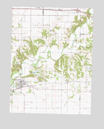
Mackinaw, IL USGS Topographic Map
Click on map above to begin viewing in our Map Viewer.

This topographic map contains these locations and features:
Feature Name Type Latitude Longitude GNIS ID View Map
Alloway CreekStreamN40.5670°W89.3290°403449View Map
Amerman BridgeBridgeN40.5623°W89.3320°424570View Map
Amerman School (historical)SchoolN40.5634°W89.3254°1747439View Map
Bergen CemeteryCemeteryN40.5284°W89.2964°404210View Map
Brock LakeLakeN40.5245°W89.3739°404891View Map
Brock ParkParkN40.5245°W89.3715°404892View Map
Camp JeremiaLocaleN40.5700°W89.2929°405477View Map
Chaffer School (historical)SchoolN40.6150°W89.3468°1747449View Map
Dee-Mack High SchoolSchoolN40.5339°W89.3537°1811105View Map
Dee-Mack Primary-Junior High SchoolSchoolN40.5350°W89.3584°1811107View Map
Funks BranchStreamN40.5761°W89.2759°408820View Map
Hardscrabble CemeteryCemeteryN40.5942°W89.3078°409777View Map
Heritage LakeReservoirN40.5467°W89.3418°1691368View Map
Heritage LakePopulated PlaceN40.5474°W89.3258°2629894View Map
Heritage Lake Census Designated PlaceCensusN40.5454°W89.3309°2629865View Map
Heritage Lake DamDamN40.5467°W89.3418°1691367View Map
Hill CemeteryCemeteryN40.5284°W89.2970°410252View Map
Hollands CreekStreamN40.5764°W89.2854°410393View Map
Interchange 112CrossingN40.6225°W89.2751°1824281View Map
Le Baube LakeReservoirN40.5884°W89.2851°1692229View Map
Le Baube Lake DamDamN40.5884°W89.2851°1692228View Map
Lee School (historical)SchoolN40.5831°W89.3076°1747477View Map
Liiiy CemeteryCemeteryN40.5367°W89.2868°403792View Map
LillyPopulated PlaceN40.5375°W89.2868°422912View Map
Lindsey CemeteryCemeteryN40.5256°W89.2920°412238View Map
Lindstrom HeliportAirportN40.6239°W89.3731°427572View Map
Lone Star School (historical)SchoolN40.5067°W89.3198°1747480View Map
MackinawPopulated PlaceN40.5370°W89.3576°412805View Map
Mackinaw CemeteryCemeteryN40.5403°W89.3546°1821596View Map
Mackinaw Fire Protection DistrictBuildingN40.5361°W89.3601°2640576View Map
Mackinaw Post OfficePost OfficeN40.5363°W89.3595°2788319View Map
Mackinaw Rescue SquadBuildingN40.5361°W89.3601°2640327View Map
Maraldo LakeReservoirN40.5464°W89.3339°412981View Map
Mitchell CemeteryCemeteryN40.5273°W89.2526°413686View Map
Mitchell LakeReservoirN40.5587°W89.3707°1692233View Map
Mitchell Lake DamDamN40.5567°W89.3718°1692232View Map
Mount Pleasant School (historical)SchoolN40.5281°W89.3098°1747495View Map
New Castle (historical)Populated PlaceN40.5786°W89.3612°1811160View Map
New Castle ChurchChurchN40.5856°W89.3601°414387View Map
Newcastle School (historical)SchoolN40.5856°W89.3601°1747497View Map
Oak Knoll SanatoriumHospitalN40.5378°W89.3301°414833View Map
Oak Ridge School (historical)SchoolN40.5614°W89.2773°1747500View Map
ParkLands Nature PreserveParkN40.5589°W89.3048°2013749View Map
Porter BridgeBridgeN40.5239°W89.3570°425345View Map
Posey Ridge LakesReservoirN40.5784°W89.2624°416058View Map
Roberson CemeteryCemeteryN40.5934°W89.3602°416769View Map
Rock CreekStreamN40.5798°W89.2806°416804View Map
Rocky Ford BridgeBridgeN40.5867°W89.2784°425406View Map
Science Hill School (historical)SchoolN40.6148°W89.3040°1802033View Map
Spin LakeReservoirN40.5546°W89.2553°418906View Map
Spin Lake DamDamN40.5567°W89.2568°1691285View Map
Stout BridgeBridgeN40.5461°W89.3590°425527View Map
Stumbaugh CemeteryCemeteryN40.6223°W89.3034°419236View Map
Township of Deer CreekCivilN40.6088°W89.3371°428879View Map
Township of MackinawCivilN40.5282°W89.3250°429302View Map
Union School (historical)SchoolN40.5006°W89.2673°1747526View Map
Village of MackinawCivilN40.5340°W89.3555°2399217View Map
Weishaupt AirportAirportN40.5110°W89.3679°427485View Map

Note: Coordinates in the location and feature list above are referenced to NAD83 datum.


Copyright (C) 2008-2024 Ryan Niemi / Sunset Dynamics ... All Rights Reserved