TopoQuest Logo
Do you find TopoQuest useful?
Help keep TopoQuest running and adding new maps/features by donating!
Bitcoin:  19c7KJd3qBynnjoSw5npx9KScwjBe4ifkT
Litecoin:  LXs6TkuXGGXo1vDsWCkWVdjQX94eUKd6ui
Home View Maps Find Maps Find Places Resources & Links


Bay City NE, Michigan Topographic Map

USGS Map Title: Bay City NE, MI
USGS Map MRC: 43083F7
DRG (GeoTIFF) Download: o43083f7.tif


Neighboring USGS Topographic Map Quads:


  Pinconning, MI  
43083G8


  Kawkawlin, MI  
43083F8
 

  Bay City NE, MI  
43083F7


  Bay City, MI  
43083E8
 

  Essexville, MI  
43083E7
 

  Quanicassee, MI  
43083E6


Map MRC Location:

N44°
W84°
N44°
W83°
H8 H7 H6 H5 H4 H3 H2 H1
G8 G7 G6 G5 G4 G3 G2 G1
F8 F7 F6 F5 F4 F3 F2 F1
E8 E7 E6 E5 E4 E3 E2 E1
D8 D7 D6 D5 D4 D3 D2 D1
C8 C7 C6 C5 C4 C3 C2 C1
B8 B7 B6 B5 B4 B3 B2 B1
A8 A7 A6 A5 A4 A3 A2 A1
N43°
W84°
N43°
W83°

Bay City NE, MI USGS 1:24K Topographic Map Preview:
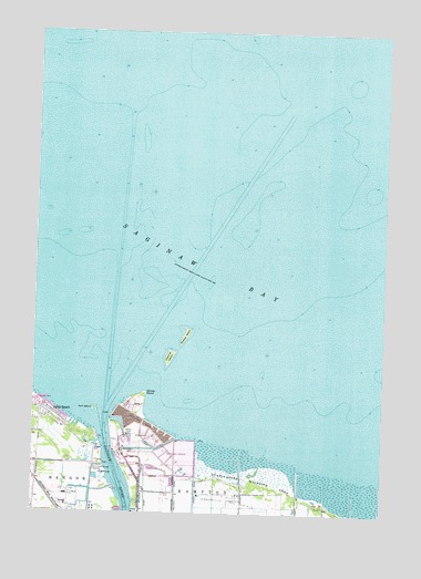
Bay City NE, MI USGS Topographic Map
Click on map above to begin viewing in our Map Viewer.

This topographic map contains these locations and features:
Feature Name Type Latitude Longitude GNIS ID View Map
Aplin BeachPopulated PlaceN43.6509°W83.8708°620163View Map
Bay City Yacht ClubLocaleN43.6409°W83.8516°1618149View Map
Bayside Post Office (historical)Post OfficeN43.6528°W83.8728°2548191View Map
Channel IslandIslandN43.6656°W83.8264°623077View Map
Charter Township of HamptonCivilN43.6253°W83.7711°1626426View Map
Consumers Power CompanyLocaleN43.6411°W83.8500°1618150View Map
Corps of Engineers Field OfficeLocaleN43.6284°W83.8378°1618151View Map
Delta College Sailing SchoolSchoolN43.6442°W83.8539°1618648View Map
Finn Road CampgroundLocaleN43.6289°W83.7800°2547359View Map
Gidley Boat WorksLocaleN43.6264°W83.8383°1618528View Map
Gull IslandIslandN43.6520°W83.8536°627507View Map
Knight Harbor MarinaLocaleN43.6333°W83.8000°2547350View Map
Saginaw Bay Yacht ClubLocaleN43.6253°W83.8386°1618529View Map
Saginaw RiverStreamN43.6470°W83.8505°636503View Map
Saginaw River Rear Range LighthouseLocaleN43.6356°W83.8508°2546929View Map
Shelter IslandIslandN43.6709°W83.8211°637732View Map
Wenona Beach Estates Mobile Home ParkPopulated PlaceN43.6539°W83.8736°2546936View Map
Wenona Beach Station (historical)LocaleN43.6472°W83.8625°2547449View Map
Windy PointCapeN43.6561°W83.8350°1616622View Map

Note: Coordinates in the location and feature list above are referenced to NAD83 datum.


Copyright (C) 2008-2024 Ryan Niemi / Sunset Dynamics ... All Rights Reserved