TopoQuest Logo
Do you find TopoQuest useful?
Help keep TopoQuest running and adding new maps/features by donating!
Bitcoin:  19c7KJd3qBynnjoSw5npx9KScwjBe4ifkT
Litecoin:  LXs6TkuXGGXo1vDsWCkWVdjQX94eUKd6ui
Home View Maps Find Maps Find Places Resources & Links


Louise, Mississippi Topographic Map

USGS Map Title: Louise, MS
USGS Map MRC: 32090H5
DRG (GeoTIFF) Download: o32090h5.tif


Neighboring USGS Topographic Map Quads:


  Richey, MS  
33090A6
 

  Midnight, MS  
33090A5
 

  Silver City, MS  
33090A4
 

  Bayland, MS  
32090H6
 

  Louise, MS  
32090H5
 

  Carter, MS  
32090H4
 

  Holly Bluff, MS  
32090G6
 

  Bayland SE, MS  
32090G5
 

  Yazoo City, MS  
32090G4


Map MRC Location:

N33°
W91°
N33°
W90°
H8 H7 H6 H5 H4 H3 H2 H1
G8 G7 G6 G5 G4 G3 G2 G1
F8 F7 F6 F5 F4 F3 F2 F1
E8 E7 E6 E5 E4 E3 E2 E1
D8 D7 D6 D5 D4 D3 D2 D1
C8 C7 C6 C5 C4 C3 C2 C1
B8 B7 B6 B5 B4 B3 B2 B1
A8 A7 A6 A5 A4 A3 A2 A1
N32°
W91°
N32°
W90°

Louise, MS USGS 1:24K Topographic Map Preview:
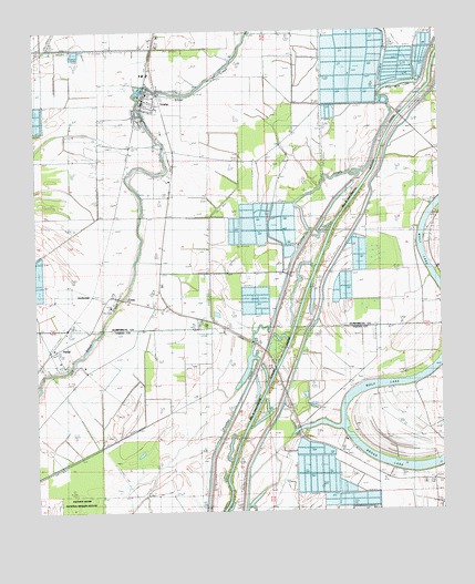
Louise, MS USGS Topographic Map
Click on map above to begin viewing in our Map Viewer.

This topographic map contains these locations and features:
Feature Name Type Latitude Longitude GNIS ID View Map
AnchoragePopulated PlaceN32.9315°W90.6143°666249View Map
Anderson Brothers Pond DamDamN32.9218°W90.5634°681738View Map
Anderson Brothers Pond DamDamN32.9468°W90.5434°681755View Map
Balup CemeteryCemeteryN32.9707°W90.5870°666499View Map
Big Mount Zion ChurchChurchN32.9568°W90.5906°667132View Map
CraigPopulated PlaceN32.9301°W90.5959°668924View Map
Five Mile LakeLakeN32.9860°W90.5066°670005View Map
Goshen BayouStreamN32.9479°W90.5404°684955View Map
Goshen CemeteryCemeteryN32.9421°W90.5918°684956View Map
Goshen LakeLakeN32.9440°W90.5587°684957View Map
Greenhill Plantation (historical)LocaleN32.9015°W90.6195°686670View Map
Holaday ChapelChurchN32.9674°W90.5523°671275View Map
Holiday School (historical)SchoolN32.9721°W90.5459°684958View Map
Holy City ChurchChurchN32.8765°W90.5020°671364View Map
Holy Jerusalem ChurchChurchN32.9760°W90.5893°671374View Map
Huddleston CemeteryCemeteryN32.9748°W90.5906°671553View Map
Humphreys County Training SchoolSchoolN32.9735°W90.5862°671584View Map
J W Stoner Pond DamDamN32.9368°W90.6084°681749View Map
Lakeview Plantation (historical)LocaleN32.9001°W90.5251°686675View Map
LouisePopulated PlaceN32.9824°W90.5887°672897View Map
Louise Attendance CenterSchoolN32.9810°W90.5890°707027View Map
Louise Post OfficePost OfficeN32.9809°W90.5917°2768748View Map
Louise Volunteer Fire DepartmentBuildingN32.9828°W90.5912°2665799View Map
McDees (historical)LocaleN32.9237°W90.6079°684987View Map
PatosiPopulated PlaceN32.9165°W90.6195°675493View Map
Pleasant Grove Baptist ChurchChurchN32.9321°W90.5023°676020View Map
Pleasant Hill ChurchChurchN32.9779°W90.5898°676073View Map
Saint Paul ChurchChurchN32.9204°W90.6043°677196View Map
Shady Grove ChurchChurchN32.9946°W90.6190°677571View Map
Simmons Lake DamDamN32.9418°W90.5351°681752View Map
Sleepy HollowPopulated PlaceN32.9682°W90.5843°684989View Map
Town of LouiseCivilN32.9814°W90.5904°2406048View Map
Will M. Whittington Auxiliary ChannelCanalN32.9176°W90.5479°693837View Map

Note: Coordinates in the location and feature list above are referenced to NAD83 datum.


Copyright (C) 2008-2024 Ryan Niemi / Sunset Dynamics ... All Rights Reserved